The left side wins on both legs: it captures Bangkok's urban skyline and river during takeoff, and the low mountain ridgelines bordering the Sukhothai plain during descent, while the right side remains flat and largely featureless throughout.
Flown BKK to THS? Did we get it right?
Flight Path
Bangkok to null is 253 miles (408 km), a flight of about 1 hour 15 minutes.
Central Thailand's Chao Phraya river basin, agricultural plains of Nakhon Sawan and Kamphaeng Phet provinces, with the beginnings of low forested hills near Sukhothai visible to the west.
Great circle distance and headings ›Phase by phase
Takeoff from BKK
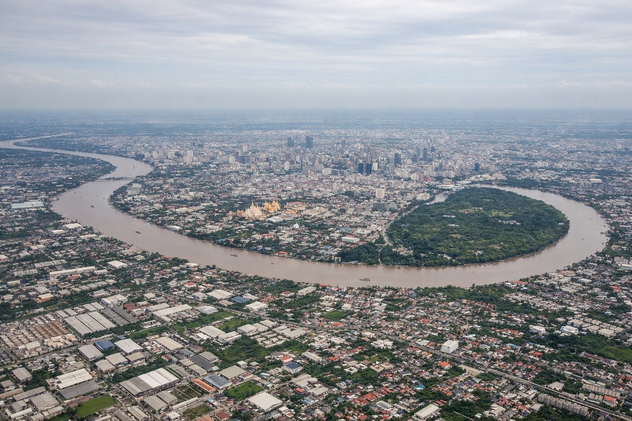
LEFTDeparting Suvarnabhumi to the north, the left side offers a view back over Bangkok's dense urban sprawl and the winding Chao Phraya River before the plane climbs over farmland. The right side shows mostly flat, featureless paddies with no distinguishing landmarks.
Landing at THS
LEFTOn approach into Sukhothai, the left side reveals the forested hills and low mountains that rim the western edge of the Sukhothai plain, giving some topographic relief. The right side stays over flat agricultural land with no notable features until touchdown.
Will your flight be in sunlight?
Pick a date and time in the Sun Map to watch the sun move across your whole flight.
About This Route
Which side of the plane should I sit on flying from Suvarnabhumi Airport (BKK) to Sukhothai Airport (THS)?
Sit on the Left side of the plane for the best views on flights from Bangkok to null. The left side wins on both legs: it captures Bangkok's urban skyline and river during takeoff, and the low mountain ridgelines bordering the Sukhothai plain during descent, while the right side remains flat and largely featureless throughout.
What can I see during takeoff from Suvarnabhumi Airport in Bangkok?
During takeoff from Suvarnabhumi Airport (BKK), sit on the Left side for the best views. Departing Suvarnabhumi to the north, the left side offers a view back over Bangkok's dense urban sprawl and the winding Chao Phraya River before the plane climbs over farmland. The right side shows mostly flat, featureless paddies with no distinguishing landmarks. Notable sights include: Chao Phraya River, Bangkok's eastern suburbs, Suvarnabhumi's parallel runways, rice paddy patchwork.
What can I see when landing at Sukhothai Airport in null?
When landing at Sukhothai Airport (THS), sit on the Left side for the best views. On approach into Sukhothai, the left side reveals the forested hills and low mountains that rim the western edge of the Sukhothai plain, giving some topographic relief. The right side stays over flat agricultural land with no notable features until touchdown. Notable sights include: Western Thai highlands foothills, Yom River floodplain, patchwork rice fields near Sukhothai.
How long is the flight from Bangkok to null?
The flight from Suvarnabhumi Airport (BKK) to Sukhothai Airport (THS) takes about 1 hour 15 minutes. The shortest flight path between them is 253 miles (408 km); winds and air traffic control usually add a few percent.
What does the Bangkok to null flight path pass over?
Central Thailand's Chao Phraya river basin, agricultural plains of Nakhon Sawan and Kamphaeng Phet provinces, with the beginnings of low forested hills near Sukhothai visible to the west.