Brisbane to Manila is 3,606 miles (5,804 km), a flight of about 7 hours 30 minutes.
The right side delivers the more dramatic and sustained departure view over Moreton Bay and its islands, which is the most visually distinctive part of this route. The landing views are split — left for Manila Bay, right for Laguna de Bay — but the takeoff spectacle on the right side edges it overall.
Flight Path
The route tracks north-northwest from Brisbane across the Coral Sea, passing over or near the southern tip of Papua New Guinea and the Torres Strait islands. It then crosses the Banda Sea and Celebes Sea, passing west of Mindanao in the southern Philippines before descending into Manila. The Sulu Sea is visible below during the final hours of the flight, and on clear days the mountainous spine of Mindanao may be visible to the right side as the aircraft enters Philippine airspace.
Great circle distance and headings ›Phase by phase
Takeoff from BNE
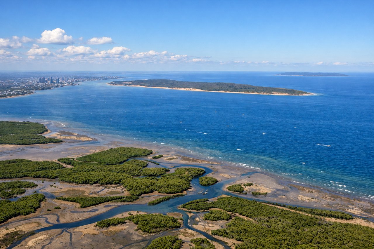
RIGHTBrisbane International typically departs northbound on runway 01R/01L, meaning the right side faces east toward Moreton Bay and its islands. You get a clear view of the bay's shallow turquoise waters, Moreton Island, and the coastal strip as the aircraft climbs out over the northern suburbs.
Landing at MNL
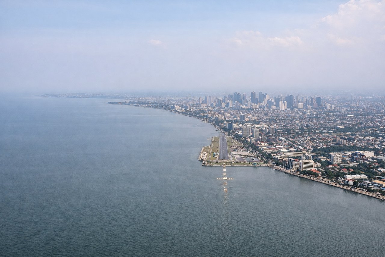
LEFTManila's Ninoy Aquino International typically has aircraft approach from the south or southeast over Manila Bay on runway 06/24 or 13/31 configurations. A southerly approach puts the left side facing west over Manila Bay, giving a sweeping view of the bay's broad open water and the Manila city skyline along the eastern shore.
Landmarks on this routeAll landmarks →
Will your flight be in sunlight?
Pick a date and time in the Sun Map to watch the sun move across your whole flight.
About This Route
Which side of the plane should I sit on flying from Brisbane International (BNE) to Ninoy Aquino International (MNL)?
Sit on the Right side of the plane for the best views on flights from Brisbane to Manila. The right side delivers the more dramatic and sustained departure view over Moreton Bay and its islands, which is the most visually distinctive part of this route. The landing views are split — left for Manila Bay, right for Laguna de Bay — but the takeoff spectacle on the right side edges it overall.
What can I see during takeoff from Brisbane International in Brisbane?
During takeoff from Brisbane International (BNE), sit on the Right side for the best views. Brisbane International typically departs northbound on runway 01R/01L, meaning the right side faces east toward Moreton Bay and its islands. You get a clear view of the bay's shallow turquoise waters, Moreton Island, and the coastal strip as the aircraft climbs out over the northern suburbs. Notable sights include: Moreton Bay and its sandbanks, Moreton Island (large sandy barrier island), the Brisbane River snaking through the city to the south, North Stradbroke Island on the southeastern horizon.
What can I see when landing at Ninoy Aquino International in Manila?
When landing at Ninoy Aquino International (MNL), sit on the Left side for the best views. Manila's Ninoy Aquino International typically has aircraft approach from the south or southeast over Manila Bay on runway 06/24 or 13/31 configurations. A southerly approach puts the left side facing west over Manila Bay, giving a sweeping view of the bay's broad open water and the Manila city skyline along the eastern shore. Notable sights include: Manila Bay (vast enclosed bay), the Manila city skyline and Roxas Boulevard waterfront, Laguna de Bay (large freshwater lake to the east, visible on right side), Corregidor Island sitting in the mouth of Manila Bay.
How long is the flight from Brisbane to Manila?
The flight from Brisbane International (BNE) to Ninoy Aquino International (MNL) takes about 7 hours 30 minutes. The shortest flight path between them is 3,606 miles (5,804 km); winds and air traffic control usually add a few percent.
What does the Brisbane to Manila flight path pass over?
The route tracks north-northwest from Brisbane across the Coral Sea, passing over or near the southern tip of Papua New Guinea and the Torres Strait islands. It then crosses the Banda Sea and Celebes Sea, passing west of Mindanao in the southern Philippines before descending into Manila. The Sulu Sea is visible below during the final hours of the flight, and on clear days the mountainous spine of Mindanao may be visible to the right side as the aircraft enters Philippine airspace.