Manila to Brisbane is 3,606 miles (5,804 km), a flight of about 7 hours 20 minutes.
The left side strings together Manila's skyline and Laguna de Bay at departure, glimpses of Philippine and Indonesian island chains and the Coral Sea approaching the Great Barrier Reef region during cruise, and Moreton Bay's islands on arrival — a more varied and landmark-rich sequence than the mostly open-water and inland-terrain views on the right.
Flight Path
Southern Philippine islands (Mindanao), the Celebes and Molucca Seas, Halmahera, the Coral Sea, and the northern Great Barrier Reef near Cairns before the route continues south along the Queensland coast toward Brisbane
Great circle distance and headings ›Phase by phase
Takeoff from MNL
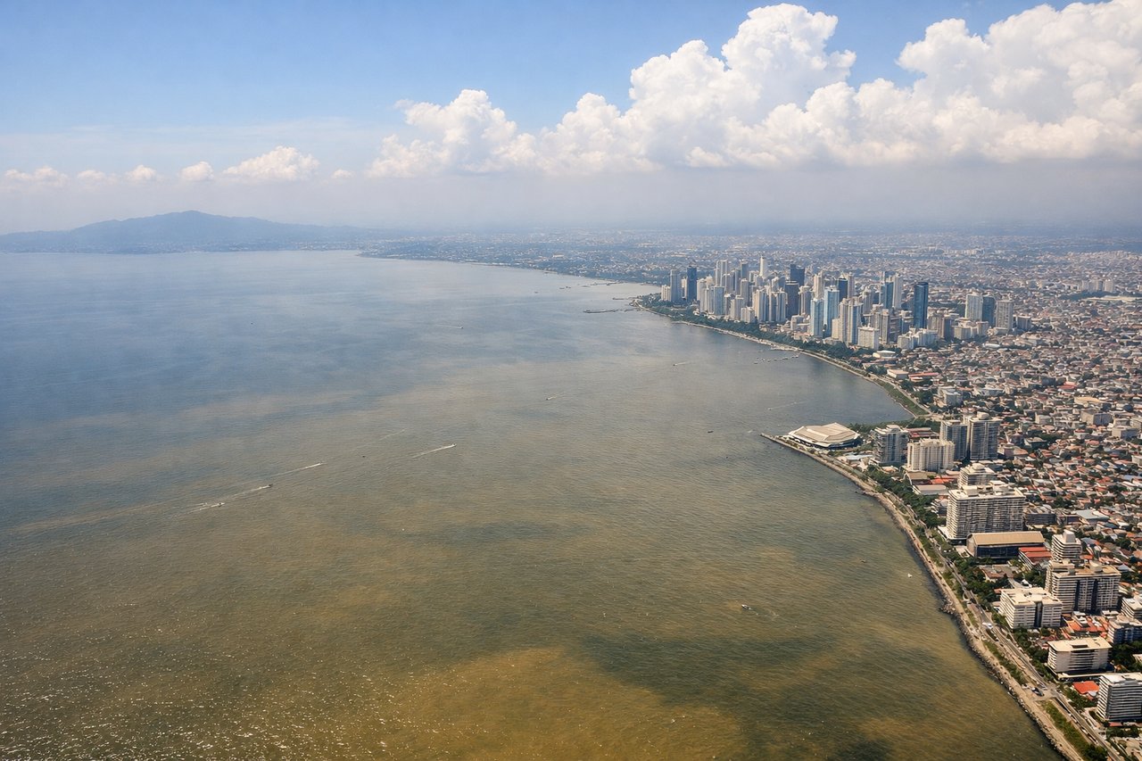
LEFTDeparting NAIA, the left side looks east over Metro Manila's skyline (Makati/BGC towers) and the wide expanse of Laguna de Bay, with the Sierra Madre foothills visible in the distance. The right side mostly shows open Manila Bay and the South China Sea with less to look at.
Landing at BNE
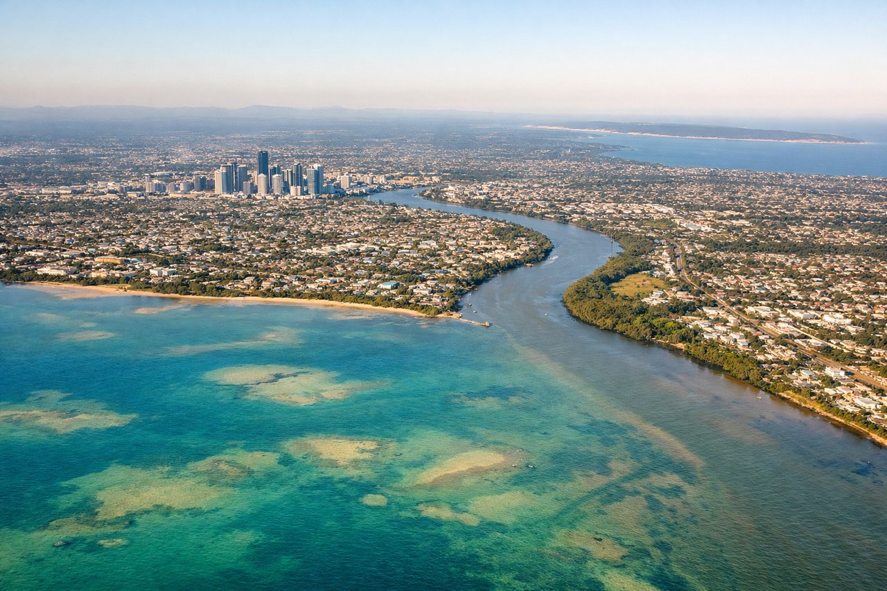
LEFTOn the descent into Brisbane, the left side faces east over Moreton Bay, with Moreton Island and North Stradbroke Island's sand dunes clearly visible before the coastline gives way to the city. The right side mostly shows inland suburbs and the Great Dividing Range foothills in flat afternoon light.
Will your flight be in sunlight?
Pick a date and time in the Sun Map to watch the sun move across your whole flight.
About This Route
Which side of the plane should I sit on flying from Ninoy Aquino International (MNL) to Brisbane International (BNE)?
Sit on the Left side of the plane for the best views on flights from Manila to Brisbane. The left side strings together Manila's skyline and Laguna de Bay at departure, glimpses of Philippine and Indonesian island chains and the Coral Sea approaching the Great Barrier Reef region during cruise, and Moreton Bay's islands on arrival — a more varied and landmark-rich sequence than the mostly open-water and inland-terrain views on the right.
What can I see during takeoff from Ninoy Aquino International in Manila?
During takeoff from Ninoy Aquino International (MNL), sit on the Left side for the best views. Departing NAIA, the left side looks east over Metro Manila's skyline (Makati/BGC towers) and the wide expanse of Laguna de Bay, with the Sierra Madre foothills visible in the distance. The right side mostly shows open Manila Bay and the South China Sea with less to look at. Notable sights include: Metro Manila skyline, Laguna de Bay, Sierra Madre foothills.
What can I see when landing at Brisbane International in Brisbane?
When landing at Brisbane International (BNE), sit on the Left side for the best views. On the descent into Brisbane, the left side faces east over Moreton Bay, with Moreton Island and North Stradbroke Island's sand dunes clearly visible before the coastline gives way to the city. The right side mostly shows inland suburbs and the Great Dividing Range foothills in flat afternoon light. Notable sights include: Moreton Bay, Moreton Island, North Stradbroke Island, Brisbane coastline.
How long is the flight from Manila to Brisbane?
The flight from Ninoy Aquino International (MNL) to Brisbane International (BNE) takes about 7 hours 20 minutes. The shortest flight path between them is 3,606 miles (5,804 km); winds and air traffic control usually add a few percent.
What does the Manila to Brisbane flight path pass over?
Southern Philippine islands (Mindanao), the Celebes and Molucca Seas, Halmahera, the Coral Sea, and the northern Great Barrier Reef near Cairns before the route continues south along the Queensland coast toward Brisbane