Brisbane to Luganville is 1,221 miles (1,965 km), a flight of about 2 hours 15 minutes.
Right side provides superior scenery on departure with Brisbane's river and bay system, and the flight path northeastward means right-side views remain favorable for most of the journey over the Coral Sea before reaching Vanuatu.
Flight Path
Coral Sea (open water with occasional reef formations visible at lower altitudes), Great Barrier Reef's outer structures (if flight path passes near them), and the gradual transition from Australian coastal waters to Vanuatu's volcanic archipelago. The flight crosses relatively open ocean with few landmarks; the most notable feature is the color transition from the reef-influenced turquoise waters near Australia to deeper blue ocean mid-route.
Great circle distance and headings ›Phase by phase
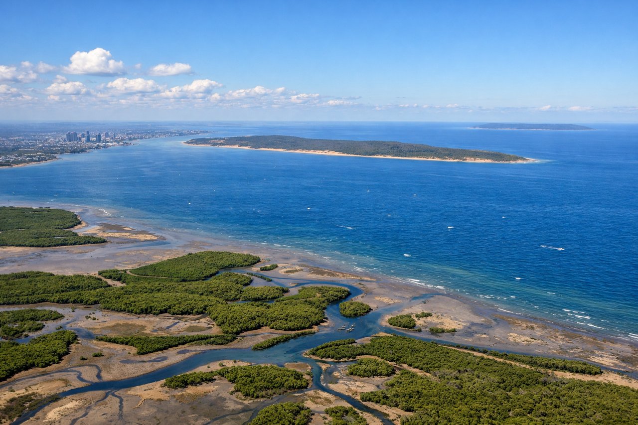
Takeoff from BNE
RIGHTRight side seats capture the Brisbane River winding through the city and Moreton Bay's islands as you climb northeast. The left side faces inland toward the western suburbs with less dramatic scenery.
Landing at SON
LEFTLeft side offers views of Vanuatu's volcanic landscape as you descend toward Santo. The approach typically brings you over Espiritu Santo's rugged interior and coastal features, best seen from the left during final descent.
Will your flight be in sunlight?
Pick a date and time in the Sun Map to watch the sun move across your whole flight.
About This Route
Which side of the plane should I sit on flying from Brisbane International (BNE) to Santo Pekoa International Airport (SON)?
Sit on the Right side of the plane for the best views on flights from Brisbane to Luganville. Right side provides superior scenery on departure with Brisbane's river and bay system, and the flight path northeastward means right-side views remain favorable for most of the journey over the Coral Sea before reaching Vanuatu.
What can I see during takeoff from Brisbane International in Brisbane?
During takeoff from Brisbane International (BNE), sit on the Right side for the best views. Right side seats capture the Brisbane River winding through the city and Moreton Bay's islands as you climb northeast. The left side faces inland toward the western suburbs with less dramatic scenery. Notable sights include: Brisbane River (central business district loop), Moreton Bay, North Stradbroke Island, Bribie Island.
What can I see when landing at Santo Pekoa International Airport in Luganville?
When landing at Santo Pekoa International Airport (SON), sit on the Left side for the best views. Left side offers views of Vanuatu's volcanic landscape as you descend toward Santo. The approach typically brings you over Espiritu Santo's rugged interior and coastal features, best seen from the left during final descent. Notable sights include: Espiritu Santo (volcanic terrain), Aore Island, Santo's fringing coral reefs, Luganville coastal settlement.
How long is the flight from Brisbane to Luganville?
The flight from Brisbane International (BNE) to Santo Pekoa International Airport (SON) takes about 2 hours 15 minutes. The shortest flight path between them is 1,221 miles (1,965 km); winds and air traffic control usually add a few percent.
What does the Brisbane to Luganville flight path pass over?
Coral Sea (open water with occasional reef formations visible at lower altitudes), Great Barrier Reef's outer structures (if flight path passes near them), and the gradual transition from Australian coastal waters to Vanuatu's volcanic archipelago. The flight crosses relatively open ocean with few landmarks; the most notable feature is the color transition from the reef-influenced turquoise waters near Australia to deeper blue ocean mid-route.