Luganville to Brisbane is 1,221 miles (1,965 km), a flight of about 2 hours 15 minutes.
While takeoff offers excellent volcanic island scenery, the landing approach into Brisbane provides more sustained visual interest with the Brisbane River system, Moreton Bay, and urban landmarks. Left seats capture the most distinctive features of both the approach and the city itself.
Flight Path
The flight crosses the Coral Sea for approximately 1,200 nautical miles. Notable features include the New Hebrides island chain receding to the south, open ocean with occasional cumulus cloud formations, and the gradual transition from tropical island waters to the Australian continental shelf. As you approach the Queensland coast, you may see Fraser Island (the world's largest sand island) and the Great Sandy Strait before descending into Brisbane airspace.
Great circle distance and headings ›Phase by phase
Takeoff from SON
RIGHTDeparting SON heading southeast toward Brisbane, right-side seats face the Coral Sea and the northern New Hebrides archipelago. You'll see Espiritu Santo island's rugged volcanic terrain and the surrounding reef systems dropping away beneath the aircraft.
Landing at BNE
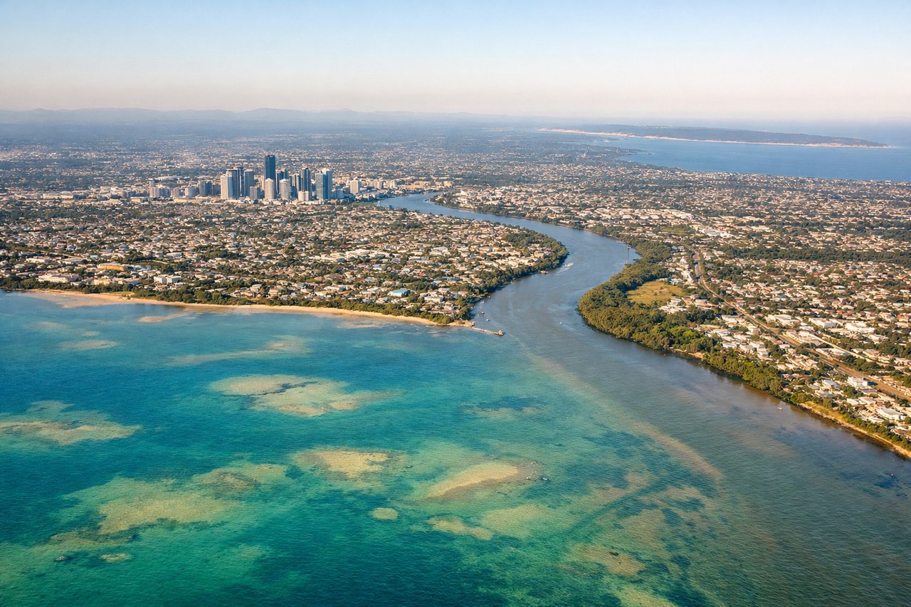
LEFTApproaching BNE from the northeast, left-side seats face the Brisbane River system and Moreton Bay. You'll see the river's distinctive meanders through the city, Moreton Island offshore, and the Brisbane CBD skyline as you descend into the final approach corridor.
Will your flight be in sunlight?
Pick a date and time in the Sun Map to watch the sun move across your whole flight.
About This Route
Which side of the plane should I sit on flying from Santo Pekoa International Airport (SON) to Brisbane International (BNE)?
Sit on the Left side of the plane for the best views on flights from Luganville to Brisbane. While takeoff offers excellent volcanic island scenery, the landing approach into Brisbane provides more sustained visual interest with the Brisbane River system, Moreton Bay, and urban landmarks. Left seats capture the most distinctive features of both the approach and the city itself.
What can I see during takeoff from Santo Pekoa International Airport in Luganville?
During takeoff from Santo Pekoa International Airport (SON), sit on the Right side for the best views. Departing SON heading southeast toward Brisbane, right-side seats face the Coral Sea and the northern New Hebrides archipelago. You'll see Espiritu Santo island's rugged volcanic terrain and the surrounding reef systems dropping away beneath the aircraft. Notable sights include: Espiritu Santo island (volcanic ridges and coastal bays), Aore Island to the west, coral reef systems in turquoise waters, Luganville settlement on the coast.
What can I see when landing at Brisbane International in Brisbane?
When landing at Brisbane International (BNE), sit on the Left side for the best views. Approaching BNE from the northeast, left-side seats face the Brisbane River system and Moreton Bay. You'll see the river's distinctive meanders through the city, Moreton Island offshore, and the Brisbane CBD skyline as you descend into the final approach corridor. Notable sights include: Brisbane River with its characteristic loops through the city, Moreton Bay and Moreton Island to the east, Brisbane CBD high-rise district, the Brisbane airport runways and surrounding suburban sprawl.
How long is the flight from Luganville to Brisbane?
The flight from Santo Pekoa International Airport (SON) to Brisbane International (BNE) takes about 2 hours 15 minutes. The shortest flight path between them is 1,221 miles (1,965 km); winds and air traffic control usually add a few percent.
What does the Luganville to Brisbane flight path pass over?
The flight crosses the Coral Sea for approximately 1,200 nautical miles. Notable features include the New Hebrides island chain receding to the south, open ocean with occasional cumulus cloud formations, and the gradual transition from tropical island waters to the Australian continental shelf. As you approach the Queensland coast, you may see Fraser Island (the world's largest sand island) and the Great Sandy Strait before descending into Brisbane airspace.