While takeoff favors the right, the landing approach over the Teesta River and Himalayan foothills is visually superior and more geographically distinctive. The left side captures the dramatic transition from plains to mountains that defines this route.
Flight Path
The flight path crosses the Deccan Plateau's northern edge, passes over the Satpura and Maikal ranges (visible as forested ridges around 15,000-20,000 feet), then descends into the Gangetic plains. The Narmada River valley is crossed in the central portion. As the aircraft approaches Bengal, the terrain flattens before rising again into the Eastern Himalayas. The Teesta River system becomes visible about 30 minutes before landing, marking entry into the Darjeeling foothills.
Great circle distance and headings ›Phase by phase
Takeoff from BOM
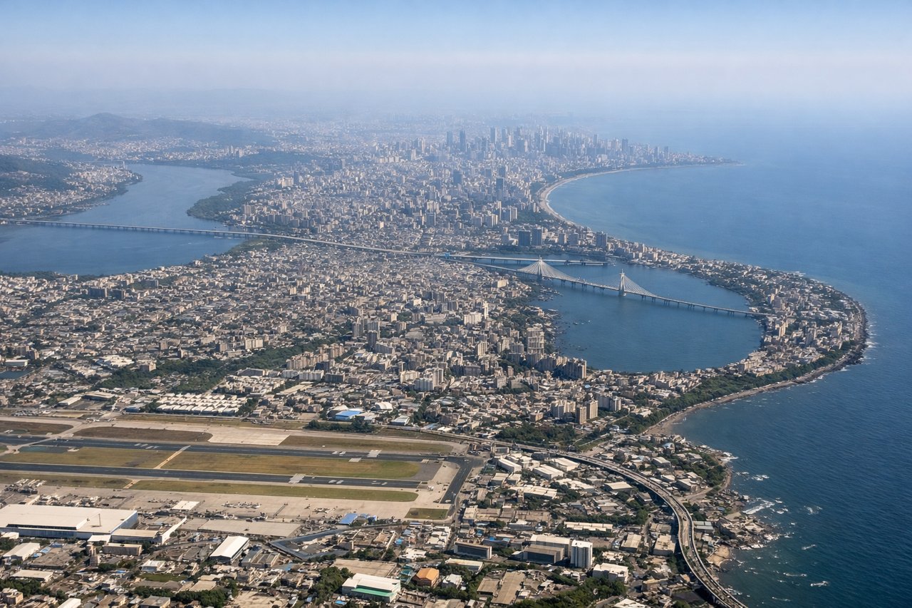
RIGHTBOM typically departs eastbound (runways 09L/09R). Right-side seats face north across the Arabian Sea initially, then turn inland toward the Western Ghats. Left seats see the urban sprawl of Mumbai and industrial areas.
Landing at IXB
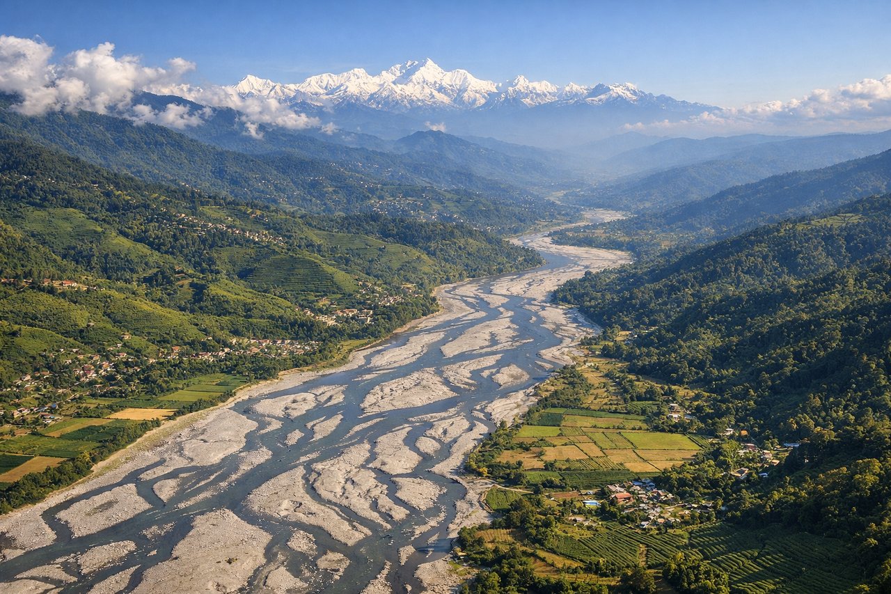
LEFTIXB approaches from the west (runway 10/28 primary). Left-side seats descend over the Teesta River valley and foothills of the Eastern Himalayas, with views of the Darjeeling district's tea plantations and the Mahananda River. Right seats see the Assam plains and less dramatic terrain.
Landmarks on this routeAll landmarks →
Will your flight be in sunlight?
See exactly which side of the plane gets sun and shade at your departure time.
About This Route
Which side of the plane should I sit on flying from Chhatrapati Shivaji International (BOM) to Bagdogra (IXB)?
Sit on the Left side of the plane for the best views on flights from Bombay to Baghdogra. While takeoff favors the right, the landing approach over the Teesta River and Himalayan foothills is visually superior and more geographically distinctive. The left side captures the dramatic transition from plains to mountains that defines this route.
What can I see during takeoff from Chhatrapati Shivaji International in Bombay?
During takeoff from Chhatrapati Shivaji International (BOM), sit on the Right side for the best views. BOM typically departs eastbound (runways 09L/09R). Right-side seats face north across the Arabian Sea initially, then turn inland toward the Western Ghats. Left seats see the urban sprawl of Mumbai and industrial areas. Notable sights include: Arabian Sea (immediate west), Mumbai harbor and docks, Thane Creek to the northeast, Western Ghats escarpment rising inland.
What can I see when landing at Bagdogra in Baghdogra?
When landing at Bagdogra (IXB), sit on the Left side for the best views. IXB approaches from the west (runway 10/28 primary). Left-side seats descend over the Teesta River valley and foothills of the Eastern Himalayas, with views of the Darjeeling district's tea plantations and the Mahananda River. Right seats see the Assam plains and less dramatic terrain. Notable sights include: Teesta River (braided channels visible), Eastern Himalayan foothills, Darjeeling district tea gardens (geometric green patterns), Mahananda River valley.
How long is the flight from Bombay to Baghdogra?
The flight from Chhatrapati Shivaji International (BOM) to Bagdogra (IXB) takes Approximately 2 hours 15 minutes.
What does the Bombay to Baghdogra flight path pass over?
The flight path crosses the Deccan Plateau's northern edge, passes over the Satpura and Maikal ranges (visible as forested ridges around 15,000-20,000 feet), then descends into the Gangetic plains. The Narmada River valley is crossed in the central portion. As the aircraft approaches Bengal, the terrain flattens before rising again into the Eastern Himalayas. The Teesta River system becomes visible about 30 minutes before landing, marking entry into the Darjeeling foothills.