Right side scores higher due to the landing sequence into Melbourne, which features Port Phillip Bay, the Dandenong Ranges, and the CBD skyline—all visually distinctive landmarks. The takeoff from Mumbai is scenic but brief; the cruise phase over the Indian Ocean and across the Australian continent offers minimal dramatic terrain on either side. The landing approach into Melbourne provides concentrated scenic value that outweighs the Mumbai departure advantage.
Flown BOM to MEL? Did we get it right?
Flight Path
Bombay to Melbourne is 6,093 miles (9,806 km), a flight of about 13 hours 20 minutes.
Indian Ocean (open water for 8+ hours with no visible landmarks), southern Indian coastline near Kanyakumari (southern tip of India, visible on some routes), Maldives archipelago (if route passes nearby—low-lying atolls, difficult to see at cruise altitude), Chagos Archipelago (remote, rarely visible), Timor Sea crossing, Kimberley region of Western Australia (remote, sparse visibility), Great Australian Bight coastline (approaching Australia from the west)
Great circle distance and headings ›Phase by phase
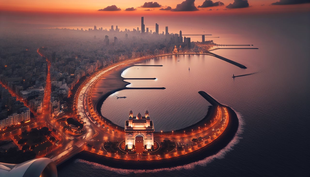
Takeoff from BOM
LEFTLeft side captures Mumbai's Arabian Sea coastline and harbor during departure. Runway 27 departures climb northwestward over the city and water, offering views of the Bombay High oil platforms and the coastal urban sprawl before turning toward the Indian subcontinent.
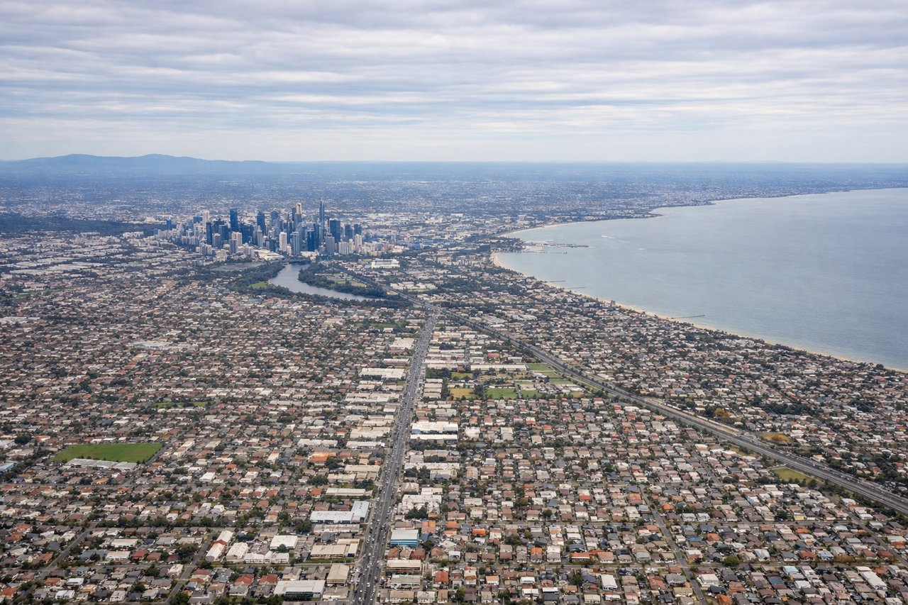
Landing at MEL
RIGHTRight side offers superior approach scenery into Melbourne. Typical arrivals from the northwest descend over the Dandenong Ranges and Port Phillip Bay, with views of the bay's distinctive geography, the Yarra River estuary, and Melbourne's CBD skyline before landing on runway 16 or 34.
Will your flight be in sunlight?
Pick a date and time in the Sun Map to watch the sun move across your whole flight.
About This Route
Which side of the plane should I sit on flying from Chhatrapati Shivaji International (BOM) to Melbourne International (MEL)?
Sit on the Right side of the plane for the best views on flights from Bombay to Melbourne. Right side scores higher due to the landing sequence into Melbourne, which features Port Phillip Bay, the Dandenong Ranges, and the CBD skyline—all visually distinctive landmarks. The takeoff from Mumbai is scenic but brief; the cruise phase over the Indian Ocean and across the Australian continent offers minimal dramatic terrain on either side. The landing approach into Melbourne provides concentrated scenic value that outweighs the Mumbai departure advantage.
What can I see during takeoff from Chhatrapati Shivaji International in Bombay?
During takeoff from Chhatrapati Shivaji International (BOM), sit on the Left side for the best views. Left side captures Mumbai's Arabian Sea coastline and harbor during departure. Runway 27 departures climb northwestward over the city and water, offering views of the Bombay High oil platforms and the coastal urban sprawl before turning toward the Indian subcontinent. Notable sights include: Arabian Sea, Mumbai harbor and Gateway of India district, Bombay High offshore platforms, Western Ghats foothills to the east.
What can I see when landing at Melbourne International in Melbourne?
When landing at Melbourne International (MEL), sit on the Right side for the best views. Right side offers superior approach scenery into Melbourne. Typical arrivals from the northwest descend over the Dandenong Ranges and Port Phillip Bay, with views of the bay's distinctive geography, the Yarra River estuary, and Melbourne's CBD skyline before landing on runway 16 or 34. Notable sights include: Port Phillip Bay, Dandenong Ranges, Yarra River estuary, Melbourne CBD skyline.
How long is the flight from Bombay to Melbourne?
The flight from Chhatrapati Shivaji International (BOM) to Melbourne International (MEL) takes about 13 hours 20 minutes. The shortest flight path between them is 6,093 miles (9,806 km); winds and air traffic control usually add a few percent.
What does the Bombay to Melbourne flight path pass over?
Indian Ocean (open water for 8+ hours with no visible landmarks), southern Indian coastline near Kanyakumari (southern tip of India, visible on some routes), Maldives archipelago (if route passes nearby—low-lying atolls, difficult to see at cruise altitude), Chagos Archipelago (remote, rarely visible), Timor Sea crossing, Kimberley region of Western Australia (remote, sparse visibility), Great Australian Bight coastline (approaching Australia from the west)