While takeoff offers Brasília's urban geometry, the landing approach to Cuzco provides more dramatic and visually distinctive scenery—the high Andes peaks, the winding Urubamba River, and the Sacred Valley are far more striking from a window seat than the relatively flat departure from Brasília.
Flown BSB to CUZ? Did we get it right?
Flight Path
Brasilia to Cuzco is 1,612 miles (2,595 km), a flight of about 3 hours 10 minutes.
The flight crosses the Brazilian Plateau westward, passing over the states of Goiás and Mato Grosso do Sul, then enters the foothills of the Andes in Peru. The Madeira River system and tributaries may be visible in the midpoint, along with the transition from cerrado grassland to Andean foothills. The approach to Peru brings increasingly dramatic topography as the aircraft climbs toward the high-altitude Cuzco basin.
Great circle distance and headings ›

Phase by phase

Takeoff from BSB
LEFTLeft side offers views of Brasília's distinctive modernist urban layout and the artificial Lake Paranoá, which is visually striking from altitude. The westward departure path also aligns left-side windows with the Brazilian Plateau terrain.
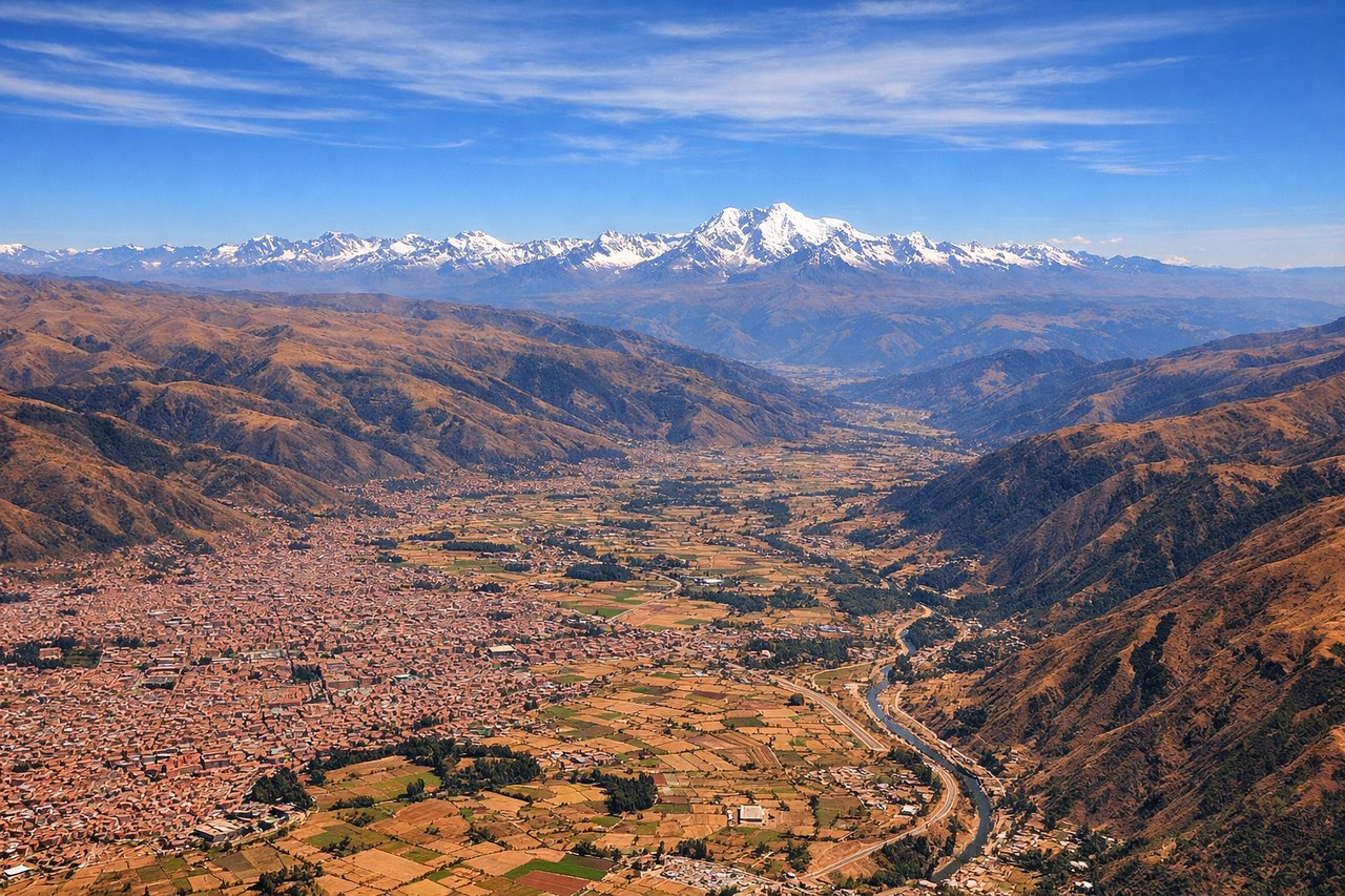
Landing at CUZ
RIGHTRight-side windows capture the dramatic approach to Cuzco through the Andes. The descent path brings the Sacred Valley and surrounding high peaks into view on the right, with the Urubamba River valley visible as a distinctive linear feature cutting through the mountains.
Will your flight be in sunlight?
Pick a date and time in the Sun Map to watch the sun move across your whole flight.
About This Route
Which side of the plane should I sit on flying from Presidente Juscelino Kubitschek (BSB) to Velazco Astete (CUZ)?
Sit on the Right side of the plane for the best views on flights from Brasilia to Cuzco. While takeoff offers Brasília's urban geometry, the landing approach to Cuzco provides more dramatic and visually distinctive scenery—the high Andes peaks, the winding Urubamba River, and the Sacred Valley are far more striking from a window seat than the relatively flat departure from Brasília.
What can I see during takeoff from Presidente Juscelino Kubitschek in Brasilia?
During takeoff from Presidente Juscelino Kubitschek (BSB), sit on the Left side for the best views. Left side offers views of Brasília's distinctive modernist urban layout and the artificial Lake Paranoá, which is visually striking from altitude. The westward departure path also aligns left-side windows with the Brazilian Plateau terrain. Notable sights include: Lake Paranoá (artificial reservoir), Brasília's radial street grid and government buildings, Brazilian Plateau escarpment to the west, cerrado grassland extending westward.
What can I see when landing at Velazco Astete in Cuzco?
When landing at Velazco Astete (CUZ), sit on the Right side for the best views. Right-side windows capture the dramatic approach to Cuzco through the Andes. The descent path brings the Sacred Valley and surrounding high peaks into view on the right, with the Urubamba River valley visible as a distinctive linear feature cutting through the mountains. Notable sights include: Urubamba River valley (winding through high terrain), Andes mountain peaks surrounding Cuzco basin, Sacred Valley agricultural terraces, Cuzco city nestled in the high-altitude basin.
How long is the flight from Brasilia to Cuzco?
The flight from Presidente Juscelino Kubitschek (BSB) to Velazco Astete (CUZ) takes about 3 hours 10 minutes. The shortest flight path between them is 1,612 miles (2,595 km); winds and air traffic control usually add a few percent.
What does the Brasilia to Cuzco flight path pass over?
The flight crosses the Brazilian Plateau westward, passing over the states of Goiás and Mato Grosso do Sul, then enters the foothills of the Andes in Peru. The Madeira River system and tributaries may be visible in the midpoint, along with the transition from cerrado grassland to Andean foothills. The approach to Peru brings increasingly dramatic topography as the aircraft climbs toward the high-altitude Cuzco basin.