Right side edges ahead due to the superior takeoff experience—Brasília's iconic modernist urban layout and Lago Paranoá provide distinctive visual interest during climb-out that left side cannot match. While landing favors left (coastal approach), the takeoff advantage and the fact that both sides score equally on cruise (flat terrain, minimal landmarks for most of the flight) gives right the overall edge. This is a close call on a relatively modest scenic route.
Flight Path
The flight path crosses the interior plateau of central Brazil, passing over the states of Goiás and Tocantins. The terrain remains predominantly cerrado scrubland—open grassland with scattered vegetation and occasional river valleys. The Rio Tocantins and its tributaries are visible as thin brown lines cutting through the landscape. No major mountain ranges or dramatic topography interrupt the route; the landscape is uniformly flat to gently rolling. As the aircraft approaches Recife, the terrain gradually transitions from inland cerrado to coastal lowlands, with the Atlantic coastline becoming visible approximately 50 miles before landing.
Great circle distance and headings ›Phase by phase
Takeoff from BSB
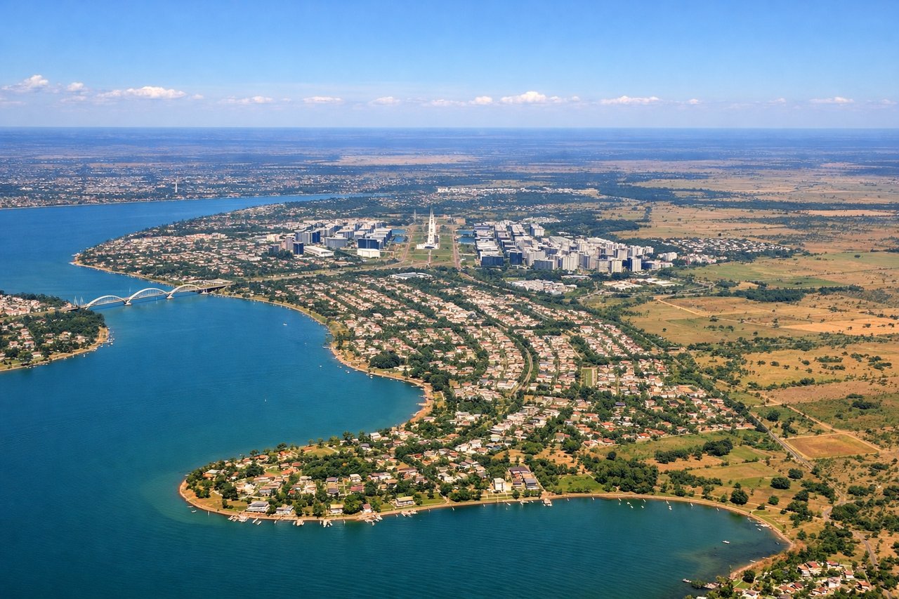
RIGHTRight side captures Brasília's modernist urban layout during climb-out, with the distinctive curved government buildings and artificial Lago Paranoá visible before the aircraft turns northeast toward Recife. Left side shows only the high plateau scrubland (cerrado) with minimal visual interest.
Landing at REC
LEFTLeft side provides the superior approach experience into Recife, with views of the Atlantic coastline, the Capibaribe River delta, and the city's waterfront districts as the aircraft descends on final approach to runway 18. Right side shows only open ocean and lacks the urban and coastal detail.
Landmarks on this routeAll landmarks →
Will your flight be in sunlight?
See exactly which side of the plane gets sun and shade at your departure time.
About This Route
Which side of the plane should I sit on flying from Presidente Juscelino Kubitschek (BSB) to Guararapes (REC)?
Sit on the Right side of the plane for the best views on flights from Brasilia to Recife. Right side edges ahead due to the superior takeoff experience—Brasília's iconic modernist urban layout and Lago Paranoá provide distinctive visual interest during climb-out that left side cannot match. While landing favors left (coastal approach), the takeoff advantage and the fact that both sides score equally on cruise (flat terrain, minimal landmarks for most of the flight) gives right the overall edge. This is a close call on a relatively modest scenic route.
What can I see during takeoff from Presidente Juscelino Kubitschek in Brasilia?
During takeoff from Presidente Juscelino Kubitschek (BSB), sit on the Right side for the best views. Right side captures Brasília's modernist urban layout during climb-out, with the distinctive curved government buildings and artificial Lago Paranoá visible before the aircraft turns northeast toward Recife. Left side shows only the high plateau scrubland (cerrado) with minimal visual interest. Notable sights include: Lago Paranoá (artificial lake), Brasília's central government district, Planalto Palace complex, cerrado plateau terrain.
What can I see when landing at Guararapes in Recife?
When landing at Guararapes (REC), sit on the Left side for the best views. Left side provides the superior approach experience into Recife, with views of the Atlantic coastline, the Capibaribe River delta, and the city's waterfront districts as the aircraft descends on final approach to runway 18. Right side shows only open ocean and lacks the urban and coastal detail. Notable sights include: Capibaribe River delta and estuary, Recife's central waterfront and harbor, Atlantic coastline with reef formations, Boa Viagem beach district.
How long is the flight from Brasilia to Recife?
The flight from Presidente Juscelino Kubitschek (BSB) to Guararapes (REC) takes 1h 50m.
What does the Brasilia to Recife flight path pass over?
The flight path crosses the interior plateau of central Brazil, passing over the states of Goiás and Tocantins. The terrain remains predominantly cerrado scrubland—open grassland with scattered vegetation and occasional river valleys. The Rio Tocantins and its tributaries are visible as thin brown lines cutting through the landscape. No major mountain ranges or dramatic topography interrupt the route; the landscape is uniformly flat to gently rolling. As the aircraft approaches Recife, the terrain gradually transitions from inland cerrado to coastal lowlands, with the Atlantic coastline becoming visible approximately 50 miles before landing.