While takeoff from BUF favors the right, the landing approach into DCA from the north is the more dramatic and geographically significant segment. Left-side seats during descent provide unobstructed views of the Potomac River, the National Mall, and Washington's monumental core—the most visually distinctive part of this route.
Flown BUF to DCA? Did we get it right?
Flight Path
Buffalo to Washington is 296 miles (476 km), a flight of about 1 hour 20 minutes.
The flight path crosses the Appalachian ridgelines (visible as linear mountain features running northeast-southwest, particularly the Blue Ridge in Virginia during descent). The Shenandoah Valley lies to the west of the direct route. The Potomac River valley becomes increasingly prominent in the final 30 minutes of descent, with the river's serpentine course becoming a major visual reference point.
Great circle distance and headings ›

Phase by phase
Takeoff from BUF
RIGHTBUF typically departs runways 24 or 23 (westbound), and right-side seats give you a clear view of Lake Ontario immediately after liftoff. You'll see the Niagara River gorge and the lake's eastern shoreline as you climb, with the city of Buffalo receding beneath you.
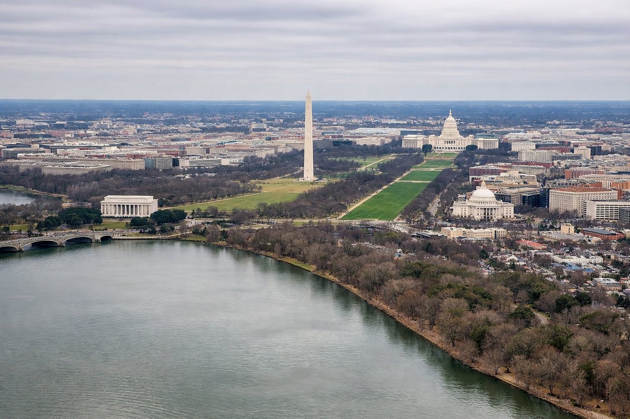
Landing at DCA
LEFTDCA uses runways 1 or 19 depending on wind. Approach from the north typically means left-side seats face the Potomac River and central Washington landmarks. You'll see the river's course, the National Mall area, and the city's monumental core as you descend into the final approach.
Will your flight be in sunlight?
Pick a date and time in the Sun Map to watch the sun move across your whole flight.
About This Route
Which side of the plane should I sit on flying from Buffalo Niagara International (BUF) to Ronald Reagan Washington National (DCA)?
Sit on the Left side of the plane for the best views on flights from Buffalo to Washington. While takeoff from BUF favors the right, the landing approach into DCA from the north is the more dramatic and geographically significant segment. Left-side seats during descent provide unobstructed views of the Potomac River, the National Mall, and Washington's monumental core—the most visually distinctive part of this route.
What can I see during takeoff from Buffalo Niagara International in Buffalo?
During takeoff from Buffalo Niagara International (BUF), sit on the Right side for the best views. BUF typically departs runways 24 or 23 (westbound), and right-side seats give you a clear view of Lake Ontario immediately after liftoff. You'll see the Niagara River gorge and the lake's eastern shoreline as you climb, with the city of Buffalo receding beneath you. Notable sights include: Lake Ontario (north), Niagara River and gorge (east), Buffalo city grid (south), Niagara Falls area (northeast).
What can I see when landing at Ronald Reagan Washington National in Washington?
When landing at Ronald Reagan Washington National (DCA), sit on the Left side for the best views. DCA uses runways 1 or 19 depending on wind. Approach from the north typically means left-side seats face the Potomac River and central Washington landmarks. You'll see the river's course, the National Mall area, and the city's monumental core as you descend into the final approach. Notable sights include: Potomac River (west and south of approach), National Mall and central Washington (south), Arlington, Virginia (west), Anacostia River confluence (southeast).
How long is the flight from Buffalo to Washington?
The flight from Buffalo Niagara International (BUF) to Ronald Reagan Washington National (DCA) takes about 1 hour 20 minutes. The shortest flight path between them is 296 miles (476 km); winds and air traffic control usually add a few percent.
What does the Buffalo to Washington flight path pass over?
The flight path crosses the Appalachian ridgelines (visible as linear mountain features running northeast-southwest, particularly the Blue Ridge in Virginia during descent). The Shenandoah Valley lies to the west of the direct route. The Potomac River valley becomes increasingly prominent in the final 30 minutes of descent, with the river's serpentine course becoming a major visual reference point.