While takeoff favors the mountain-side right view, the cruise phase along the coastal airway and the bay-facing final approach give the left side more sustained scenic variety, including coastline glimpses and the South Bay wetlands.
Flown BUR to SJC? Did we get it right?
Flight Path
Burbank to San Jose is 296 miles (477 km), a flight of about 1 hour 5 minutes.
Route generally tracks near the California coast and Santa Barbara Channel before cutting inland past Vandenberg and the Santa Lucia Range toward Monterey Bay and the South Bay approach into San Jose.
Great circle distance and headings ›

Phase by phase
Takeoff from BUR
RIGHTDeparting Runway 15, the initial climb and turn puts the steep San Gabriel Mountains right off the right side of the plane, towering abruptly over the Burbank valley floor. The left side mostly shows the flatter San Fernando Valley and distant downtown LA haze.
Landing at SJC
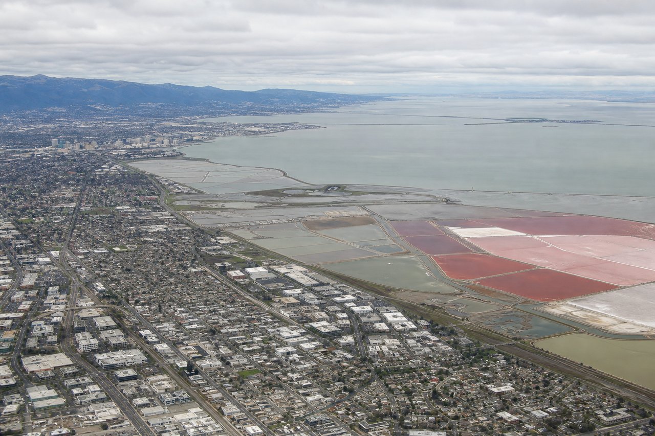
LEFTOn approach into SJC from the south, the left side offers views across the South Bay and Santa Clara Valley toward the Santa Cruz Mountains, plus glimpses of the Bay's wetlands before touchdown on Runway 30. The right side mainly shows the drier, less distinctive Diablo Range foothills.
Will your flight be in sunlight?
Pick a date and time in the Sun Map to watch the sun move across your whole flight.
About This Route
Which side of the plane should I sit on flying from Burbank Glendale Pasadena (BUR) to Norman Y Mineta San Jose International (SJC)?
Sit on the Left side of the plane for the best views on flights from Burbank to San Jose. While takeoff favors the mountain-side right view, the cruise phase along the coastal airway and the bay-facing final approach give the left side more sustained scenic variety, including coastline glimpses and the South Bay wetlands.
What can I see during takeoff from Burbank Glendale Pasadena in Burbank?
During takeoff from Burbank Glendale Pasadena (BUR), sit on the Right side for the best views. Departing Runway 15, the initial climb and turn puts the steep San Gabriel Mountains right off the right side of the plane, towering abruptly over the Burbank valley floor. The left side mostly shows the flatter San Fernando Valley and distant downtown LA haze. Notable sights include: San Gabriel Mountains, Verdugo Mountains, San Fernando Valley.
What can I see when landing at Norman Y Mineta San Jose International in San Jose?
When landing at Norman Y Mineta San Jose International (SJC), sit on the Left side for the best views. On approach into SJC from the south, the left side offers views across the South Bay and Santa Clara Valley toward the Santa Cruz Mountains, plus glimpses of the Bay's wetlands before touchdown on Runway 30. The right side mainly shows the drier, less distinctive Diablo Range foothills. Notable sights include: Santa Cruz Mountains, South San Francisco Bay wetlands, Santa Clara Valley.
How long is the flight from Burbank to San Jose?
The flight from Burbank Glendale Pasadena (BUR) to Norman Y Mineta San Jose International (SJC) takes about 1 hour 5 minutes. The shortest flight path between them is 296 miles (477 km); winds and air traffic control usually add a few percent.
What does the Burbank to San Jose flight path pass over?
Route generally tracks near the California coast and Santa Barbara Channel before cutting inland past Vandenberg and the Santa Lucia Range toward Monterey Bay and the South Bay approach into San Jose.