The right side combines the only meaningful coastal and urban scenery at departure (Chesapeake Bay, Baltimore) with the dramatic volcanic terrain and bay views on arrival into Keflavik, while the left side offers comparatively flat, unremarkable terrain during both phases.
Flight Path
Extended cruise over the open North Atlantic Ocean with no land visible for several hours; on clear days passengers may spot scattered cloud streets or, near the flight's northern arc, the icy southern tip of Greenland in the far distance before descent into Iceland.
Great circle distance and headings ›Phase by phase
Takeoff from BWI
RIGHTDeparting BWI and turning northeast toward the Iceland routing, the right side looks out over the Chesapeake Bay and Baltimore's harbor before the climb continues over Pennsylvania and into New England, giving passengers a brief but genuine coastal/urban view. The left side mostly shows flat Maryland and Pennsylvania farmland with the distant, low Appalachian ridgelines.
Landing at KEF
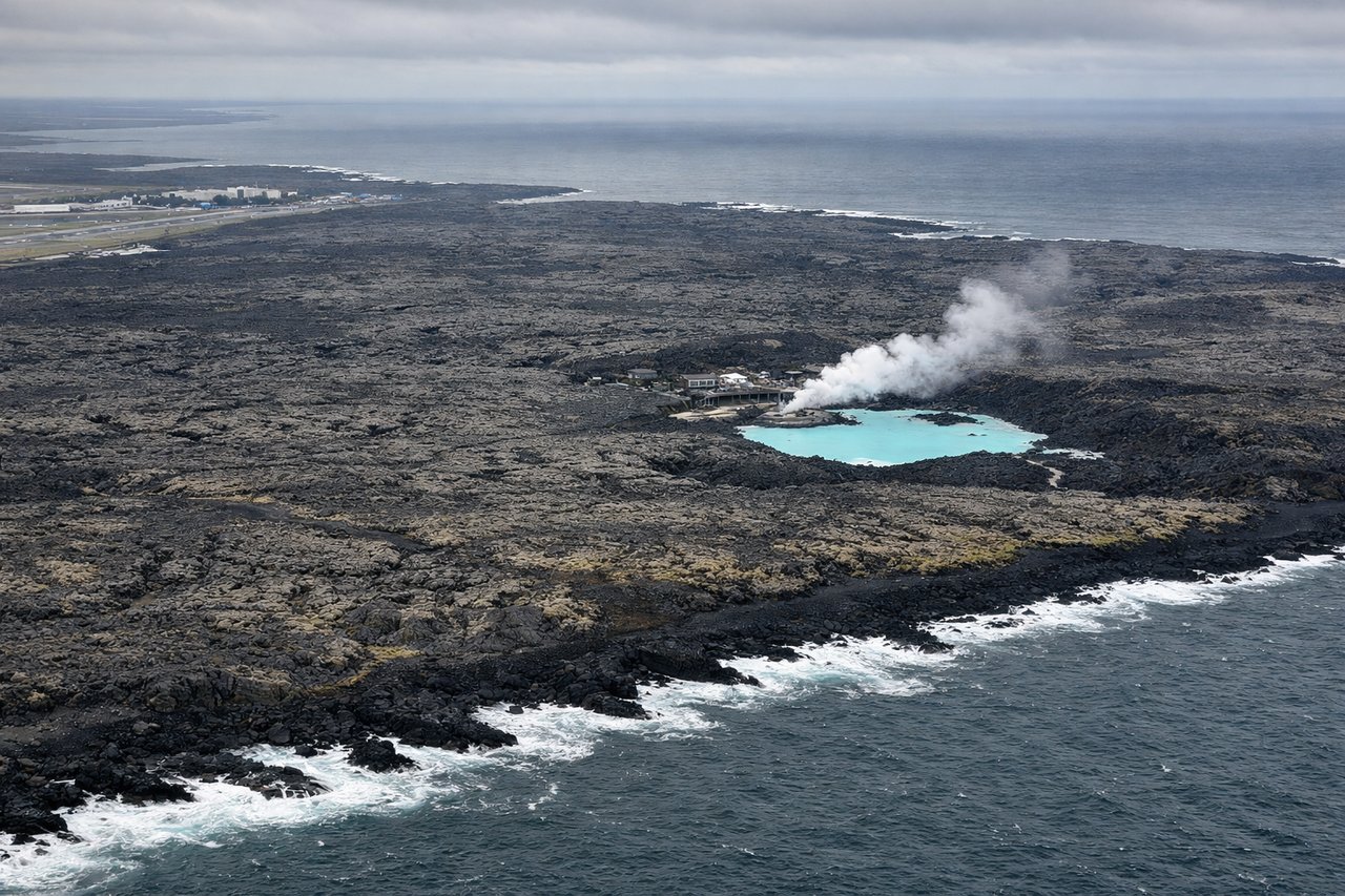
RIGHTOn approach into Keflavik, arrivals typically curve in from the south or southeast, putting the black volcanic Reykjanes peninsula and its lava fields on the right side, with glimpses of the Faxaflói bay and Reykjavik's coastline beyond. The left side during this turn mostly shows open ocean or the featureless interior of the peninsula.
Landmarks on this routeAll landmarks →
Will your flight be in sunlight?
See exactly which side of the plane gets sun and shade at your departure time.
About This Route
Which side of the plane should I sit on flying from Baltimore Washington International (BWI) to Keflavik Nas (KEF)?
Sit on the Right side of the plane for the best views on flights from Baltimore to Keflavik. The right side combines the only meaningful coastal and urban scenery at departure (Chesapeake Bay, Baltimore) with the dramatic volcanic terrain and bay views on arrival into Keflavik, while the left side offers comparatively flat, unremarkable terrain during both phases.
What can I see during takeoff from Baltimore Washington International in Baltimore?
During takeoff from Baltimore Washington International (BWI), sit on the Right side for the best views. Departing BWI and turning northeast toward the Iceland routing, the right side looks out over the Chesapeake Bay and Baltimore's harbor before the climb continues over Pennsylvania and into New England, giving passengers a brief but genuine coastal/urban view. The left side mostly shows flat Maryland and Pennsylvania farmland with the distant, low Appalachian ridgelines. Notable sights include: Chesapeake Bay, Baltimore Harbor and downtown skyline, Susquehanna River mouth.
What can I see when landing at Keflavik Nas in Keflavik?
When landing at Keflavik Nas (KEF), sit on the Right side for the best views. On approach into Keflavik, arrivals typically curve in from the south or southeast, putting the black volcanic Reykjanes peninsula and its lava fields on the right side, with glimpses of the Faxaflói bay and Reykjavik's coastline beyond. The left side during this turn mostly shows open ocean or the featureless interior of the peninsula. Notable sights include: Reykjanes Peninsula lava fields, Faxaflói Bay, distant Reykjavik coastline, Atlantic coast cliffs.
How long is the flight from Baltimore to Keflavik?
The flight from Baltimore Washington International (BWI) to Keflavik Nas (KEF) takes 5h 45m.
What does the Baltimore to Keflavik flight path pass over?
Extended cruise over the open North Atlantic Ocean with no land visible for several hours; on clear days passengers may spot scattered cloud streets or, near the flight's northern arc, the icy southern tip of Greenland in the far distance before descent into Iceland.