While left seats win at takeoff with Iceland's dramatic volcanic landscape, right seats dominate the landing experience with the Chesapeake Bay and Baltimore harbor—two of the most visually striking features on this route. The landing view is more consistently impressive and geographically significant.
Flight Path
The flight crosses the North Atlantic at high altitude (typically 31,000-35,000 feet). Notable features include the Mid-Atlantic Ridge region (not visible at altitude), the Grand Banks southeast of Newfoundland (visible as ocean texture and occasional cloud patterns), and the transition from open ocean to the continental shelf approaching North America. At cruise altitude, the curvature of the Earth becomes apparent, and the Atlantic typically appears as a featureless expanse with occasional weather systems visible as cloud formations. The Nova Scotia coast and New England coastline become visible during descent into the US East Coast.
Great circle distance and headings ›Phase by phase
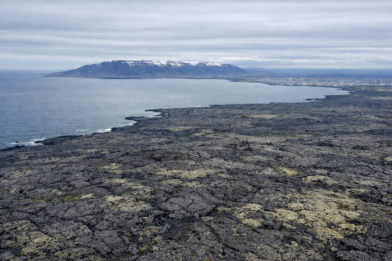
Takeoff from KEF
LEFTKEF typically departs runway 02 (northbound) or 20 (southbound). Left seats offer views of Iceland's southwestern coast, including the Reykjanes Peninsula's distinctive lava fields and the Atlantic Ocean. Right seats face inland toward less dramatic terrain.
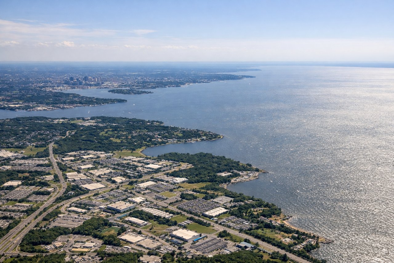
Landing at BWI
RIGHTBWI uses runways 01L/R (northbound) or 10L/R (eastbound) depending on wind. Right seats during descent offer views of the Chesapeake Bay, the Patapsco River estuary, and the Baltimore harbor area. Left seats see the inland Piedmont plateau with less distinctive features.
Landmarks on this routeAll landmarks →
Will your flight be in sunlight?
See exactly which side of the plane gets sun and shade at your departure time.
About This Route
Which side of the plane should I sit on flying from Keflavik Nas (KEF) to Baltimore Washington International (BWI)?
Sit on the Right side of the plane for the best views on flights from Keflavik to Baltimore. While left seats win at takeoff with Iceland's dramatic volcanic landscape, right seats dominate the landing experience with the Chesapeake Bay and Baltimore harbor—two of the most visually striking features on this route. The landing view is more consistently impressive and geographically significant.
What can I see during takeoff from Keflavik Nas in Keflavik?
During takeoff from Keflavik Nas (KEF), sit on the Left side for the best views. KEF typically departs runway 02 (northbound) or 20 (southbound). Left seats offer views of Iceland's southwestern coast, including the Reykjanes Peninsula's distinctive lava fields and the Atlantic Ocean. Right seats face inland toward less dramatic terrain. Notable sights include: Reykjanes Peninsula lava fields (dark volcanic rock formations), Atlantic Ocean to the west, Fagradalsfjall volcanic region, Grindavík town and geothermal areas.
What can I see when landing at Baltimore Washington International in Baltimore?
When landing at Baltimore Washington International (BWI), sit on the Right side for the best views. BWI uses runways 01L/R (northbound) or 10L/R (eastbound) depending on wind. Right seats during descent offer views of the Chesapeake Bay, the Patapsco River estuary, and the Baltimore harbor area. Left seats see the inland Piedmont plateau with less distinctive features. Notable sights include: Chesapeake Bay (large water body dominating the view), Patapsco River and Baltimore Inner Harbor, Dundalk and industrial areas along the bay, Eastern Shore peninsula across the water.
How long is the flight from Keflavik to Baltimore?
The flight from Keflavik Nas (KEF) to Baltimore Washington International (BWI) takes Approximately 5 hours 45 minutes to 6 hours 15 minutes.
What does the Keflavik to Baltimore flight path pass over?
The flight crosses the North Atlantic at high altitude (typically 31,000-35,000 feet). Notable features include the Mid-Atlantic Ridge region (not visible at altitude), the Grand Banks southeast of Newfoundland (visible as ocean texture and occasional cloud patterns), and the transition from open ocean to the continental shelf approaching North America. At cruise altitude, the curvature of the Earth becomes apparent, and the Atlantic typically appears as a featureless expanse with occasional weather systems visible as cloud formations. The Nova Scotia coast and New England coastline become visible during descent into the US East Coast.