While takeoff favors the left side for a brief harbor and bay view, the right side's payoff during the Rocky Mountain crossing and the dramatic Wasatch Range on final approach into SLC is more visually striking and memorable, giving it the higher overall score.
Flight Path
Appalachian ridges of western Pennsylvania, the flat farmland of the Midwest (Ohio, Indiana, Iowa), the high plains of Nebraska and Wyoming, and the Rocky Mountains before descending into the Salt Lake Valley.
Great circle distance and headings ›.jpeg?width=600)

.jpg?width=600)

Phase by phase
Takeoff from BWI
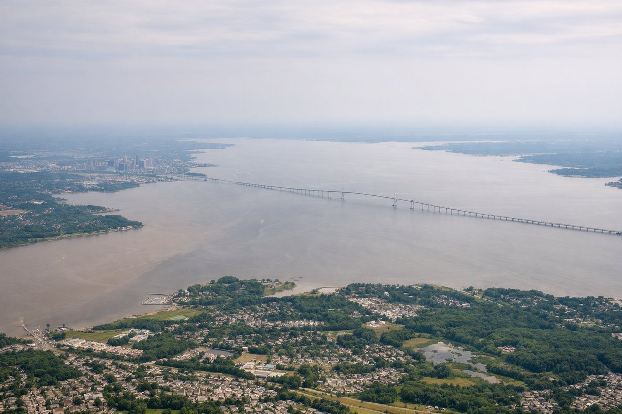
LEFTDeparting BWI to the west, the initial climb and turn give a good look back toward Baltimore's Inner Harbor and the upper Chesapeake Bay to the south, which is the most interesting scenery near the airport. The right side over the Maryland suburbs is comparatively unremarkable.
Landing at SLC
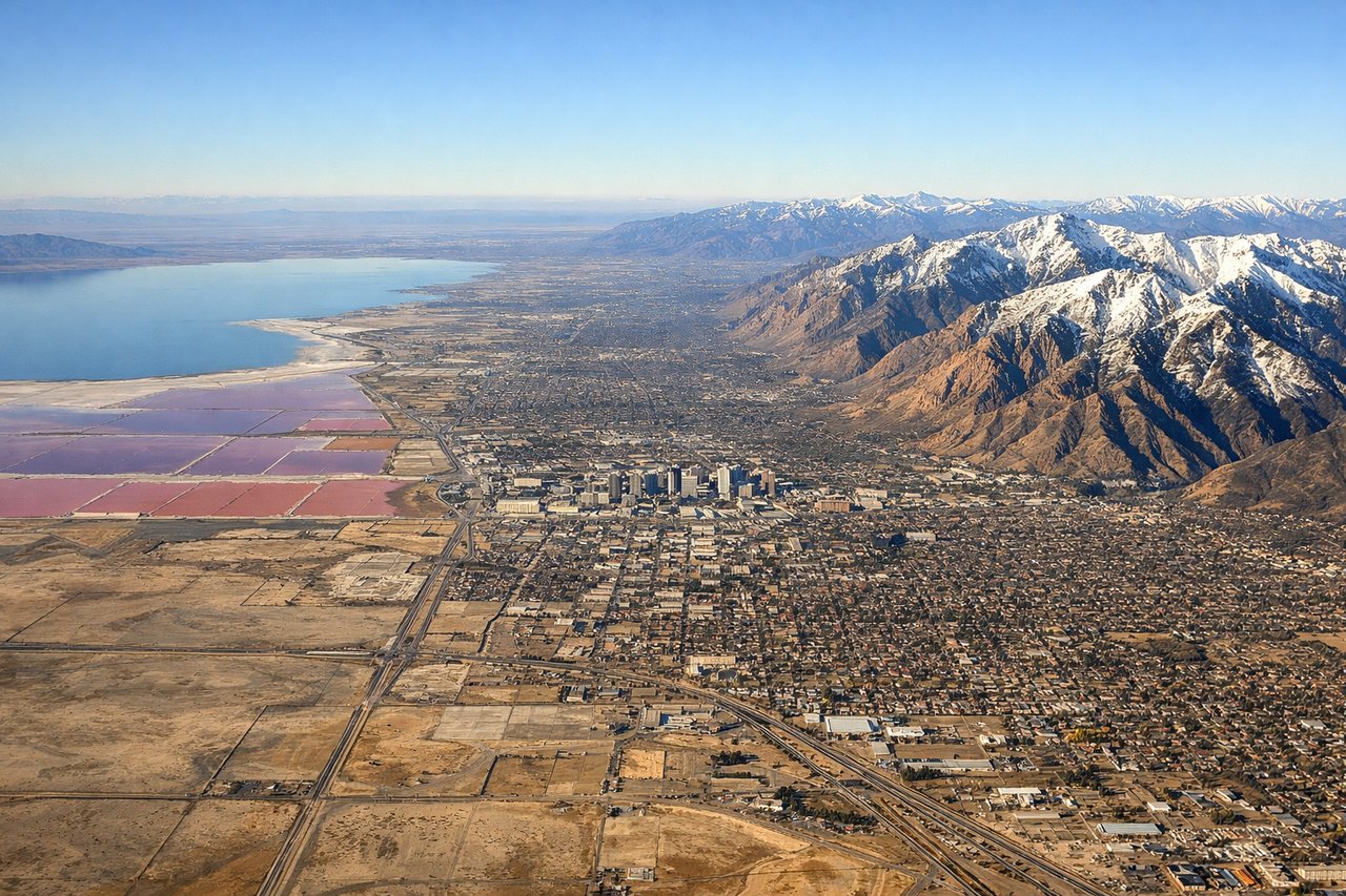
RIGHTOn approach into SLC the aircraft aligns with the north-south runways, and the east-facing side gets a close, dramatic view of the Wasatch Range rising sharply from the valley floor, while the Great Salt Lake and its salt flats appear in the distance to the west on the opposite side. The mountain wall is the more striking and identifiable feature during the final descent.
Landmarks on this routeAll landmarks →
Will your flight be in sunlight?
See exactly which side of the plane gets sun and shade at your departure time.
About This Route
Which side of the plane should I sit on flying from Baltimore Washington International (BWI) to Salt Lake City International (SLC)?
Sit on the Right side of the plane for the best views on flights from Baltimore to Salt Lake City. While takeoff favors the left side for a brief harbor and bay view, the right side's payoff during the Rocky Mountain crossing and the dramatic Wasatch Range on final approach into SLC is more visually striking and memorable, giving it the higher overall score.
What can I see during takeoff from Baltimore Washington International in Baltimore?
During takeoff from Baltimore Washington International (BWI), sit on the Left side for the best views. Departing BWI to the west, the initial climb and turn give a good look back toward Baltimore's Inner Harbor and the upper Chesapeake Bay to the south, which is the most interesting scenery near the airport. The right side over the Maryland suburbs is comparatively unremarkable. Notable sights include: Chesapeake Bay, Baltimore Inner Harbor, Patapsco River, Baltimore skyline.
What can I see when landing at Salt Lake City International in Salt Lake City?
When landing at Salt Lake City International (SLC), sit on the Right side for the best views. On approach into SLC the aircraft aligns with the north-south runways, and the east-facing side gets a close, dramatic view of the Wasatch Range rising sharply from the valley floor, while the Great Salt Lake and its salt flats appear in the distance to the west on the opposite side. The mountain wall is the more striking and identifiable feature during the final descent. Notable sights include: Wasatch Range, Salt Lake Valley, Great Salt Lake, Oquirrh Mountains.
How long is the flight from Baltimore to Salt Lake City?
The flight from Baltimore Washington International (BWI) to Salt Lake City International (SLC) takes 4h15m.
What does the Baltimore to Salt Lake City flight path pass over?
Appalachian ridges of western Pennsylvania, the flat farmland of the Midwest (Ohio, Indiana, Iowa), the high plains of Nebraska and Wyoming, and the Rocky Mountains before descending into the Salt Lake Valley.