While left seats capture the dramatic Wasatch Range departure, right seats provide superior views on the longer, more visually interesting landing sequence into BWI, with the Patapsco estuary and Baltimore Harbor being more distinctive than the relatively flat eastern approach corridor.
Flight Path
The flight crosses the Wasatch Range, then the Great Basin (sparse, arid terrain with scattered low mountains), transitions over the Rocky Mountains in Wyoming and Colorado (visible as a series of north-south trending ranges), crosses the High Plains of Kansas and Missouri (flat to gently rolling), then descends over the Appalachian foothills of West Virginia and Maryland before reaching the Chesapeake Bay region. The Appalachian ridges become increasingly visible in the final 90 minutes of flight, running northeast-southwest across the landscape.
Great circle distance and headings ›
.jpg?width=600)

.jpeg?width=600)
Phase by phase
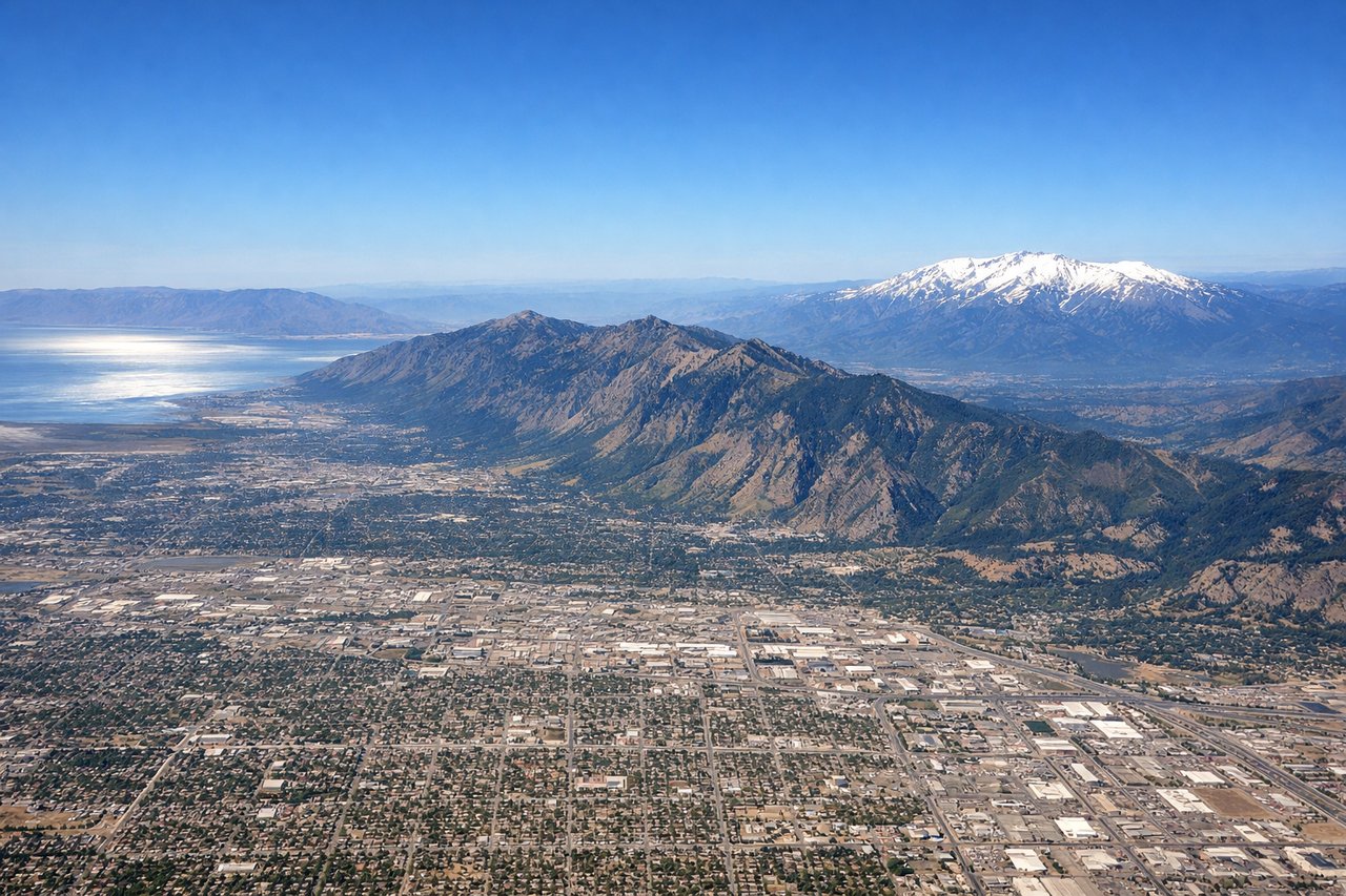
Takeoff from SLC
LEFTSLC typically departs westbound (Runways 16L/R or 34L/R depending on wind). Left seats face north initially, capturing the Wasatch Range's dramatic eastern escarpment and the Great Salt Lake's northern arm before the aircraft turns eastbound for the crossing.
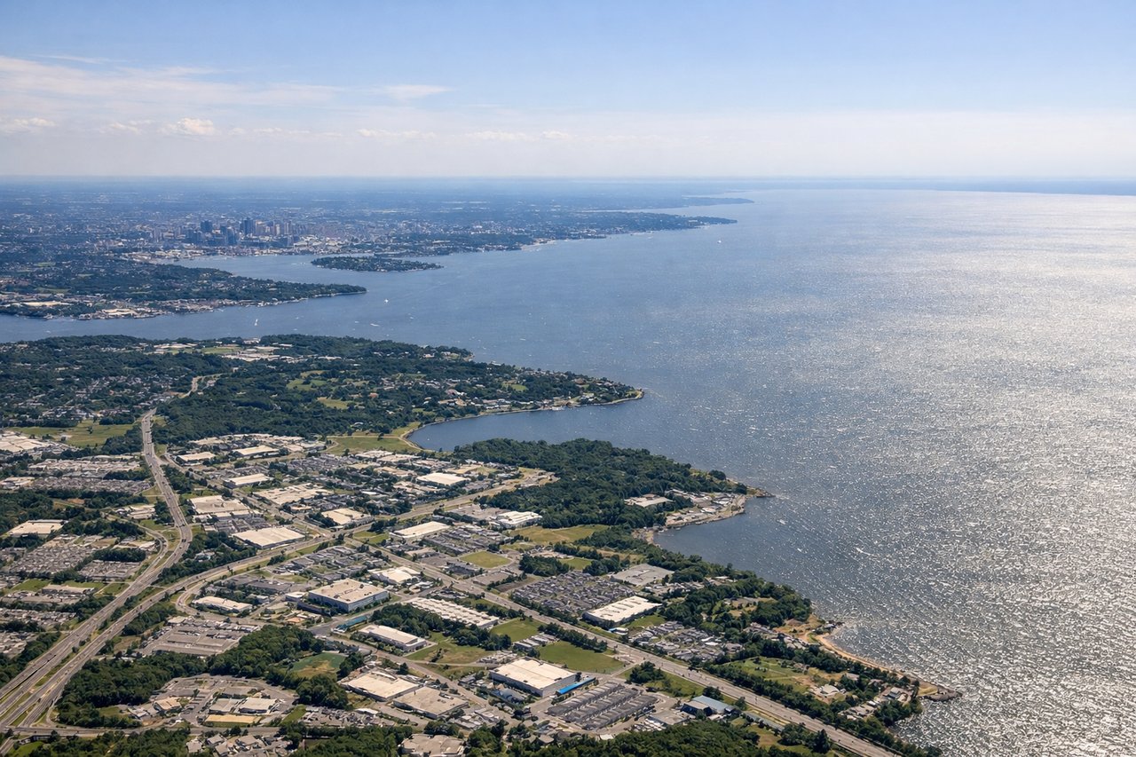
Landing at BWI
RIGHTBWI uses Runways 10L/R or 28L/R. Eastbound arrivals typically descend on approach vectors from the west, and right-side seats face north toward the Patapsco River estuary, Baltimore's Inner Harbor, and the city's downtown skyline. This provides the most dramatic urban and water feature views during final approach.
Landmarks on this routeAll landmarks →
Will your flight be in sunlight?
See exactly which side of the plane gets sun and shade at your departure time.
About This Route
Which side of the plane should I sit on flying from Salt Lake City International (SLC) to Baltimore Washington International (BWI)?
Sit on the Right side of the plane for the best views on flights from Salt Lake City to Baltimore. While left seats capture the dramatic Wasatch Range departure, right seats provide superior views on the longer, more visually interesting landing sequence into BWI, with the Patapsco estuary and Baltimore Harbor being more distinctive than the relatively flat eastern approach corridor.
What can I see during takeoff from Salt Lake City International in Salt Lake City?
During takeoff from Salt Lake City International (SLC), sit on the Left side for the best views. SLC typically departs westbound (Runways 16L/R or 34L/R depending on wind). Left seats face north initially, capturing the Wasatch Range's dramatic eastern escarpment and the Great Salt Lake's northern arm before the aircraft turns eastbound for the crossing. Notable sights include: Wasatch Range (immediately north and east), Great Salt Lake (northwest, visible as a large pale body of water), Antelope Island (prominent in the lake's center), Oquirrh Mountains (west across the lake).
What can I see when landing at Baltimore Washington International in Baltimore?
When landing at Baltimore Washington International (BWI), sit on the Right side for the best views. BWI uses Runways 10L/R or 28L/R. Eastbound arrivals typically descend on approach vectors from the west, and right-side seats face north toward the Patapsco River estuary, Baltimore's Inner Harbor, and the city's downtown skyline. This provides the most dramatic urban and water feature views during final approach. Notable sights include: Patapsco River estuary (wide, branching waterway), Baltimore Inner Harbor (distinctive rectangular basin with visible piers and structures), Chesapeake Bay (broad water body to the east and northeast), Downtown Baltimore skyline (visible as a cluster of mid-rise buildings).
How long is the flight from Salt Lake City to Baltimore?
The flight from Salt Lake City International (SLC) to Baltimore Washington International (BWI) takes Approximately 4 hours 15 minutes.
What does the Salt Lake City to Baltimore flight path pass over?
The flight crosses the Wasatch Range, then the Great Basin (sparse, arid terrain with scattered low mountains), transitions over the Rocky Mountains in Wyoming and Colorado (visible as a series of north-south trending ranges), crosses the High Plains of Kansas and Missouri (flat to gently rolling), then descends over the Appalachian foothills of West Virginia and Maryland before reaching the Chesapeake Bay region. The Appalachian ridges become increasingly visible in the final 90 minutes of flight, running northeast-southwest across the landscape.