Belize City to Miami is 768 miles (1,236 km), a flight of about 2 hours 15 minutes.
The right side delivers the standout Belize Barrier Reef view at takeoff and the Florida Keys/Biscayne Bay/Miami skyline sequence on arrival, while the left side offers mostly open Caribbean water and flat terrain with no comparable landmarks.
Flight Path
Yucatan Channel, western tip of Cuba near Cabo San Antonio, open Straits of Florida
Great circle distance and headings ›


Phase by phase
Takeoff from BZE
RIGHTDeparting BZE to the east/northeast, the right side looks directly over the Belize Barrier Reef and its scattered cayes just offshore, one of the most visually striking coastal features in the Caribbean. The left side mostly shows flat mainland jungle and Belize City itself.
Landing at MIA
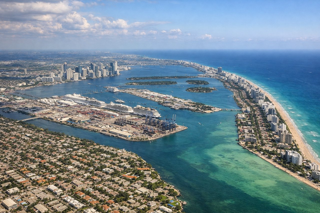
RIGHTOn approach into MIA from the south, the flight path typically tracks up past the Florida Keys and Biscayne Bay before turning onto final, giving right-side passengers views of the turquoise shallows, Miami Beach's barrier island, and the downtown skyline against the bay. The left side mainly faces the flat, marshy Everglades interior.
Landmarks on this routeAll landmarks →
Will your flight be in sunlight?
Pick a date and time in the Sun Map to watch the sun move across your whole flight.
About This Route
Which side of the plane should I sit on flying from Philip S W Goldson International (BZE) to Miami International (MIA)?
Sit on the Right side of the plane for the best views on flights from Belize City to Miami. The right side delivers the standout Belize Barrier Reef view at takeoff and the Florida Keys/Biscayne Bay/Miami skyline sequence on arrival, while the left side offers mostly open Caribbean water and flat terrain with no comparable landmarks.
What can I see during takeoff from Philip S W Goldson International in Belize City?
During takeoff from Philip S W Goldson International (BZE), sit on the Right side for the best views. Departing BZE to the east/northeast, the right side looks directly over the Belize Barrier Reef and its scattered cayes just offshore, one of the most visually striking coastal features in the Caribbean. The left side mostly shows flat mainland jungle and Belize City itself. Notable sights include: Belize Barrier Reef, Turneffe Atoll cayes, Belize City coastline, Caribbean turquoise shallows.
What can I see when landing at Miami International in Miami?
When landing at Miami International (MIA), sit on the Right side for the best views. On approach into MIA from the south, the flight path typically tracks up past the Florida Keys and Biscayne Bay before turning onto final, giving right-side passengers views of the turquoise shallows, Miami Beach's barrier island, and the downtown skyline against the bay. The left side mainly faces the flat, marshy Everglades interior. Notable sights include: Florida Keys chain, Biscayne Bay, Miami Beach barrier island, downtown Miami skyline.
How long is the flight from Belize City to Miami?
The flight from Philip S W Goldson International (BZE) to Miami International (MIA) takes about 2 hours 15 minutes. The shortest flight path between them is 768 miles (1,236 km); winds and air traffic control usually add a few percent.
What does the Belize City to Miami flight path pass over?
Yucatan Channel, western tip of Cuba near Cabo San Antonio, open Straits of Florida