Right-side seats capture the most dramatic geography: the Belize Barrier Reef and Caribbean during departure, then the flight path carries you northwest over the Yucatan Peninsula and eventually the Gulf of Mexico, where right-side views show the coastline and water features. Left side spends most of the flight over flat, featureless inland terrain.
Flown BZE to MSP? Did we get it right?
Flight Path
Belize City to Minneapolis is 1,910 miles (3,074 km), a flight of about 4 hours.
After leaving Belize airspace, the flight crosses the Yucatan Peninsula (flat, low-lying, covered in dense jungle and scrubland—minimal visual interest). You'll pass over or near the Yucatan Channel and the Gulf of Mexico. The flight then crosses into the southern United States, passing over Texas or Louisiana depending on routing. The Mississippi River valley becomes visible in the final descent approach to Minneapolis, with its distinctive meandering pattern visible from altitude. The Great Lakes region appears as you approach Minnesota, with Lake Michigan visible to the east on clear days.
Great circle distance and headings ›

Phase by phase
Takeoff from BZE
RIGHTBZE typically departs northbound on Runway 09/27 or uses the primary runway 09. Right-side seats face east toward the Caribbean Sea and the Belize Barrier Reef system as you climb out, offering immediate water views. Left side shows the flat Yucatan Peninsula interior.
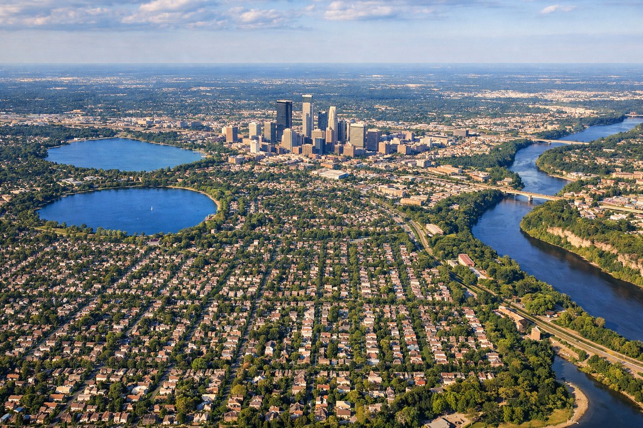
Landing at MSP
LEFTApproaching BZE from the north typically uses Runway 09 landing northbound. Left-side seats during descent offer views of the Belize Barrier Reef, the Caribbean coastline, and Belize City's waterfront as you descend toward the airport on the peninsula. Right side shows inland mangrove and flat terrain.
Will your flight be in sunlight?
Pick a date and time in the Sun Map to watch the sun move across your whole flight.
About This Route
Which side of the plane should I sit on flying from Philip S W Goldson International (BZE) to Minneapolis St Paul International (MSP)?
Sit on the Right side of the plane for the best views on flights from Belize City to Minneapolis. Right-side seats capture the most dramatic geography: the Belize Barrier Reef and Caribbean during departure, then the flight path carries you northwest over the Yucatan Peninsula and eventually the Gulf of Mexico, where right-side views show the coastline and water features. Left side spends most of the flight over flat, featureless inland terrain.
What can I see during takeoff from Philip S W Goldson International in Belize City?
During takeoff from Philip S W Goldson International (BZE), sit on the Right side for the best views. BZE typically departs northbound on Runway 09/27 or uses the primary runway 09. Right-side seats face east toward the Caribbean Sea and the Belize Barrier Reef system as you climb out, offering immediate water views. Left side shows the flat Yucatan Peninsula interior. Notable sights include: Belize Barrier Reef (visible as turquoise shallow water and reef structure), Caribbean Sea, Belize City waterfront and harbor, Half Moon Caye (small island visible southeast).
What can I see when landing at Minneapolis St Paul International in Minneapolis?
When landing at Minneapolis St Paul International (MSP), sit on the Left side for the best views. Approaching BZE from the north typically uses Runway 09 landing northbound. Left-side seats during descent offer views of the Belize Barrier Reef, the Caribbean coastline, and Belize City's waterfront as you descend toward the airport on the peninsula. Right side shows inland mangrove and flat terrain. Notable sights include: Belize Barrier Reef and reef structure, Caribbean Sea, Belize City waterfront and harbor, mangrove wetlands and lagoons.
How long is the flight from Belize City to Minneapolis?
The flight from Philip S W Goldson International (BZE) to Minneapolis St Paul International (MSP) takes about 4 hours. The shortest flight path between them is 1,910 miles (3,074 km); winds and air traffic control usually add a few percent.
What does the Belize City to Minneapolis flight path pass over?
After leaving Belize airspace, the flight crosses the Yucatan Peninsula (flat, low-lying, covered in dense jungle and scrubland—minimal visual interest). You'll pass over or near the Yucatan Channel and the Gulf of Mexico. The flight then crosses into the southern United States, passing over Texas or Louisiana depending on routing. The Mississippi River valley becomes visible in the final descent approach to Minneapolis, with its distinctive meandering pattern visible from altitude. The Great Lakes region appears as you approach Minnesota, with Lake Michigan visible to the east on clear days.