While takeoff offers coastal scenery, the landing approach into Calgary provides the most dramatic and visually distinctive views—the Rocky Mountains are a world-class landmark visible for over 100 miles on approach, making the right side the superior choice for the overall flight.
Flown BZE to YYC? Did we get it right?
Flight Path
Belize City to Calgary is 2,715 miles (4,369 km), a flight of about 5 hours 45 minutes.
The flight path crosses the Great Plains of the central United States and Canada. Notable features include the Mississippi River valley (visible during the first 90 minutes), the Missouri River system, the Great Plains extending from Texas through Oklahoma and Kansas into the Canadian prairies, and the transition zone where the Great Plains meet the Rocky Mountain foothills near the Alberta-Montana border. The landscape shifts from humid subtropical wetlands and forests in Belize to temperate deciduous forests in the southern US, then to vast open prairie and grassland, finally reaching the dramatic mountain terrain of western Canada.
Great circle distance and headings ›Phase by phase
Takeoff from BZE
LEFTLeft side offers views of Belize City's coastal geography and the Caribbean Sea as the aircraft climbs northwestward. You'll see the lagoons, mangrove systems, and barrier reef structures that define the Belize coastline during initial climb.
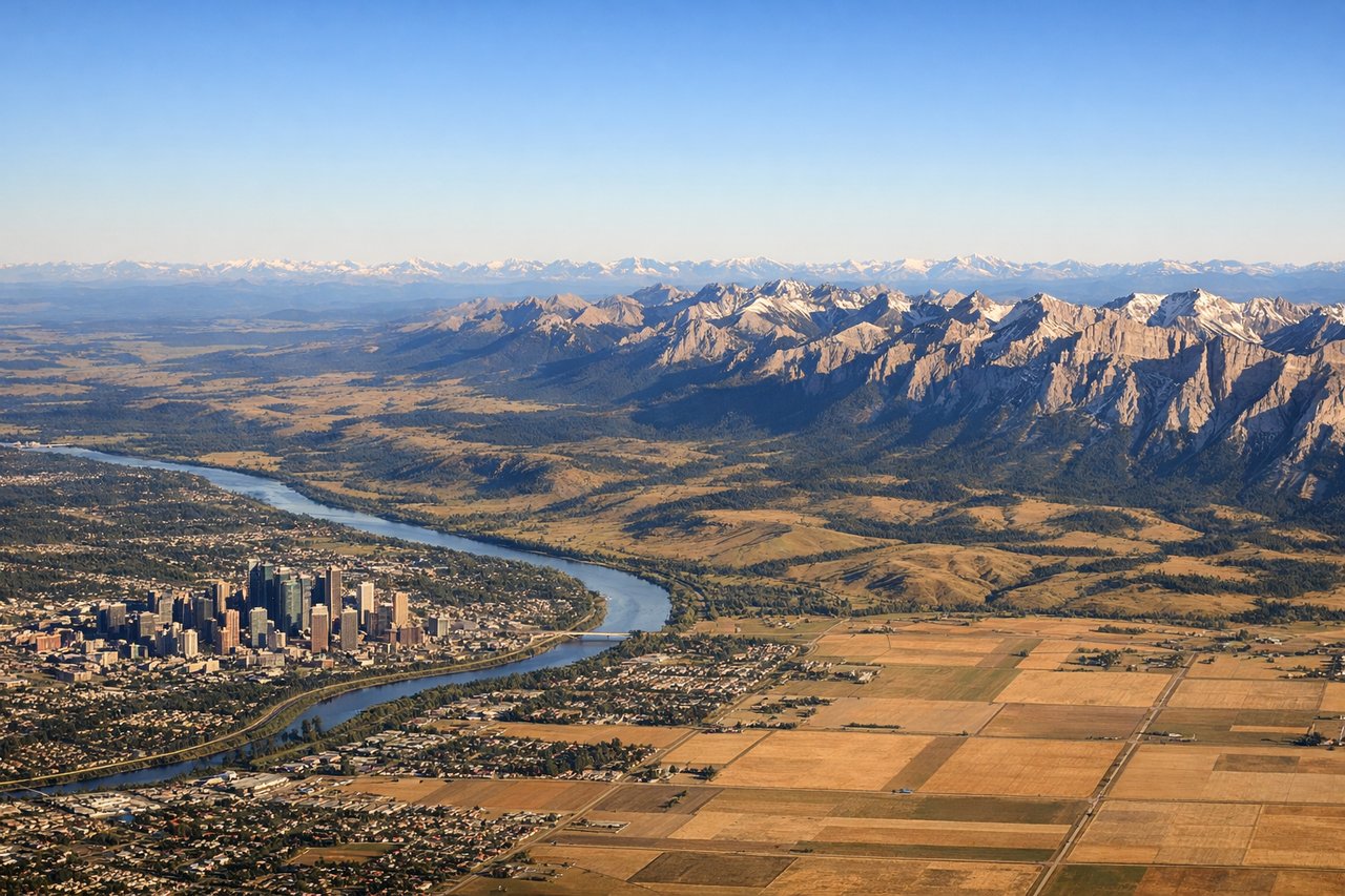
Landing at YYC
RIGHTRight side provides excellent views during descent into Calgary. You'll see the Canadian Rocky Mountains rising dramatically to the west and southwest, with the foothills rolling eastward toward the prairie. The Bow River valley and Calgary's urban sprawl become visible in the final approach.
Will your flight be in sunlight?
Pick a date and time in the Sun Map to watch the sun move across your whole flight.
About This Route
Which side of the plane should I sit on flying from Philip S W Goldson International (BZE) to Calgary International (YYC)?
Sit on the Right side of the plane for the best views on flights from Belize City to Calgary. While takeoff offers coastal scenery, the landing approach into Calgary provides the most dramatic and visually distinctive views—the Rocky Mountains are a world-class landmark visible for over 100 miles on approach, making the right side the superior choice for the overall flight.
What can I see during takeoff from Philip S W Goldson International in Belize City?
During takeoff from Philip S W Goldson International (BZE), sit on the Left side for the best views. Left side offers views of Belize City's coastal geography and the Caribbean Sea as the aircraft climbs northwestward. You'll see the lagoons, mangrove systems, and barrier reef structures that define the Belize coastline during initial climb. Notable sights include: Caribbean Sea, Belize City waterfront and lagoons, Half Moon Caye (visible as a small island feature in the reef system), mangrove-lined coastal wetlands.
What can I see when landing at Calgary International in Calgary?
When landing at Calgary International (YYC), sit on the Right side for the best views. Right side provides excellent views during descent into Calgary. You'll see the Canadian Rocky Mountains rising dramatically to the west and southwest, with the foothills rolling eastward toward the prairie. The Bow River valley and Calgary's urban sprawl become visible in the final approach. Notable sights include: Canadian Rocky Mountains (western skyline), foothills transition zone, Bow River valley, Calgary city grid and downtown core.
How long is the flight from Belize City to Calgary?
The flight from Philip S W Goldson International (BZE) to Calgary International (YYC) takes about 5 hours 45 minutes. The shortest flight path between them is 2,715 miles (4,369 km); winds and air traffic control usually add a few percent.
What does the Belize City to Calgary flight path pass over?
The flight path crosses the Great Plains of the central United States and Canada. Notable features include the Mississippi River valley (visible during the first 90 minutes), the Missouri River system, the Great Plains extending from Texas through Oklahoma and Kansas into the Canadian prairies, and the transition zone where the Great Plains meet the Rocky Mountain foothills near the Alberta-Montana border. The landscape shifts from humid subtropical wetlands and forests in Belize to temperate deciduous forests in the southern US, then to vast open prairie and grassland, finally reaching the dramatic mountain terrain of western Canada.