The right side delivers the spectacular Belize Barrier Reef on departure — one of the most visually dramatic coastal features in the Western Hemisphere — plus views of the Yucatan Peninsula's flat jungle interior and Gulf of Mexico coastline during the early climb. The left side has the better Toronto arrival view, but the reef alone makes right side the overall winner for the full journey.
Flown BZE to YYZ? Did we get it right?
Flight Path
Belize City to Toronto is 1,875 miles (3,018 km), a flight of about 4 hours 30 minutes.
The route tracks northward over the Yucatan Peninsula's flat limestone jungle, then crosses the Gulf of Mexico. Over the Gulf, both sides show open water. The aircraft then crosses the Mississippi Delta region and lower Mississippi River valley, traverses the US Midwest flatlands of Tennessee, Kentucky, and Ohio, crosses Lake Erie near its western end, and enters Canadian airspace over southern Ontario before descending into Toronto.
Great circle distance and headings ›

Phase by phase
Takeoff from BZE
RIGHTBZE's primary runway is oriented roughly east-west (runway 07/25). Departing eastward on runway 07, the aircraft climbs out over the Caribbean Sea and turns northward. Right-side seats face south and west, giving views back over Belize City, the coastal lagoons, and the northern tip of the Belize Barrier Reef — the second-largest barrier reef in the world — with its distinctive turquoise shallows and reef crest clearly visible against deep blue water.
Landing at YYZ
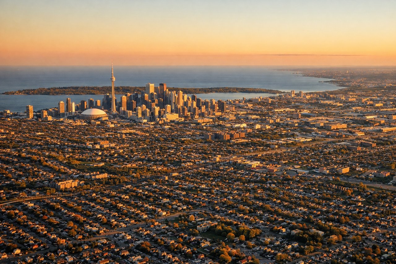
LEFTAircraft approaching Toronto Pearson typically land on runways oriented roughly east-west (06L/24R or 06R/24L) or northwest-southeast (15L/33R). On a standard approach from the south, left-side seats face east and south, offering views of downtown Toronto's skyline including the CN Tower, Lake Ontario's northern shoreline, and the city's dense urban grid as the aircraft descends over the western suburbs.
Will your flight be in sunlight?
Pick a date and time in the Sun Map to watch the sun move across your whole flight.
About This Route
Which side of the plane should I sit on flying from Philip S W Goldson International (BZE) to Lester B Pearson International (YYZ)?
Sit on the Right side of the plane for the best views on flights from Belize City to Toronto. The right side delivers the spectacular Belize Barrier Reef on departure — one of the most visually dramatic coastal features in the Western Hemisphere — plus views of the Yucatan Peninsula's flat jungle interior and Gulf of Mexico coastline during the early climb. The left side has the better Toronto arrival view, but the reef alone makes right side the overall winner for the full journey.
What can I see during takeoff from Philip S W Goldson International in Belize City?
During takeoff from Philip S W Goldson International (BZE), sit on the Right side for the best views. BZE's primary runway is oriented roughly east-west (runway 07/25). Departing eastward on runway 07, the aircraft climbs out over the Caribbean Sea and turns northward. Right-side seats face south and west, giving views back over Belize City, the coastal lagoons, and the northern tip of the Belize Barrier Reef — the second-largest barrier reef in the world — with its distinctive turquoise shallows and reef crest clearly visible against deep blue water. Notable sights include: Belize Barrier Reef crest and turquoise lagoon shallows, Belize City coastal sprawl and mouth of the Belize River, Northern Cayes including Caye Caulker and Ambergris Caye, coastal mangrove wetlands south of the city.
What can I see when landing at Lester B Pearson International in Toronto?
When landing at Lester B Pearson International (YYZ), sit on the Left side for the best views. Aircraft approaching Toronto Pearson typically land on runways oriented roughly east-west (06L/24R or 06R/24L) or northwest-southeast (15L/33R). On a standard approach from the south, left-side seats face east and south, offering views of downtown Toronto's skyline including the CN Tower, Lake Ontario's northern shoreline, and the city's dense urban grid as the aircraft descends over the western suburbs. Notable sights include: CN Tower and downtown Toronto skyline, Lake Ontario northern shoreline and Toronto waterfront, Humber Bay and Etobicoke Creek valley, Highway 427 and 401 interchange grid visible below final approach.
How long is the flight from Belize City to Toronto?
The flight from Philip S W Goldson International (BZE) to Lester B Pearson International (YYZ) takes about 4 hours 30 minutes. The shortest flight path between them is 1,875 miles (3,018 km); winds and air traffic control usually add a few percent.
What does the Belize City to Toronto flight path pass over?
The route tracks northward over the Yucatan Peninsula's flat limestone jungle, then crosses the Gulf of Mexico. Over the Gulf, both sides show open water. The aircraft then crosses the Mississippi Delta region and lower Mississippi River valley, traverses the US Midwest flatlands of Tennessee, Kentucky, and Ohio, crosses Lake Erie near its western end, and enters Canadian airspace over southern Ontario before descending into Toronto.