Right-side views dominate both departure and arrival phases. Takeoff provides urban-to-mountain transition views of the Pearl River Delta and Nanling foothills. Cruise crosses the Tibetan Plateau and Central Asian highlands with significant terrain variation. Landing delivers the most dramatic scenery: the Trans-Ili Alatau Mountains and Turgen Gorge provide genuine alpine drama comparable to major scenic routes. Left side offers only flat delta plains on departure and featureless steppe on arrival, scoring significantly lower.
Flown CAN to ALA? Did we get it right?
Flight Path
Guangzhou to Almaty is 2,476 miles (3,985 km), a flight of about 5 hours 45 minutes.
Tibetan Plateau (high-altitude terrain with sparse vegetation and glaciated peaks), Kunlun Mountains (southern boundary of plateau), Taklamakan Desert margins (visible as tan/beige expanses), Tian Shan Mountains (northern approach to Central Asia), Issyk-Kul Lake (large alpine lake in Kyrgyzstan, visible on clear days), Chu River valley (descent corridor into Kazakhstan)
Great circle distance and headings ›Phase by phase
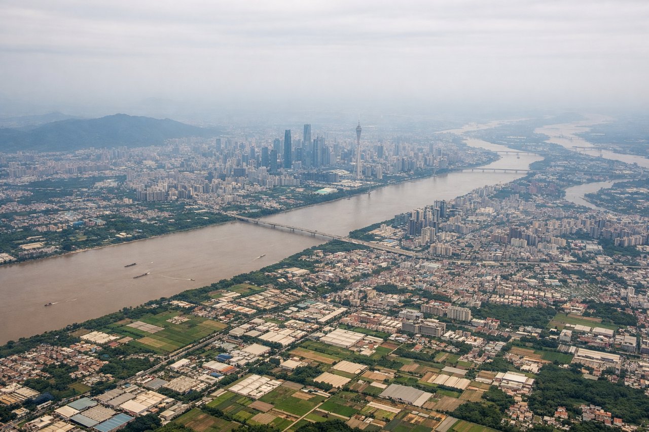
Takeoff from CAN
RIGHTRight-side departures from CAN typically use westernmost runways (02L/20R) with initial northwesterly turns that provide views of the Pearl River Delta's urban sprawl, industrial zones, and the transition toward the Nanling Mountains. Left-side views show the flat delta plain and open water with minimal terrain drama.
Landing at ALA
RIGHTRight-side approaches to Almaty (typically via runway 23R/23L from the southwest) descend over the Turgen Gorge and the northern foothills of the Trans-Ili Alatau Mountains, providing dramatic alpine scenery. Left-side approaches show the flat Kazakh steppe with minimal terrain variation.
Will your flight be in sunlight?
Pick a date and time in the Sun Map to watch the sun move across your whole flight.
About This Route
Which side of the plane should I sit on flying from Guangzhou Baiyun International Airport (CAN) to Almaty (ALA)?
Sit on the Right side of the plane for the best views on flights from Guangzhou to Almaty. Right-side views dominate both departure and arrival phases. Takeoff provides urban-to-mountain transition views of the Pearl River Delta and Nanling foothills. Cruise crosses the Tibetan Plateau and Central Asian highlands with significant terrain variation. Landing delivers the most dramatic scenery: the Trans-Ili Alatau Mountains and Turgen Gorge provide genuine alpine drama comparable to major scenic routes. Left side offers only flat delta plains on departure and featureless steppe on arrival, scoring significantly lower.
What can I see during takeoff from Guangzhou Baiyun International Airport in Guangzhou?
During takeoff from Guangzhou Baiyun International Airport (CAN), sit on the Right side for the best views. Right-side departures from CAN typically use westernmost runways (02L/20R) with initial northwesterly turns that provide views of the Pearl River Delta's urban sprawl, industrial zones, and the transition toward the Nanling Mountains. Left-side views show the flat delta plain and open water with minimal terrain drama. Notable sights include: Pearl River Delta urban grid, Guangzhou city sprawl, Nanling Mountains foothills (distant), industrial waterways and shipping channels.
What can I see when landing at Almaty in Almaty?
When landing at Almaty (ALA), sit on the Right side for the best views. Right-side approaches to Almaty (typically via runway 23R/23L from the southwest) descend over the Turgen Gorge and the northern foothills of the Trans-Ili Alatau Mountains, providing dramatic alpine scenery. Left-side approaches show the flat Kazakh steppe with minimal terrain variation. Notable sights include: Trans-Ili Alatau Mountains (snow-capped peaks), Turgen Gorge, Almaty city nestled against mountain backdrop, Big Almaty Lake (visible in clear conditions).
How long is the flight from Guangzhou to Almaty?
The flight from Guangzhou Baiyun International Airport (CAN) to Almaty (ALA) takes about 5 hours 45 minutes. The shortest flight path between them is 2,476 miles (3,985 km); winds and air traffic control usually add a few percent.
What does the Guangzhou to Almaty flight path pass over?
Tibetan Plateau (high-altitude terrain with sparse vegetation and glaciated peaks), Kunlun Mountains (southern boundary of plateau), Taklamakan Desert margins (visible as tan/beige expanses), Tian Shan Mountains (northern approach to Central Asia), Issyk-Kul Lake (large alpine lake in Kyrgyzstan, visible on clear days), Chu River valley (descent corridor into Kazakhstan)