The right side captures the Tian Shan departure, a cruise track that skirts the Tibetan Plateau's northern rim and Kunlun foothills, and a karst-hill, river-delta arrival into Guangzhou — far more terrain variety than the flatter northern views on the left.
Flown ALA to CAN? Did we get it right?
Flight Path
Almaty to Guangzhou is 2,476 miles (3,985 km), a flight of about 5 hours 45 minutes.
Tarim Basin and Taklamakan Desert margins, Kunlun Mountains foothills, Sichuan Basin, Guizhou-Guangxi karst plateau
Great circle distance and headings ›


Phase by phase
Takeoff from ALA
RIGHTAlmaty sits right against the northern edge of the Tian Shan range, and departures toward the southwest put those snow-capped peaks directly on the right side of the aircraft during climb-out. The left side shows only the flat Kazakh steppe stretching north.
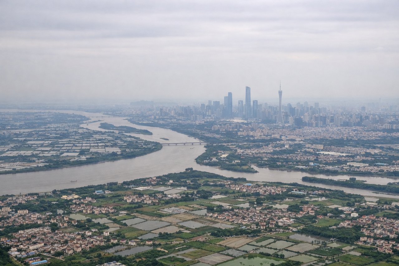
Landing at CAN
RIGHTOn approach into Guangzhou from the north, the descent path passes over the limestone karst hills of northern Guangdong and Guangxi before crossing the sprawling Pearl River Delta, all visible on the right side of the cabin. The left side mostly shows flatter agricultural land and river tributaries with less visual drama.
Will your flight be in sunlight?
Pick a date and time in the Sun Map to watch the sun move across your whole flight.
About This Route
Which side of the plane should I sit on flying from Almaty (ALA) to Guangzhou Baiyun International Airport (CAN)?
Sit on the Right side of the plane for the best views on flights from Almaty to Guangzhou. The right side captures the Tian Shan departure, a cruise track that skirts the Tibetan Plateau's northern rim and Kunlun foothills, and a karst-hill, river-delta arrival into Guangzhou — far more terrain variety than the flatter northern views on the left.
What can I see during takeoff from Almaty in Almaty?
During takeoff from Almaty (ALA), sit on the Right side for the best views. Almaty sits right against the northern edge of the Tian Shan range, and departures toward the southwest put those snow-capped peaks directly on the right side of the aircraft during climb-out. The left side shows only the flat Kazakh steppe stretching north. Notable sights include: Tian Shan range, Trans-Ili Alatau peaks, Ile River valley, Almaty city grid.
What can I see when landing at Guangzhou Baiyun International Airport in Guangzhou?
When landing at Guangzhou Baiyun International Airport (CAN), sit on the Right side for the best views. On approach into Guangzhou from the north, the descent path passes over the limestone karst hills of northern Guangdong and Guangxi before crossing the sprawling Pearl River Delta, all visible on the right side of the cabin. The left side mostly shows flatter agricultural land and river tributaries with less visual drama. Notable sights include: Karst hill clusters, Pearl River tributaries, Guangzhou skyline (Canton Tower area), Baiyun Mountain.
How long is the flight from Almaty to Guangzhou?
The flight from Almaty (ALA) to Guangzhou Baiyun International Airport (CAN) takes about 5 hours 45 minutes. The shortest flight path between them is 2,476 miles (3,985 km); winds and air traffic control usually add a few percent.
What does the Almaty to Guangzhou flight path pass over?
Tarim Basin and Taklamakan Desert margins, Kunlun Mountains foothills, Sichuan Basin, Guizhou-Guangxi karst plateau