Guangzhou to Dhaka is 1,449 miles (2,331 km), a flight of about 3 hours 20 minutes.
The right side consistently offers more terrain variety — Baiyun Mountain and the Pearl River Delta at departure, followed by glimpses of Yunnan's highlands and Bangladesh's tea-hill country near arrival — while the left side is dominated by flat coastal plains and open water with little distinguishing scenery.
Flight Path
The route crosses northern Vietnam's lowlands, skirts the eastern edge of the Yunnan-Myanmar highlands, passes near the Irrawaddy basin, and crosses the Chittagong Hill Tracts before descending into the Ganges-Brahmaputra-Meghna delta approaching Dhaka.
Great circle distance and headings ›Phase by phase
Takeoff from CAN
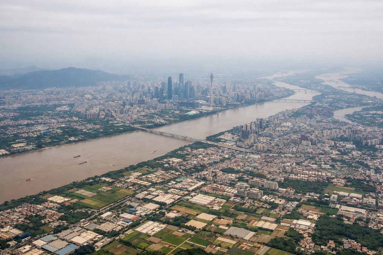
RIGHTBaiyun Airport sits just north of Guangzhou proper, and as the aircraft climbs and turns onto its westward heading, the right-side window catches the forested slopes of Baiyun Mountain and the sprawling Pearl River Delta with its dense grid of waterways and urban development. The left side mostly shows flatter industrial suburbs with less visual interest.
Landing at DAC
RIGHTOn approach into Dhaka, flights routed from the east often pass near the Sylhet lowlands and the confluence zone of the Meghna River system before descending into the delta. The right side offers glimpses of tea-garden hills and braided river channels, while the left side over the Bay of Bengal approach corridor shows mostly flat, featureless floodplain.
Will your flight be in sunlight?
Pick a date and time in the Sun Map to watch the sun move across your whole flight.
About This Route
Which side of the plane should I sit on flying from Guangzhou Baiyun International Airport (CAN) to Hazrat Shahjalal International Airport (DAC)?
Sit on the Right side of the plane for the best views on flights from Guangzhou to Dhaka. The right side consistently offers more terrain variety — Baiyun Mountain and the Pearl River Delta at departure, followed by glimpses of Yunnan's highlands and Bangladesh's tea-hill country near arrival — while the left side is dominated by flat coastal plains and open water with little distinguishing scenery.
What can I see during takeoff from Guangzhou Baiyun International Airport in Guangzhou?
During takeoff from Guangzhou Baiyun International Airport (CAN), sit on the Right side for the best views. Baiyun Airport sits just north of Guangzhou proper, and as the aircraft climbs and turns onto its westward heading, the right-side window catches the forested slopes of Baiyun Mountain and the sprawling Pearl River Delta with its dense grid of waterways and urban development. The left side mostly shows flatter industrial suburbs with less visual interest. Notable sights include: Baiyun Mountain, Pearl River Delta waterways, Guangzhou urban sprawl, North River (Bei Jiang) tributaries.
What can I see when landing at Hazrat Shahjalal International Airport in Dhaka?
When landing at Hazrat Shahjalal International Airport (DAC), sit on the Right side for the best views. On approach into Dhaka, flights routed from the east often pass near the Sylhet lowlands and the confluence zone of the Meghna River system before descending into the delta. The right side offers glimpses of tea-garden hills and braided river channels, while the left side over the Bay of Bengal approach corridor shows mostly flat, featureless floodplain. Notable sights include: Meghna River confluence, Sylhet tea-garden hills, braided delta channels, Dhaka's Buriganga River.
How long is the flight from Guangzhou to Dhaka?
The flight from Guangzhou Baiyun International Airport (CAN) to Hazrat Shahjalal International Airport (DAC) takes about 3 hours 20 minutes. The shortest flight path between them is 1,449 miles (2,331 km); winds and air traffic control usually add a few percent.
What does the Guangzhou to Dhaka flight path pass over?
The route crosses northern Vietnam's lowlands, skirts the eastern edge of the Yunnan-Myanmar highlands, passes near the Irrawaddy basin, and crosses the Chittagong Hill Tracts before descending into the Ganges-Brahmaputra-Meghna delta approaching Dhaka.