Dhaka to Guangzhou is 1,449 miles (2,331 km), a flight of about 3 hours 15 minutes.
While takeoff favors the right side, the long cruise segment over Myanmar's Shan Plateau and the karst mountains of Yunnan and Guangxi—visible mainly to the north (left)—plus the mountain-backed Guangzhou approach on landing give the left side more sustained scenic value overall.
Flight Path
Shan Plateau highlands of eastern Myanmar, Yunnan's mountainous plateau near the China-Myanmar border, and the karst limestone peaks of western Guangxi province
Great circle distance and headings ›Phase by phase
Takeoff from DAC
RIGHTDeparting DAC, the right (south) side shows the Chittagong Hill Tracts rising beyond the flat Meghna delta, along with occasional glimpses of the Bay of Bengal coastline near Chittagong. The left side stays over the featureless Ganges-Brahmaputra delta farmland.
Landing at CAN
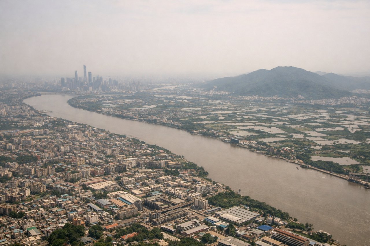
LEFTOn approach into CAN, northerly arrivals descend south over the Pearl River Delta, giving the left (east) side a clear view of Baiyun Mountain and the Guangzhou skyline along the Pearl River, while the right side mostly overlooks flatter delta farmland and industrial zones.
Will your flight be in sunlight?
Pick a date and time in the Sun Map to watch the sun move across your whole flight.
About This Route
Which side of the plane should I sit on flying from Hazrat Shahjalal International Airport (DAC) to Guangzhou Baiyun International Airport (CAN)?
Sit on the Left side of the plane for the best views on flights from Dhaka to Guangzhou. While takeoff favors the right side, the long cruise segment over Myanmar's Shan Plateau and the karst mountains of Yunnan and Guangxi—visible mainly to the north (left)—plus the mountain-backed Guangzhou approach on landing give the left side more sustained scenic value overall.
What can I see during takeoff from Hazrat Shahjalal International Airport in Dhaka?
During takeoff from Hazrat Shahjalal International Airport (DAC), sit on the Right side for the best views. Departing DAC, the right (south) side shows the Chittagong Hill Tracts rising beyond the flat Meghna delta, along with occasional glimpses of the Bay of Bengal coastline near Chittagong. The left side stays over the featureless Ganges-Brahmaputra delta farmland. Notable sights include: Meghna River delta, Chittagong Hill Tracts, Bay of Bengal coastline near Chittagong.
What can I see when landing at Guangzhou Baiyun International Airport in Guangzhou?
When landing at Guangzhou Baiyun International Airport (CAN), sit on the Left side for the best views. On approach into CAN, northerly arrivals descend south over the Pearl River Delta, giving the left (east) side a clear view of Baiyun Mountain and the Guangzhou skyline along the Pearl River, while the right side mostly overlooks flatter delta farmland and industrial zones. Notable sights include: Baiyun Mountain, Pearl River, Guangzhou skyline (Canton Tower area), Pearl River Delta waterways.
How long is the flight from Dhaka to Guangzhou?
The flight from Hazrat Shahjalal International Airport (DAC) to Guangzhou Baiyun International Airport (CAN) takes about 3 hours 15 minutes. The shortest flight path between them is 1,449 miles (2,331 km); winds and air traffic control usually add a few percent.
What does the Dhaka to Guangzhou flight path pass over?
Shan Plateau highlands of eastern Myanmar, Yunnan's mountainous plateau near the China-Myanmar border, and the karst limestone peaks of western Guangxi province