The left side wins narrowly because the Paris departure offers a genuinely iconic skyline view (Eiffel Tower, Seine, La Défense), which outweighs the more modest Atlanta skyline glimpse on landing; both sides otherwise share the same long, featureless North Atlantic crossing.
Flight Path
The route crosses the North Atlantic Ocean along a great-circle track that arcs north toward the Newfoundland Grand Banks before curving southwest down the U.S. East Coast; aside from occasional glimpses of Newfoundland's rugged coastline, the mid-flight hours are almost entirely open ocean with no land visible.
Great circle distance and headings ›.jpg?width=600)
.jpg?width=600)
.jpeg?width=600)
Phase by phase
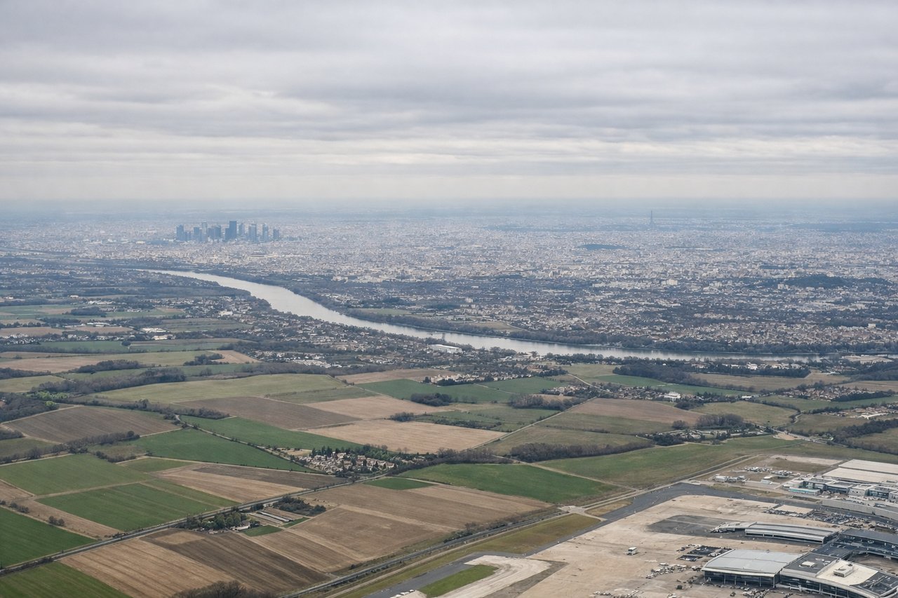
Takeoff from CDG
LEFTWestbound departures off CDG's 26-side runways typically bank south onto the Atlantic track, putting Paris directly below on the left. Passengers get a brief but recognizable view of the Eiffel Tower, the Seine's bends, and the La Défense skyscraper cluster before the city gives way to French farmland.

Landing at ATL
RIGHTWith prevailing westerly winds, arrivals into ATL land toward the west, approaching from the east. Downtown Atlanta and Buckhead's skyline sit north of the airport, so they appear on the right side of the aircraft during the final descent.
Landmarks on this routeAll landmarks →
Will your flight be in sunlight?
See exactly which side of the plane gets sun and shade at your departure time.
About This Route
Which side of the plane should I sit on flying from Charles De Gaulle (CDG) to The William B Hartsfield Atlanta International (ATL)?
Sit on the Left side of the plane for the best views on flights from Paris to Atlanta. The left side wins narrowly because the Paris departure offers a genuinely iconic skyline view (Eiffel Tower, Seine, La Défense), which outweighs the more modest Atlanta skyline glimpse on landing; both sides otherwise share the same long, featureless North Atlantic crossing.
What can I see during takeoff from Charles De Gaulle in Paris?
During takeoff from Charles De Gaulle (CDG), sit on the Left side for the best views. Westbound departures off CDG's 26-side runways typically bank south onto the Atlantic track, putting Paris directly below on the left. Passengers get a brief but recognizable view of the Eiffel Tower, the Seine's bends, and the La Défense skyscraper cluster before the city gives way to French farmland. Notable sights include: Eiffel Tower, Seine River, La Défense towers, Montmartre hill.
What can I see when landing at The William B Hartsfield Atlanta International in Atlanta?
When landing at The William B Hartsfield Atlanta International (ATL), sit on the Right side for the best views. With prevailing westerly winds, arrivals into ATL land toward the west, approaching from the east. Downtown Atlanta and Buckhead's skyline sit north of the airport, so they appear on the right side of the aircraft during the final descent. Notable sights include: Downtown Atlanta skyline, Buckhead high-rises, Chattahoochee River, Georgia pine forest belt.
How long is the flight from Paris to Atlanta?
The flight from Charles De Gaulle (CDG) to The William B Hartsfield Atlanta International (ATL) takes 9h 35m.
What does the Paris to Atlanta flight path pass over?
The route crosses the North Atlantic Ocean along a great-circle track that arcs north toward the Newfoundland Grand Banks before curving southwest down the U.S. East Coast; aside from occasional glimpses of Newfoundland's rugged coastline, the mid-flight hours are almost entirely open ocean with no land visible.