Paris to Bucharest is 1,150 miles (1,851 km), a flight of about 3 hours 5 minutes.
The right side offers a brief but genuine Paris skyline view on departure and the more textured Carpathian foothill terrain on arrival, while the left side faces mostly flat farmland across Germany and Hungary for most of the cruise.
Flight Path
Southern German farmland, the Bohemian/Austrian border hills, the Hungarian plain, and the western edge of the Carpathian range approaching Romania
Great circle distance and headings ›.jpg?width=600)

.jpg?width=600)
Phase by phase
Takeoff from CDG
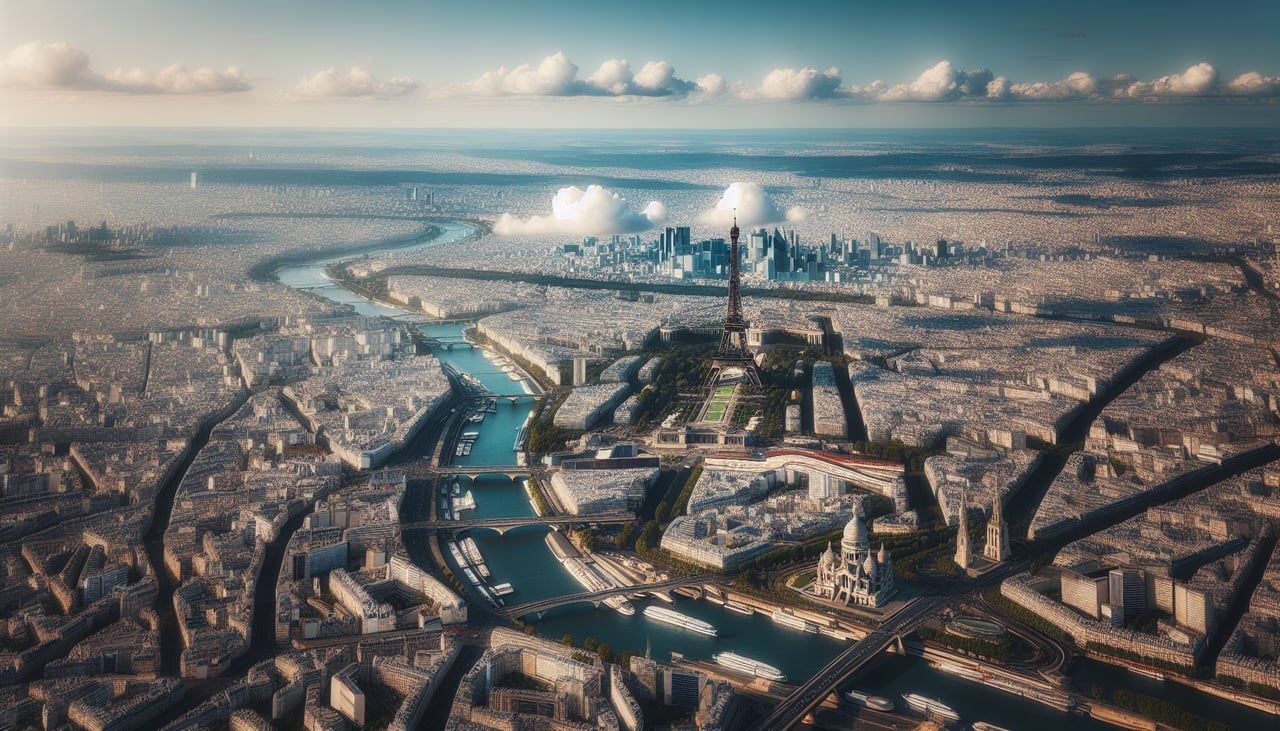
RIGHTCDG departures to the east typically roll off toward the west first, then bank left (south) to join the eastbound routing toward Romania. During that turn, passengers on the right side get a clear look back at the Paris skyline, including the Eiffel Tower area and the Seine, before the city falls away behind.
Landing at OTP
RIGHTOn approach into OTP from the west, the descent path crosses the southern edge of the Carpathian foothills and the Transylvanian plain before leveling out over the Wallachian plain toward Bucharest. Passengers on the right side see these rolling hills and forested ridgelines give way to the city's outskirts, while the left side mostly faces flat farmland.
Landmarks on this routeAll landmarks →
Will your flight be in sunlight?
Pick a date and time in the Sun Map to watch the sun move across your whole flight.
About This Route
Which side of the plane should I sit on flying from Charles De Gaulle (CDG) to Otopeni (OTP)?
Sit on the Right side of the plane for the best views on flights from Paris to Bucharest. The right side offers a brief but genuine Paris skyline view on departure and the more textured Carpathian foothill terrain on arrival, while the left side faces mostly flat farmland across Germany and Hungary for most of the cruise.
What can I see during takeoff from Charles De Gaulle in Paris?
During takeoff from Charles De Gaulle (CDG), sit on the Right side for the best views. CDG departures to the east typically roll off toward the west first, then bank left (south) to join the eastbound routing toward Romania. During that turn, passengers on the right side get a clear look back at the Paris skyline, including the Eiffel Tower area and the Seine, before the city falls away behind. Notable sights include: Paris skyline, Seine River bends, La Défense towers, Charles de Gaulle airport grounds.
What can I see when landing at Otopeni in Bucharest?
When landing at Otopeni (OTP), sit on the Right side for the best views. On approach into OTP from the west, the descent path crosses the southern edge of the Carpathian foothills and the Transylvanian plain before leveling out over the Wallachian plain toward Bucharest. Passengers on the right side see these rolling hills and forested ridgelines give way to the city's outskirts, while the left side mostly faces flat farmland. Notable sights include: Carpathian foothills, Wallachian plain, Bucharest outskirts, Arges River valley.
How long is the flight from Paris to Bucharest?
The flight from Charles De Gaulle (CDG) to Otopeni (OTP) takes about 3 hours 5 minutes. The shortest flight path between them is 1,150 miles (1,851 km); winds and air traffic control usually add a few percent.
What does the Paris to Bucharest flight path pass over?
Southern German farmland, the Bohemian/Austrian border hills, the Hungarian plain, and the western edge of the Carpathian range approaching Romania