Bucharest to Paris is 1,150 miles (1,851 km), a flight of about 2 hours 55 minutes.
The left side delivers the best views at both ends of the flight — Bucharest on departure and central Paris on approach. Over the cruise portion, the left side also faces generally south, keeping the Alps and Carpathian foothills in view on the horizon during the westward track across Central Europe.
Flight Path
The route tracks northwest over Transylvania and the southern Carpathians briefly, then crosses Hungary's Great Plain (Alföld), passes north of Budapest, crosses western Slovakia and the Czech Republic over Moravia, then enters Germany over Bavaria before crossing into France via Alsace and the Rhine valley. The Rhine river crossing and the Vosges hills on the French side are the most visually distinctive midpoint features at cruise altitude.
Great circle distance and headings ›.jpg?width=600)

.jpg?width=600)
Phase by phase
Takeoff from OTP
LEFTOTP's primary departure runway 08R sends aircraft heading east before turning northwest toward Paris. The left side faces south toward Bucharest city center, with the Dâmbovița river valley and the urban grid of the capital visible during the initial climb. The Vlăsia plain stretches out clearly below.
Landing at CDG
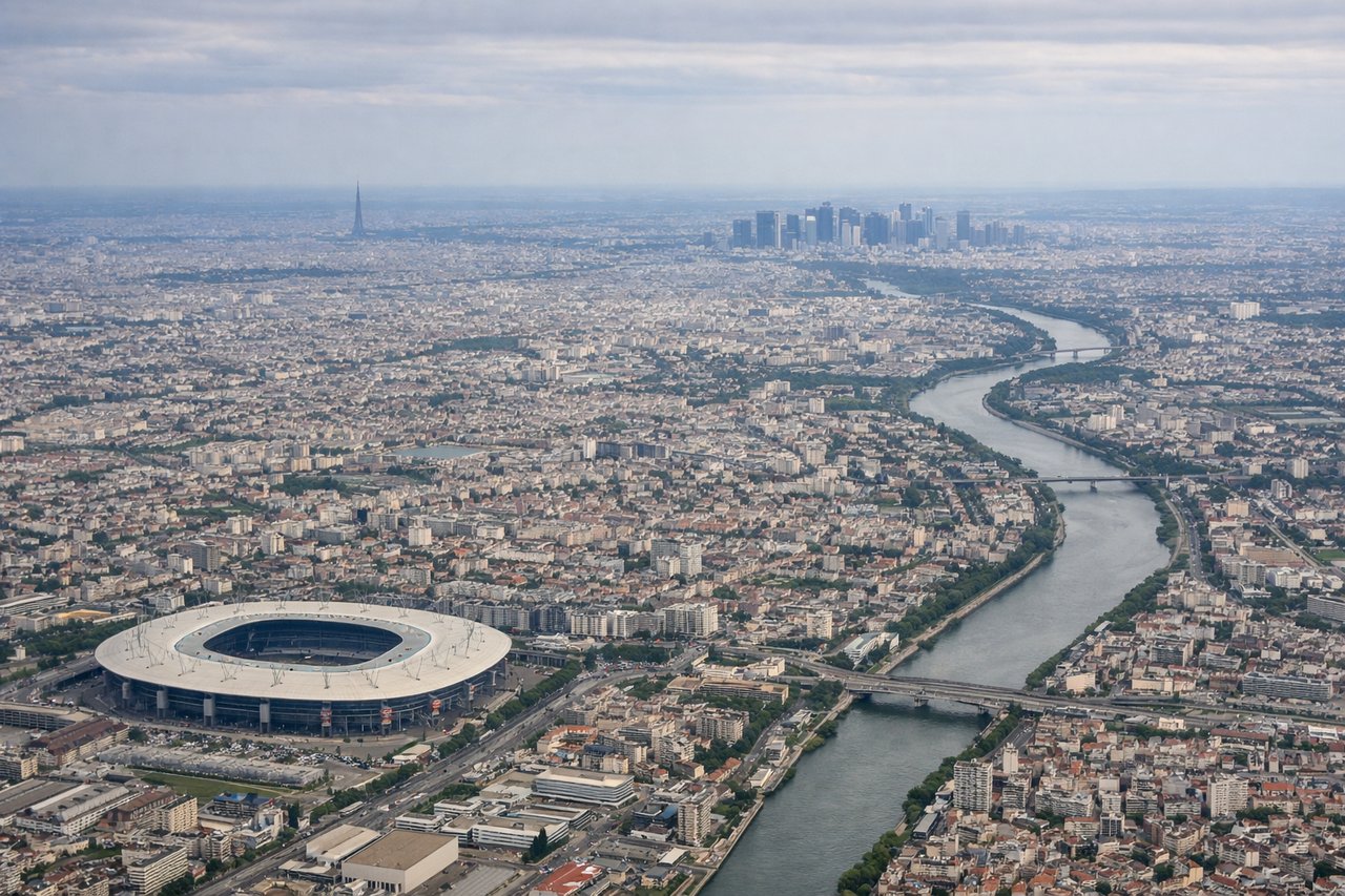
LEFTCDG typically uses runways 27L or 26R for westerly landings, meaning the approach comes from the east over the Paris basin. The left side faces south toward central Paris, giving a clear view of the Seine river bends, the dense Île-de-France urban fabric, and on clear days the Eiffel Tower area and La Défense cluster are identifiable from altitude.
Landmarks on this routeAll landmarks →
Will your flight be in sunlight?
Pick a date and time in the Sun Map to watch the sun move across your whole flight.
About This Route
Which side of the plane should I sit on flying from Otopeni (OTP) to Charles De Gaulle (CDG)?
Sit on the Left side of the plane for the best views on flights from Bucharest to Paris. The left side delivers the best views at both ends of the flight — Bucharest on departure and central Paris on approach. Over the cruise portion, the left side also faces generally south, keeping the Alps and Carpathian foothills in view on the horizon during the westward track across Central Europe.
What can I see during takeoff from Otopeni in Bucharest?
During takeoff from Otopeni (OTP), sit on the Left side for the best views. OTP's primary departure runway 08R sends aircraft heading east before turning northwest toward Paris. The left side faces south toward Bucharest city center, with the Dâmbovița river valley and the urban grid of the capital visible during the initial climb. The Vlăsia plain stretches out clearly below. Notable sights include: Bucharest city center to the south, Dâmbovița river snaking through the urban area, Băneasa forest patch just southwest of the airport, Colentina lake chain east of the city.
What can I see when landing at Charles De Gaulle in Paris?
When landing at Charles De Gaulle (CDG), sit on the Left side for the best views. CDG typically uses runways 27L or 26R for westerly landings, meaning the approach comes from the east over the Paris basin. The left side faces south toward central Paris, giving a clear view of the Seine river bends, the dense Île-de-France urban fabric, and on clear days the Eiffel Tower area and La Défense cluster are identifiable from altitude. Notable sights include: Seine river bends south of Paris, La Défense business district high-rises, dense Île-de-France urban grid, Forêt de Chantilly to the northeast during initial descent.
How long is the flight from Bucharest to Paris?
The flight from Otopeni (OTP) to Charles De Gaulle (CDG) takes about 2 hours 55 minutes. The shortest flight path between them is 1,150 miles (1,851 km); winds and air traffic control usually add a few percent.
What does the Bucharest to Paris flight path pass over?
The route tracks northwest over Transylvania and the southern Carpathians briefly, then crosses Hungary's Great Plain (Alföld), passes north of Budapest, crosses western Slovakia and the Czech Republic over Moravia, then enters Germany over Bavaria before crossing into France via Alsace and the Rhine valley. The Rhine river crossing and the Vosges hills on the French side are the most visually distinctive midpoint features at cruise altitude.