While takeoff from Congonhas favors the right side, the landing approach into Curitiba from the left provides more dramatic and visually distinctive scenery with the Serra do Mar escarpment. The landing view is more memorable and geographically significant.
Flown CGH to CWB? Did we get it right?
Flight Path
Sao Paulo to Curitiba is 206 miles (331 km), a flight of about 1 hour 15 minutes.
The flight path crosses the Paraná plateau interior, passing over agricultural regions and small towns. The notable geographic transition occurs as the aircraft approaches Curitiba: the plateau terrain gradually becomes more undulating, and the Serra do Mar escarpment becomes visible on the western horizon during descent. The Ribeira River valley and surrounding forested areas mark the approach corridor into Afonso Pena.
Great circle distance and headings ›Phase by phase
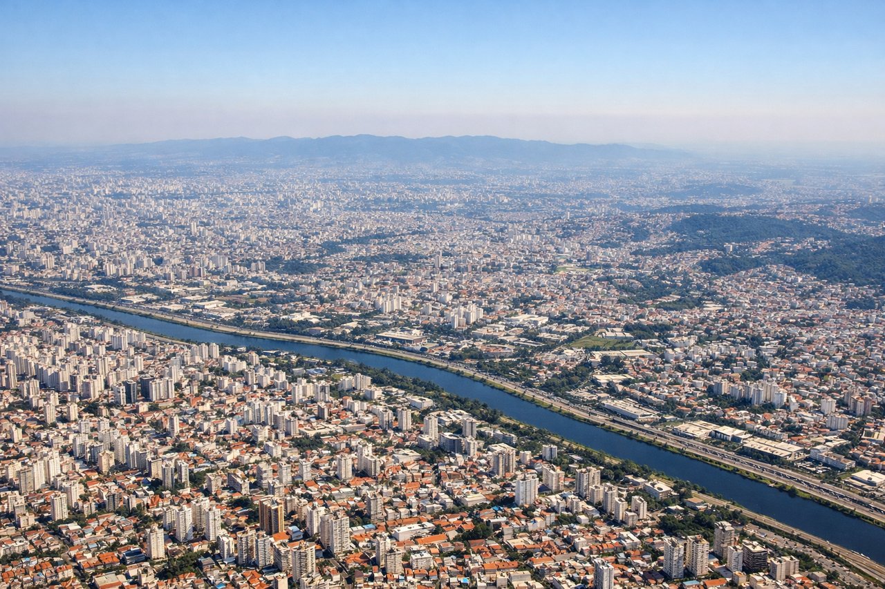
Takeoff from CGH
RIGHTRight side offers views of São Paulo's urban sprawl and the Serra da Cantareira mountain range to the north. Left side faces the industrial suburbs and lacks significant visual landmarks during initial climb.
Landing at CWB
LEFTLeft side provides excellent views of Curitiba's approach over the Paraná plateau and the Serra do Mar escarpment. Right side faces inland plateau with fewer distinctive features during descent.
Will your flight be in sunlight?
Pick a date and time in the Sun Map to watch the sun move across your whole flight.
About This Route
Which side of the plane should I sit on flying from Congonhas (CGH) to Afonso Pena (CWB)?
Sit on the Left side of the plane for the best views on flights from Sao Paulo to Curitiba. While takeoff from Congonhas favors the right side, the landing approach into Curitiba from the left provides more dramatic and visually distinctive scenery with the Serra do Mar escarpment. The landing view is more memorable and geographically significant.
What can I see during takeoff from Congonhas in Sao Paulo?
During takeoff from Congonhas (CGH), sit on the Right side for the best views. Right side offers views of São Paulo's urban sprawl and the Serra da Cantareira mountain range to the north. Left side faces the industrial suburbs and lacks significant visual landmarks during initial climb. Notable sights include: Serra da Cantareira (north), Pinheiros River valley, São Paulo city grid extending southward, Guarapiranga Reservoir (southeast).
What can I see when landing at Afonso Pena in Curitiba?
When landing at Afonso Pena (CWB), sit on the Left side for the best views. Left side provides excellent views of Curitiba's approach over the Paraná plateau and the Serra do Mar escarpment. Right side faces inland plateau with fewer distinctive features during descent. Notable sights include: Serra do Mar escarpment (southwest), Paraná plateau terrain, Iguazu River valley (distant), Curitiba city and surrounding agricultural grid.
How long is the flight from Sao Paulo to Curitiba?
The flight from Congonhas (CGH) to Afonso Pena (CWB) takes about 1 hour 15 minutes. The shortest flight path between them is 206 miles (331 km); winds and air traffic control usually add a few percent.
What does the Sao Paulo to Curitiba flight path pass over?
The flight path crosses the Paraná plateau interior, passing over agricultural regions and small towns. The notable geographic transition occurs as the aircraft approaches Curitiba: the plateau terrain gradually becomes more undulating, and the Serra do Mar escarpment becomes visible on the western horizon during descent. The Ribeira River valley and surrounding forested areas mark the approach corridor into Afonso Pena.