Right side scores 3.5 vs left's 2.5 due to superior scenic content on both legs. Departure offers Java Sea and island views; arrival showcases the Seine valley and Île-de-France landscape. Left side (south-facing from Jakarta, north-facing from Paris) encounters primarily open ocean during cruise and lacks distinctive landmarks during both takeoff and landing sequences. The right side provides more varied terrain and recognizable geographic features throughout the full flight.
Flown CGK to CDG? Did we get it right?
Flight Path
Jakarta to Paris is 7,176 miles (11,548 km), a flight of about 12 hours 15 minutes.
Cruise path crosses the Arabian Sea, Oman coastline, Persian Gulf region, Iraq/Syria, Turkey, and the Mediterranean. Notable features include the Zagros Mountains (Iran-Iraq border, visible as a distant ridge during mid-flight), the Taurus Mountains (southern Turkey), and the Mediterranean coastline approaching southern France. Most of cruise occurs over open water and desert with limited ground visibility; the route passes south of the Caucasus and north of the Arabian Peninsula.
Great circle distance and headings ›Phase by phase
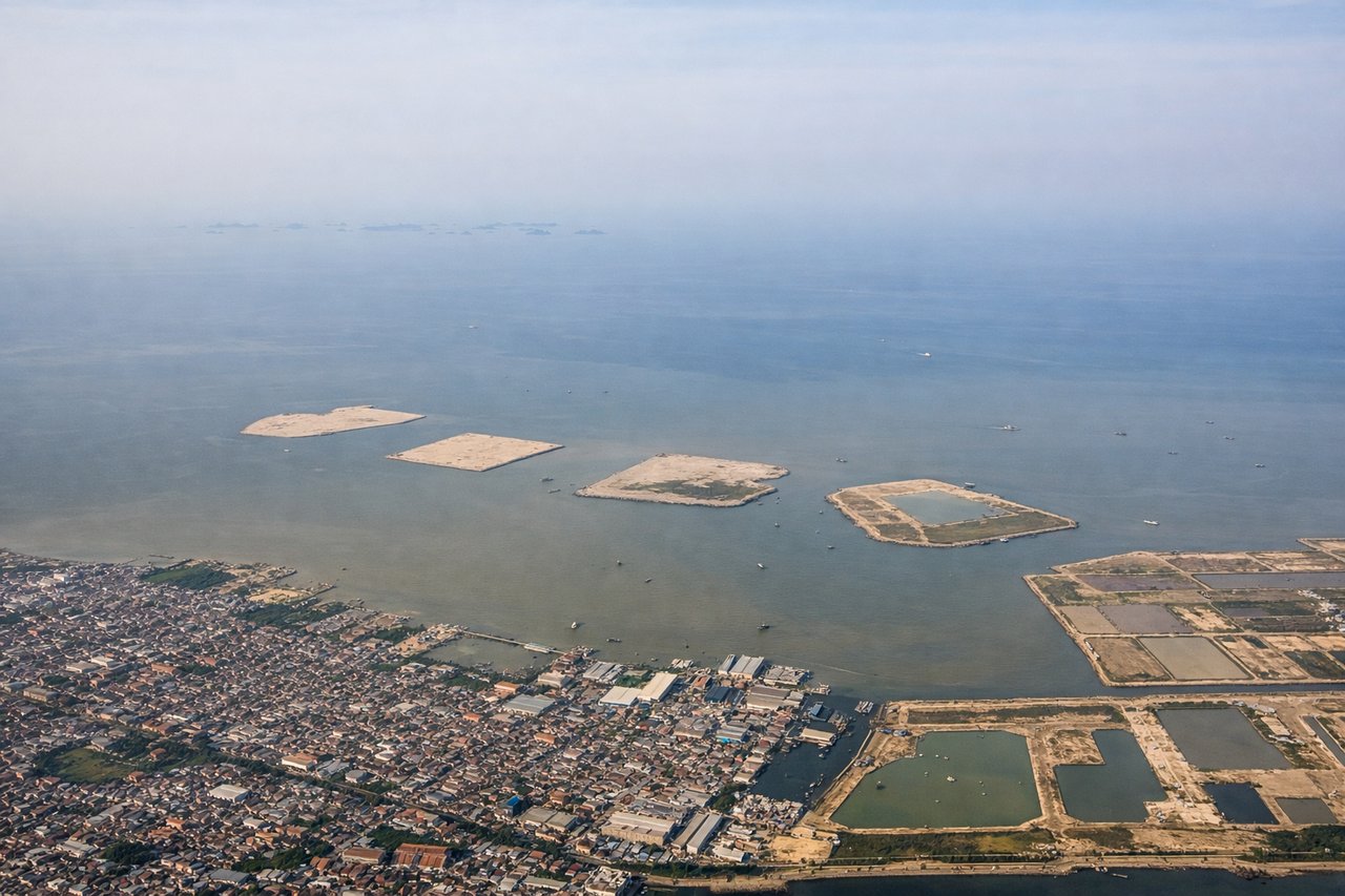
Takeoff from CGK
RIGHTRight side captures Jakarta's northern coastline and Java Sea during departure. Aircraft typically depart runway 07 or 25 depending on wind; either direction offers views of the city's sprawl and coastal waters. Right side (north-facing) shows the Java Sea and Thousand Islands archipelago more prominently during initial climb.
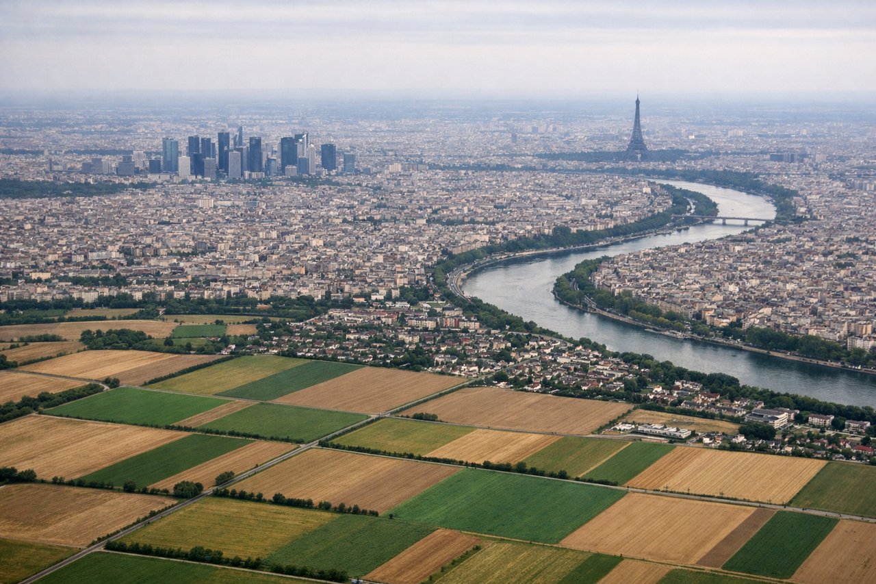
Landing at CDG
RIGHTRight side (north-facing) during CDG approach offers views of the Seine River valley, Île-de-France agricultural landscape, and the northern approach corridor. CDG typically uses westerly operations (runways 26/27), meaning aircraft descend from the northeast and turn southwest for landing. Right side captures the Seine's meanders, suburban Paris sprawl, and the transition from rural Picardy farmland into the metropolitan area.
Will your flight be in sunlight?
Pick a date and time in the Sun Map to watch the sun move across your whole flight.
About This Route
Which side of the plane should I sit on flying from Soekarno Hatta International (CGK) to Charles De Gaulle (CDG)?
Sit on the Right side of the plane for the best views on flights from Jakarta to Paris. Right side scores 3.5 vs left's 2.5 due to superior scenic content on both legs. Departure offers Java Sea and island views; arrival showcases the Seine valley and Île-de-France landscape. Left side (south-facing from Jakarta, north-facing from Paris) encounters primarily open ocean during cruise and lacks distinctive landmarks during both takeoff and landing sequences. The right side provides more varied terrain and recognizable geographic features throughout the full flight.
What can I see during takeoff from Soekarno Hatta International in Jakarta?
During takeoff from Soekarno Hatta International (CGK), sit on the Right side for the best views. Right side captures Jakarta's northern coastline and Java Sea during departure. Aircraft typically depart runway 07 or 25 depending on wind; either direction offers views of the city's sprawl and coastal waters. Right side (north-facing) shows the Java Sea and Thousand Islands archipelago more prominently during initial climb. Notable sights include: Jakarta harbor and port facilities, Thousand Islands (Kepulauan Seribu) scattered across Java Sea, northern Jakarta urban sprawl, Java coastline.
What can I see when landing at Charles De Gaulle in Paris?
When landing at Charles De Gaulle (CDG), sit on the Right side for the best views. Right side (north-facing) during CDG approach offers views of the Seine River valley, Île-de-France agricultural landscape, and the northern approach corridor. CDG typically uses westerly operations (runways 26/27), meaning aircraft descend from the northeast and turn southwest for landing. Right side captures the Seine's meanders, suburban Paris sprawl, and the transition from rural Picardy farmland into the metropolitan area. Notable sights include: Seine River with distinctive meanders, Île-de-France agricultural patchwork, suburban Paris development (Roissy, Gonesse areas), northern Paris districts and Sacré-Cœur basilica visible on clear days.
How long is the flight from Jakarta to Paris?
The flight from Soekarno Hatta International (CGK) to Charles De Gaulle (CDG) takes about 12 hours 15 minutes. The shortest flight path between them is 7,176 miles (11,548 km); winds and air traffic control usually add a few percent.
What does the Jakarta to Paris flight path pass over?
Cruise path crosses the Arabian Sea, Oman coastline, Persian Gulf region, Iraq/Syria, Turkey, and the Mediterranean. Notable features include the Zagros Mountains (Iran-Iraq border, visible as a distant ridge during mid-flight), the Taurus Mountains (southern Turkey), and the Mediterranean coastline approaching southern France. Most of cruise occurs over open water and desert with limited ground visibility; the route passes south of the Caucasus and north of the Arabian Peninsula.