Jakarta to Jayapura is 2,345 miles (3,774 km), a flight of about 5 hours 5 minutes.
While takeoff offers good bay views on the right, the landing approach on the left provides more dramatic and geographically distinctive scenery—the Cyclops Mountains and Cenderawasih Bay are far more visually striking than Jakarta's urban sprawl.
Flight Path
The flight crosses central Java and the Java Sea, then transitions over the Banda Sea. Notable features include the volcanic peaks of central Java (Merapi, Semeru) visible during initial eastbound climb if weather permits, the Banda Sea's deep blue waters with occasional small island groups, and the gradual transition to Papua's denser cloud cover and mountainous terrain as you approach the eastern end of the route. The Arafura Sea lies to the south of the direct track.
Great circle distance and headings ›Phase by phase
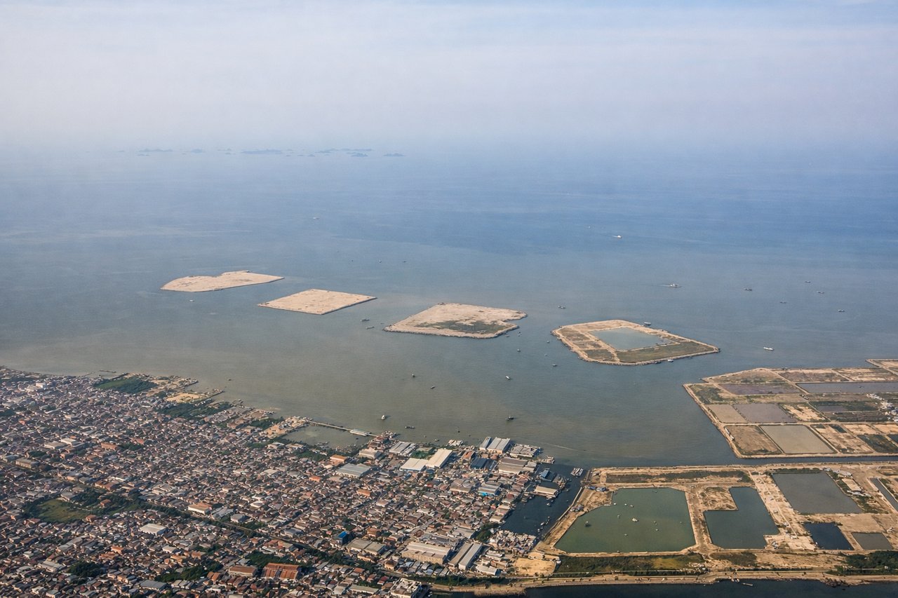
Takeoff from CGK
RIGHTCGK typically departs eastbound (Runway 25L/R). Right-side seats face north across Jakarta Bay and the Thousand Islands archipelago during initial climb, offering clear water views and island chains. Left side shows the congested urban sprawl of Jakarta itself.
Landing at DJJ
LEFTDJJ (Sentani) sits on the north coast of Papua with Cenderawasih Bay to the north. Left-side seats during descent on final approach (typically from the north) face directly toward the Cyclops Mountains and the dramatic coastal terrain where jungle meets the bay. Right side shows less distinctive inland features.
Will your flight be in sunlight?
Pick a date and time in the Sun Map to watch the sun move across your whole flight.
About This Route
Which side of the plane should I sit on flying from Soekarno Hatta International (CGK) to Sentani (DJJ)?
Sit on the Left side of the plane for the best views on flights from Jakarta to Jayapura. While takeoff offers good bay views on the right, the landing approach on the left provides more dramatic and geographically distinctive scenery—the Cyclops Mountains and Cenderawasih Bay are far more visually striking than Jakarta's urban sprawl.
What can I see during takeoff from Soekarno Hatta International in Jakarta?
During takeoff from Soekarno Hatta International (CGK), sit on the Right side for the best views. CGK typically departs eastbound (Runway 25L/R). Right-side seats face north across Jakarta Bay and the Thousand Islands archipelago during initial climb, offering clear water views and island chains. Left side shows the congested urban sprawl of Jakarta itself. Notable sights include: Jakarta Bay (Teluk Jakarta), Thousand Islands chain (Kepulauan Seribu) stretching northeast, northern Jakarta coastal districts, Java Sea horizon.
What can I see when landing at Sentani in Jayapura?
When landing at Sentani (DJJ), sit on the Left side for the best views. DJJ (Sentani) sits on the north coast of Papua with Cenderawasih Bay to the north. Left-side seats during descent on final approach (typically from the north) face directly toward the Cyclops Mountains and the dramatic coastal terrain where jungle meets the bay. Right side shows less distinctive inland features. Notable sights include: Cenderawasih Bay (Teluk Cenderawasih), Cyclops Mountains (Pegunungan Siklop) rising steeply from the coast, Sentani Lake to the south, dense rainforest canopy.
How long is the flight from Jakarta to Jayapura?
The flight from Soekarno Hatta International (CGK) to Sentani (DJJ) takes about 5 hours 5 minutes. The shortest flight path between them is 2,345 miles (3,774 km); winds and air traffic control usually add a few percent.
What does the Jakarta to Jayapura flight path pass over?
The flight crosses central Java and the Java Sea, then transitions over the Banda Sea. Notable features include the volcanic peaks of central Java (Merapi, Semeru) visible during initial eastbound climb if weather permits, the Banda Sea's deep blue waters with occasional small island groups, and the gradual transition to Papua's denser cloud cover and mountainous terrain as you approach the eastern end of the route. The Arafura Sea lies to the south of the direct track.