Right side scores 3.5 vs left's 2.5 due to superior coastal and urban scenery on both departure and arrival. The right side captures Jakarta's harbor and Java Sea during takeoff, then the Pacific approach and Los Angeles basin during landing. Left side offers only flat inland terrain on departure and urban sprawl on arrival, lacking the dramatic geographic variety and water features that define this transpacific route.
Flown CGK to LAX? Did we get it right?
Flight Path
Jakarta to Los Angeles is 8,979 miles (14,450 km), a flight of about 17 hours 15 minutes.
The flight crosses the Pacific Ocean for approximately 8-9 hours at cruise altitude. Notable geographic features along the route include: the Philippine Sea and Mariana Trench region (deepest ocean point on Earth, though not visible from altitude), the International Date Line crossing, the Hawaiian Islands chain (typically 500+ miles south of the great circle route but occasionally visible as distant peaks in clear conditions), and the North Pacific High pressure system's influence on cloud patterns. The cruise phase is predominantly open ocean with no visible landmarks for extended periods. As the aircraft approaches North America, the Hawaiian Islands may appear to the south, followed by the California coast becoming visible approximately 1-2 hours before landing, with the Sierra Nevada mountains and Central Valley appearing before the final descent into Los Angeles.
Great circle distance and headings ›Phase by phase
Takeoff from CGK
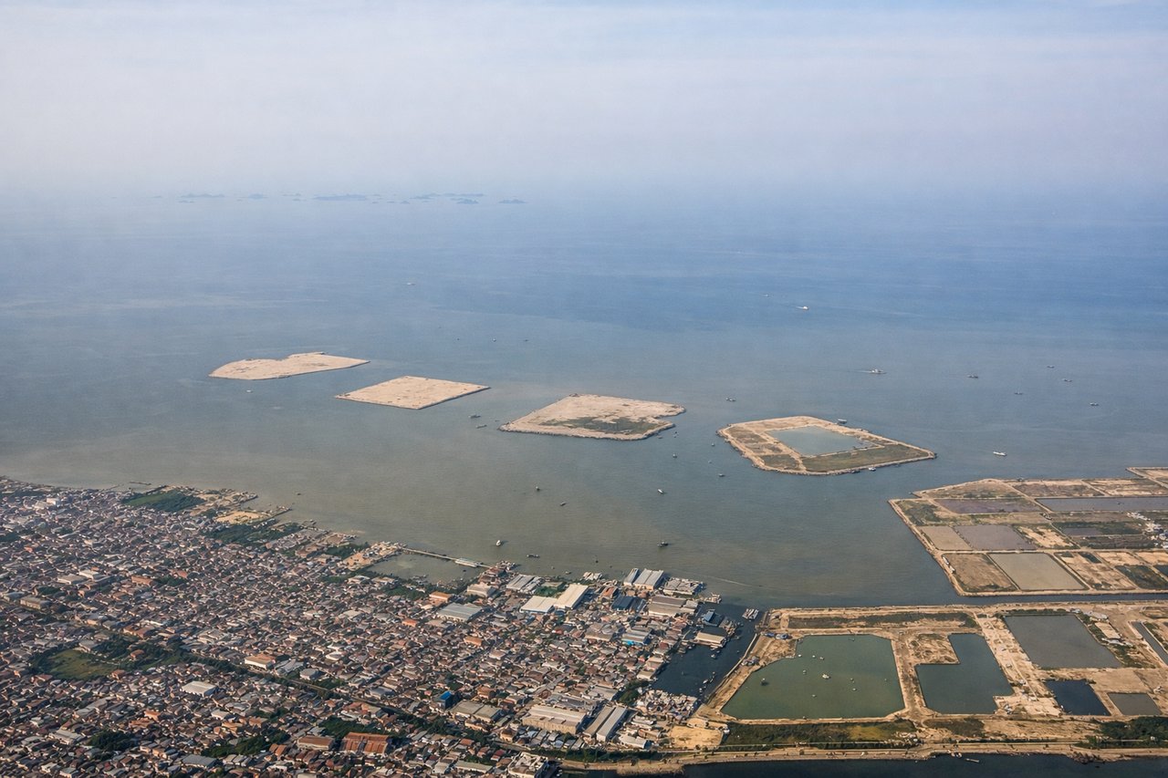
RIGHTRight side captures Jakarta's urban sprawl and the Java Sea coastline during initial climb. The city's harbor, industrial zones, and transition to water provide immediate visual interest. Left side departs over flat inland plains with minimal landmarks.
Landing at LAX
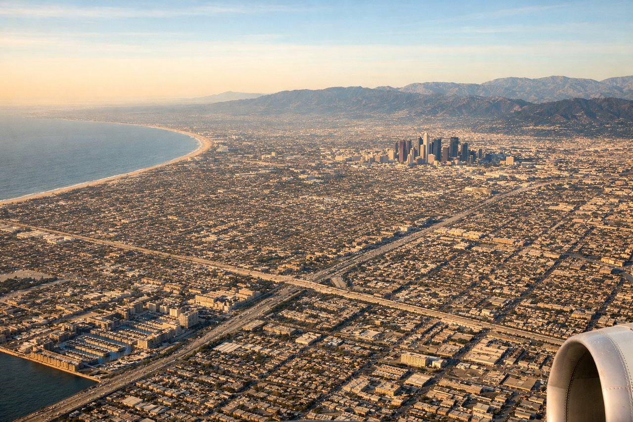
RIGHTRight side (south complex) offers the superior arrival experience. During typical west-flow operations, the approach path over the Pacific provides open ocean views, then the final descent reveals the Los Angeles basin, Long Beach harbor, and the San Gabriel Mountains. Left side approaches over inland urban sprawl with less dramatic terrain.
Will your flight be in sunlight?
Pick a date and time in the Sun Map to watch the sun move across your whole flight.
About This Route
Which side of the plane should I sit on flying from Soekarno Hatta International (CGK) to Los Angeles International (LAX)?
Sit on the Right side of the plane for the best views on flights from Jakarta to Los Angeles. Right side scores 3.5 vs left's 2.5 due to superior coastal and urban scenery on both departure and arrival. The right side captures Jakarta's harbor and Java Sea during takeoff, then the Pacific approach and Los Angeles basin during landing. Left side offers only flat inland terrain on departure and urban sprawl on arrival, lacking the dramatic geographic variety and water features that define this transpacific route.
What can I see during takeoff from Soekarno Hatta International in Jakarta?
During takeoff from Soekarno Hatta International (CGK), sit on the Right side for the best views. Right side captures Jakarta's urban sprawl and the Java Sea coastline during initial climb. The city's harbor, industrial zones, and transition to water provide immediate visual interest. Left side departs over flat inland plains with minimal landmarks. Notable sights include: Jakarta harbor and port facilities, Java Sea coastline, Thousand Islands (Kepulauan Seribu) archipelago visible at distance, urban grid of central Jakarta.
What can I see when landing at Los Angeles International in Los Angeles?
When landing at Los Angeles International (LAX), sit on the Right side for the best views. Right side (south complex) offers the superior arrival experience. During typical west-flow operations, the approach path over the Pacific provides open ocean views, then the final descent reveals the Los Angeles basin, Long Beach harbor, and the San Gabriel Mountains. Left side approaches over inland urban sprawl with less dramatic terrain. Notable sights include: Pacific Ocean approach corridor, Long Beach harbor and container ships, Los Angeles basin urban grid, San Gabriel Mountains on the eastern horizon.
How long is the flight from Jakarta to Los Angeles?
The flight from Soekarno Hatta International (CGK) to Los Angeles International (LAX) takes about 17 hours 15 minutes. The shortest flight path between them is 8,979 miles (14,450 km); winds and air traffic control usually add a few percent.
What does the Jakarta to Los Angeles flight path pass over?
The flight crosses the Pacific Ocean for approximately 8-9 hours at cruise altitude. Notable geographic features along the route include: the Philippine Sea and Mariana Trench region (deepest ocean point on Earth, though not visible from altitude), the International Date Line crossing, the Hawaiian Islands chain (typically 500+ miles south of the great circle route but occasionally visible as distant peaks in clear conditions), and the North Pacific High pressure system's influence on cloud patterns. The cruise phase is predominantly open ocean with no visible landmarks for extended periods. As the aircraft approaches North America, the Hawaiian Islands may appear to the south, followed by the California coast becoming visible approximately 1-2 hours before landing, with the Sierra Nevada mountains and Central Valley appearing before the final descent into Los Angeles.