While the right side wins at takeoff for Jakarta Bay views, the left side dominates the majority of the flight. Once airborne and tracking northeast, the left side faces northwest over the South China Sea and picks up the Palawan island chain of the Philippines during descent. The Manila Bay arrival on the left is one of the most visually rewarding urban approaches in Southeast Asia, making left the better overall choice.
Flown CGK to MNL? Did we get it right?
Flight Path
Jakarta to Manila is 1,732 miles (2,788 km), a flight of about 3 hours 30 minutes.
The flight tracks northeast over the Java Sea, crosses the southern tip of Borneo (Kalimantan) or passes just west of it depending on routing, then crosses the Sulu Sea. The Palawan archipelago of the Philippines becomes visible on the left side during descent, a long narrow island with mountainous spine running roughly north-south. The Sulu Sea below is deep blue and largely featureless at cruise altitude. Some flights pass near the Spratly Islands area, though these low coral atolls are difficult to distinguish at cruise altitude.
Great circle distance and headings ›Phase by phase
Takeoff from CGK
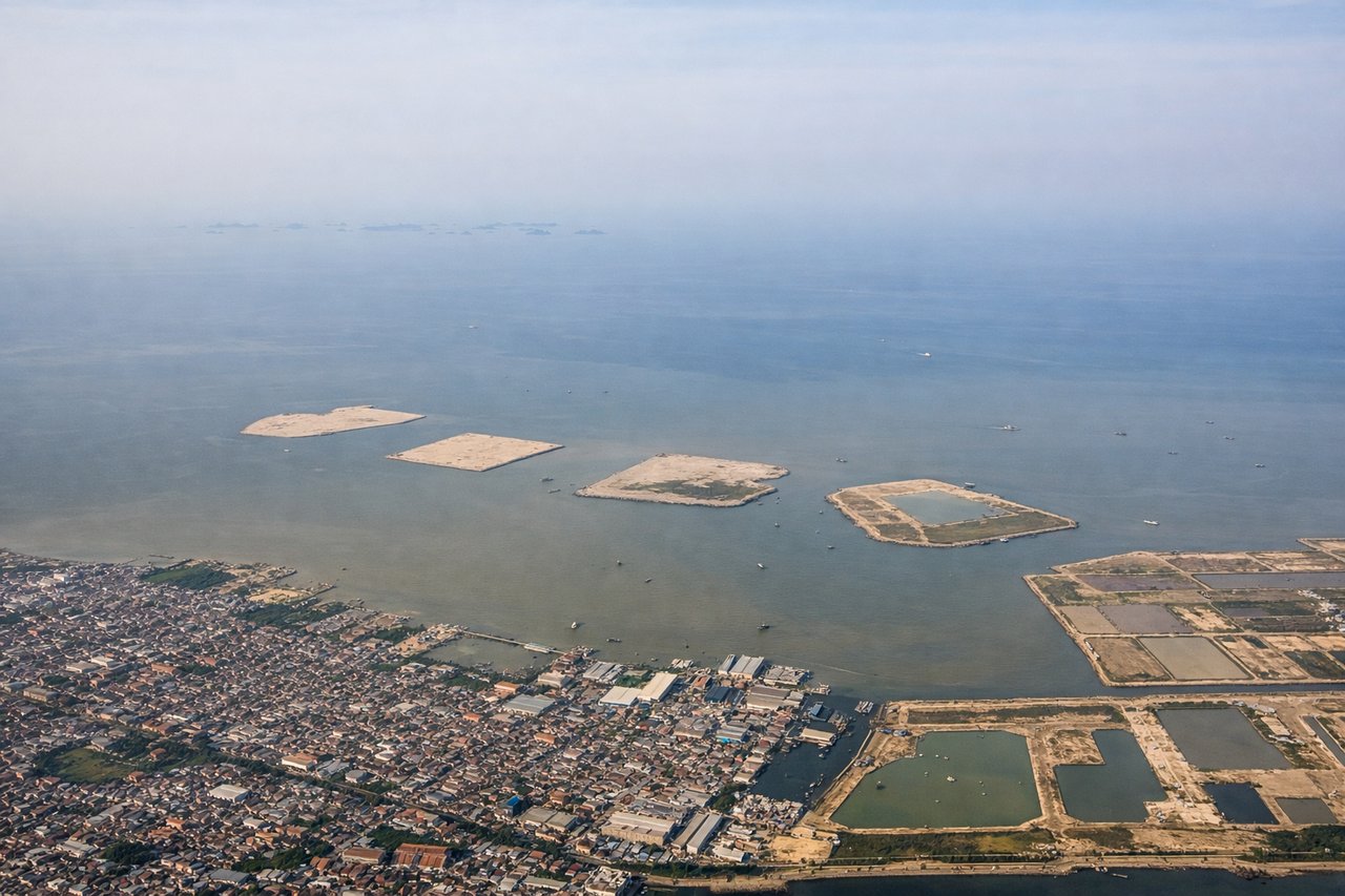
RIGHTCGK's primary departure runway 25R sends aircraft westward before turning north, putting the right side facing south toward the Java Sea and the Jakarta coastline. You get a clear view of the sprawling Jakarta urban grid and the bay dotted with the Thousand Islands (Kepulauan Seribu) as the aircraft climbs and banks northeast.
Landing at MNL
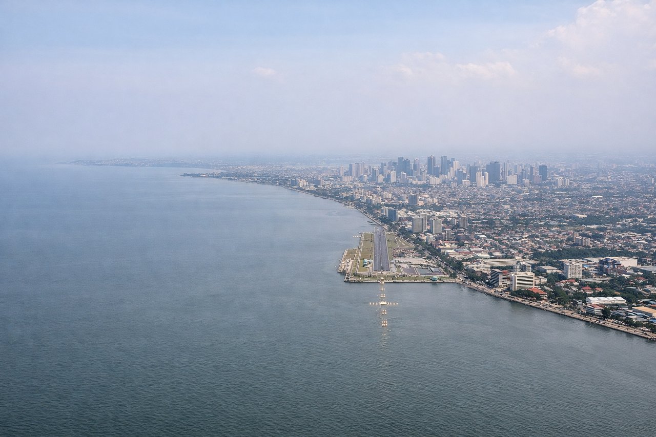
LEFTNAIA's primary arrival runway 06 brings aircraft in from the southwest over Manila Bay, so the left side faces directly over the bay and gives a sweeping view of the Manila waterfront, Intramuros, and the Pasig River delta. The right side faces inland toward suburban Paranaque and is considerably less scenic.
Will your flight be in sunlight?
Pick a date and time in the Sun Map to watch the sun move across your whole flight.
About This Route
Which side of the plane should I sit on flying from Soekarno Hatta International (CGK) to Ninoy Aquino International (MNL)?
Sit on the Left side of the plane for the best views on flights from Jakarta to Manila. While the right side wins at takeoff for Jakarta Bay views, the left side dominates the majority of the flight. Once airborne and tracking northeast, the left side faces northwest over the South China Sea and picks up the Palawan island chain of the Philippines during descent. The Manila Bay arrival on the left is one of the most visually rewarding urban approaches in Southeast Asia, making left the better overall choice.
What can I see during takeoff from Soekarno Hatta International in Jakarta?
During takeoff from Soekarno Hatta International (CGK), sit on the Right side for the best views. CGK's primary departure runway 25R sends aircraft westward before turning north, putting the right side facing south toward the Java Sea and the Jakarta coastline. You get a clear view of the sprawling Jakarta urban grid and the bay dotted with the Thousand Islands (Kepulauan Seribu) as the aircraft climbs and banks northeast. Notable sights include: Jakarta Bay and Kepulauan Seribu (Thousand Islands) chain, Jakarta city grid and port district (Tanjung Priok), Java Sea coastline stretching east.
What can I see when landing at Ninoy Aquino International in Manila?
When landing at Ninoy Aquino International (MNL), sit on the Left side for the best views. NAIA's primary arrival runway 06 brings aircraft in from the southwest over Manila Bay, so the left side faces directly over the bay and gives a sweeping view of the Manila waterfront, Intramuros, and the Pasig River delta. The right side faces inland toward suburban Paranaque and is considerably less scenic. Notable sights include: Manila Bay and the Manila waterfront boulevard (Roxas Boulevard), Intramuros and the historic walled city district, Laguna de Bay visible to the southeast on approach, Corregidor Island sitting in the mouth of Manila Bay.
How long is the flight from Jakarta to Manila?
The flight from Soekarno Hatta International (CGK) to Ninoy Aquino International (MNL) takes about 3 hours 30 minutes. The shortest flight path between them is 1,732 miles (2,788 km); winds and air traffic control usually add a few percent.
What does the Jakarta to Manila flight path pass over?
The flight tracks northeast over the Java Sea, crosses the southern tip of Borneo (Kalimantan) or passes just west of it depending on routing, then crosses the Sulu Sea. The Palawan archipelago of the Philippines becomes visible on the left side during descent, a long narrow island with mountainous spine running roughly north-south. The Sulu Sea below is deep blue and largely featureless at cruise altitude. Some flights pass near the Spratly Islands area, though these low coral atolls are difficult to distinguish at cruise altitude.