Right side edges ahead due to superior takeoff experience. While both sides score equally for the cruise phase (flat Java terrain with minimal dramatic features), the right side's immediate access to Jakarta's harbor, Java Sea coastline, and the Thousand Islands during climb-out provides more engaging early scenery. The landing experience is comparable on both sides, but the takeoff advantage gives right a slight edge for the full flight experience.
Flown CGK to SUB? Did we get it right?
Flight Path
Jakarta to Surabaya is 429 miles (691 km), a flight of about 1 hour 15 minutes.
The flight path crosses central Java at cruise altitude (approximately 25,000-30,000 feet). Visible features include the flat to gently rolling terrain of central Java, scattered volcanic peaks of the Java volcanic arc (including Mount Semeru and Mount Bromo in the distance to the south), agricultural plains and rice paddies, and occasional river valleys. The landscape transitions from the densely populated regions around Jakarta to more rural, agricultural central Java. No major mountain ranges block the route; the terrain remains predominantly low-lying with volcanic cones visible on the southern horizon. The Java Sea remains visible to the north throughout much of the cruise phase.
Great circle distance and headings ›Phase by phase
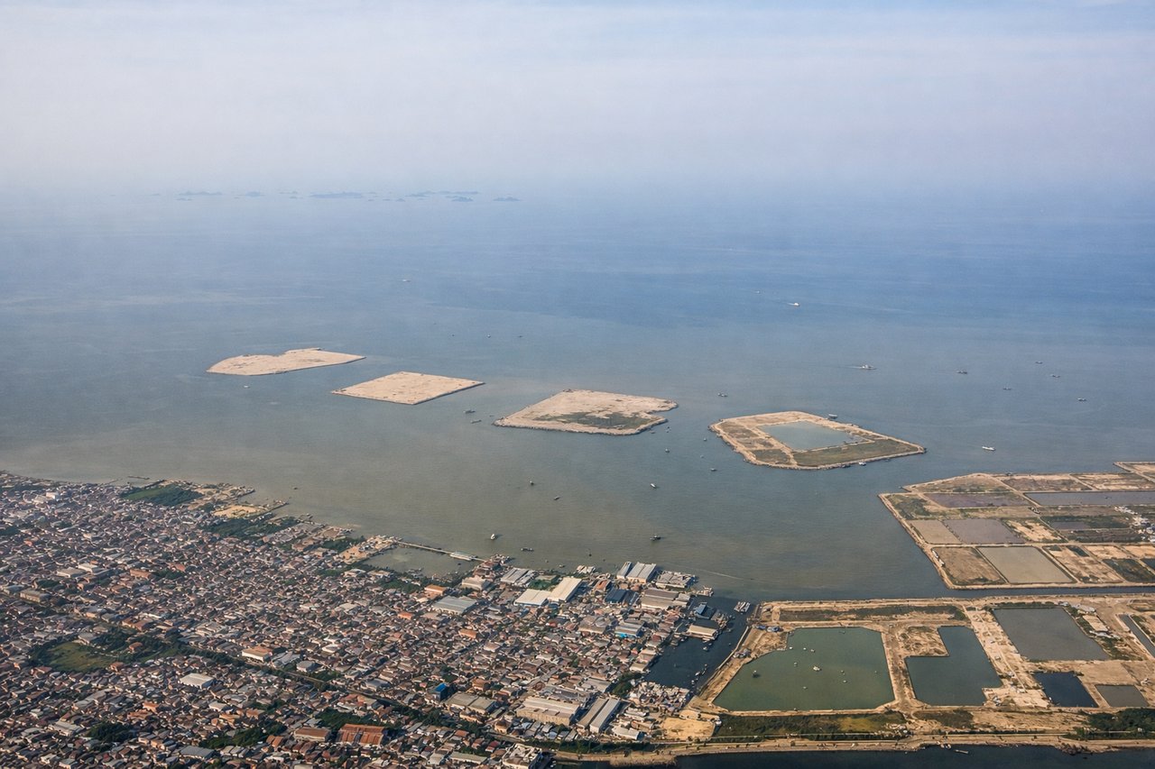
Takeoff from CGK
RIGHTRight side captures Jakarta's northern harbor and coastal sprawl during initial climb. The Java Sea coastline, port facilities, and northern Jakarta suburbs are visible immediately after takeoff, providing urban and maritime scenery in the first 10-15 minutes of flight.
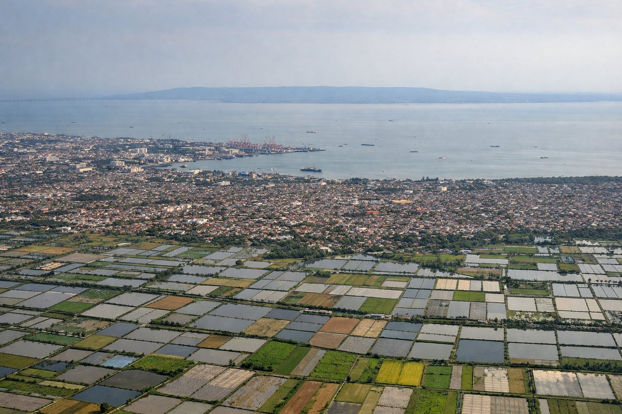
Landing at SUB
LEFTLeft side offers superior approach scenery into Surabaya. The descent path typically brings aircraft over the Madura Strait and eastern Java's coastal plains, with views of Surabaya's urban sprawl, the Suramadu Bridge (major causeway), and the transition from agricultural land to city. The landing approach provides clear urban and infrastructure landmarks.
Will your flight be in sunlight?
Pick a date and time in the Sun Map to watch the sun move across your whole flight.
About This Route
Which side of the plane should I sit on flying from Soekarno Hatta International (CGK) to Juanda International Airport (SUB)?
Sit on the Right side of the plane for the best views on flights from Jakarta to Surabaya. Right side edges ahead due to superior takeoff experience. While both sides score equally for the cruise phase (flat Java terrain with minimal dramatic features), the right side's immediate access to Jakarta's harbor, Java Sea coastline, and the Thousand Islands during climb-out provides more engaging early scenery. The landing experience is comparable on both sides, but the takeoff advantage gives right a slight edge for the full flight experience.
What can I see during takeoff from Soekarno Hatta International in Jakarta?
During takeoff from Soekarno Hatta International (CGK), sit on the Right side for the best views. Right side captures Jakarta's northern harbor and coastal sprawl during initial climb. The Java Sea coastline, port facilities, and northern Jakarta suburbs are visible immediately after takeoff, providing urban and maritime scenery in the first 10-15 minutes of flight. Notable sights include: Jakarta harbor and port infrastructure, Java Sea coastline, northern Jakarta urban sprawl, Thousand Islands (Kepulauan Seribu) archipelago in distance.
What can I see when landing at Juanda International Airport in Surabaya?
When landing at Juanda International Airport (SUB), sit on the Left side for the best views. Left side offers superior approach scenery into Surabaya. The descent path typically brings aircraft over the Madura Strait and eastern Java's coastal plains, with views of Surabaya's urban sprawl, the Suramadu Bridge (major causeway), and the transition from agricultural land to city. The landing approach provides clear urban and infrastructure landmarks. Notable sights include: Suramadu Bridge (toll causeway connecting Java and Madura), Surabaya city center and harbor, Madura Strait, eastern Java agricultural plains.
How long is the flight from Jakarta to Surabaya?
The flight from Soekarno Hatta International (CGK) to Juanda International Airport (SUB) takes about 1 hour 15 minutes. The shortest flight path between them is 429 miles (691 km); winds and air traffic control usually add a few percent.
What does the Jakarta to Surabaya flight path pass over?
The flight path crosses central Java at cruise altitude (approximately 25,000-30,000 feet). Visible features include the flat to gently rolling terrain of central Java, scattered volcanic peaks of the Java volcanic arc (including Mount Semeru and Mount Bromo in the distance to the south), agricultural plains and rice paddies, and occasional river valleys. The landscape transitions from the densely populated regions around Jakarta to more rural, agricultural central Java. No major mountain ranges block the route; the terrain remains predominantly low-lying with volcanic cones visible on the southern horizon. The Java Sea remains visible to the north throughout much of the cruise phase.