Jakarta to Tanjung Pinang is 509 miles (819 km), a flight of about 1 hour 15 minutes.
While takeoff favors the right for Jakarta Bay views, the landing approach to TNJ is significantly more visually rewarding on the left, with mangrove channels, island geography, and the Riau Islands' distinctive water-forest patterns. The landing experience outweighs the takeoff advantage.
Flight Path
The flight path crosses the Java Sea northwestward, passing over open water with occasional fishing vessels visible. Around the midpoint, you'll cross into the Riau Islands region where scattered islands begin appearing below, with visible shipping lanes between Sumatra and the islands. The water transitions from open sea to the more complex island-strait geography as you approach TNJ, with mangrove-lined channels and shallow water passages becoming increasingly visible in the final 20 minutes of descent.
Great circle distance and headings ›Phase by phase
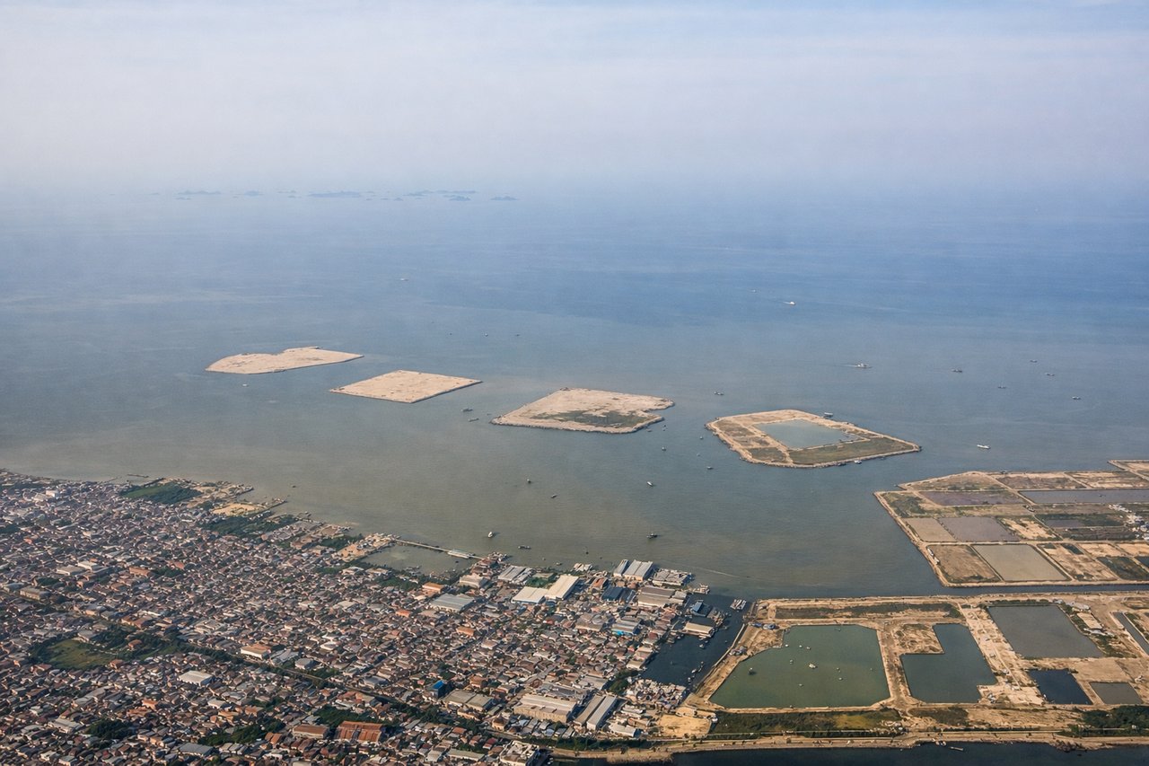
Takeoff from CGK
RIGHTCGK typically departs to the north or northeast. Right-side seats offer views of Jakarta Bay and the northern coastal plains as you climb, with the Java Sea stretching toward the horizon. Left side faces inland toward the congested urban sprawl of greater Jakarta.
Landing at TNJ
LEFTApproaching TNJ from the south, left-side seats provide views of the Riau Islands' interior waterways, mangrove forests, and the straits between islands. Right side faces open water with less distinctive features. The descent path typically brings you over the island's eastern side where water channels and vegetation patterns are most visible.
Will your flight be in sunlight?
Pick a date and time in the Sun Map to watch the sun move across your whole flight.
About This Route
Which side of the plane should I sit on flying from Soekarno Hatta International (CGK) to Raja Haji Fisabilillah International Airport (TNJ)?
Sit on the Left side of the plane for the best views on flights from Jakarta to Tanjung Pinang. While takeoff favors the right for Jakarta Bay views, the landing approach to TNJ is significantly more visually rewarding on the left, with mangrove channels, island geography, and the Riau Islands' distinctive water-forest patterns. The landing experience outweighs the takeoff advantage.
What can I see during takeoff from Soekarno Hatta International in Jakarta?
During takeoff from Soekarno Hatta International (CGK), sit on the Right side for the best views. CGK typically departs to the north or northeast. Right-side seats offer views of Jakarta Bay and the northern coastal plains as you climb, with the Java Sea stretching toward the horizon. Left side faces inland toward the congested urban sprawl of greater Jakarta. Notable sights include: Jakarta Bay (immediate offshore waters), Thousand Islands archipelago (small islands dotting the bay to the northeast), northern Jakarta coastal districts, Java Sea horizon.
What can I see when landing at Raja Haji Fisabilillah International Airport in Tanjung Pinang?
When landing at Raja Haji Fisabilillah International Airport (TNJ), sit on the Left side for the best views. Approaching TNJ from the south, left-side seats provide views of the Riau Islands' interior waterways, mangrove forests, and the straits between islands. Right side faces open water with less distinctive features. The descent path typically brings you over the island's eastern side where water channels and vegetation patterns are most visible. Notable sights include: Riau Islands mangrove forests and tidal channels, Karimun Strait (water passage between major islands), Bintan Island's forested interior, Tanjung Pinang harbor and coastal settlement.
How long is the flight from Jakarta to Tanjung Pinang?
The flight from Soekarno Hatta International (CGK) to Raja Haji Fisabilillah International Airport (TNJ) takes about 1 hour 15 minutes. The shortest flight path between them is 509 miles (819 km); winds and air traffic control usually add a few percent.
What does the Jakarta to Tanjung Pinang flight path pass over?
The flight path crosses the Java Sea northwestward, passing over open water with occasional fishing vessels visible. Around the midpoint, you'll cross into the Riau Islands region where scattered islands begin appearing below, with visible shipping lanes between Sumatra and the islands. The water transitions from open sea to the more complex island-strait geography as you approach TNJ, with mangrove-lined channels and shallow water passages becoming increasingly visible in the final 20 minutes of descent.