The landing approach into LAX offers more dramatic and visually distinctive scenery with the San Gabriel and San Bernardino Mountains. The takeoff from Rome is pleasant but less visually striking than the mountain approach into Los Angeles.
Flown CIA to LAX? Did we get it right?
Flight Path
Rome to Los Angeles is 6,351 miles (10,222 km), a flight of about 10 hours 45 minutes.
The flight crosses the Alps (visible during initial westbound climb from Rome), then the Atlantic Ocean for approximately 6 hours. Notable features include the Pyrenees on the Spain-France border (if visible during the northern transatlantic routing), Greenland's ice sheet and coastline (far north on polar routing), and the Canadian Arctic islands before descending toward the North American continent. The approach to LAX crosses the Sierra Nevada and Mojave Desert in California.
Great circle distance and headings ›


Phase by phase
Takeoff from CIA
LEFTLeft side offers views of the Apennine Mountains running south from Rome and the Tyrrhenian Sea coastline. Right side faces inland toward featureless central Italian plains.
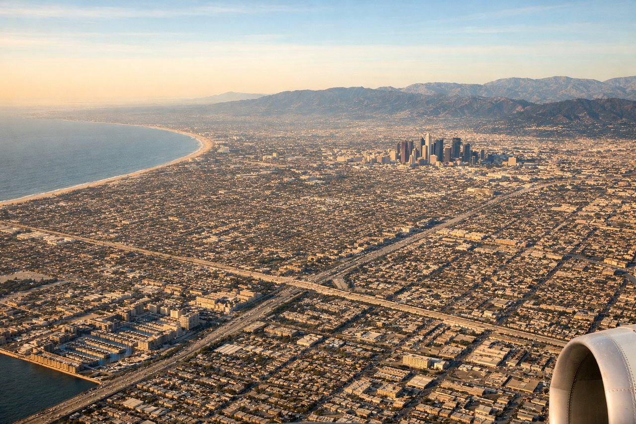
Landing at LAX
RIGHTRight side provides views of the San Gabriel and San Bernardino Mountains as the aircraft descends toward LAX from the east. Left side shows only the sprawling Los Angeles basin and urban development.
Will your flight be in sunlight?
Pick a date and time in the Sun Map to watch the sun move across your whole flight.
About This Route
Which side of the plane should I sit on flying from Ciampino (CIA) to Los Angeles International (LAX)?
Sit on the Right side of the plane for the best views on flights from Rome to Los Angeles. The landing approach into LAX offers more dramatic and visually distinctive scenery with the San Gabriel and San Bernardino Mountains. The takeoff from Rome is pleasant but less visually striking than the mountain approach into Los Angeles.
What can I see during takeoff from Ciampino in Rome?
During takeoff from Ciampino (CIA), sit on the Left side for the best views. Left side offers views of the Apennine Mountains running south from Rome and the Tyrrhenian Sea coastline. Right side faces inland toward featureless central Italian plains. Notable sights include: Apennine Mountains (south-southeast), Tyrrhenian Sea coastline, Castelli Romani volcanic hills (southeast of Rome), Mediterranean islands in distance.
What can I see when landing at Los Angeles International in Los Angeles?
When landing at Los Angeles International (LAX), sit on the Right side for the best views. Right side provides views of the San Gabriel and San Bernardino Mountains as the aircraft descends toward LAX from the east. Left side shows only the sprawling Los Angeles basin and urban development. Notable sights include: San Gabriel Mountains (north), San Bernardino Mountains (northeast), Los Angeles basin urban grid, Pacific Ocean coastline.
How long is the flight from Rome to Los Angeles?
The flight from Ciampino (CIA) to Los Angeles International (LAX) takes about 10 hours 45 minutes. The shortest flight path between them is 6,351 miles (10,222 km); winds and air traffic control usually add a few percent.
What does the Rome to Los Angeles flight path pass over?
The flight crosses the Alps (visible during initial westbound climb from Rome), then the Atlantic Ocean for approximately 6 hours. Notable features include the Pyrenees on the Spain-France border (if visible during the northern transatlantic routing), Greenland's ice sheet and coastline (far north on polar routing), and the Canadian Arctic islands before descending toward the North American continent. The approach to LAX crosses the Sierra Nevada and Mojave Desert in California.