Right side captures the most distinctive visual sequence: Jeju's volcanic landscape and Hallasan during departure, then the Nakdong River valley and Daegu basin during descent. The flight path runs northeast across relatively open terrain, making the right side consistently more scenic.
Flown CJU to TAE? Did we get it right?
Flight Path
Cheju to Taegu is 205 miles (331 km), a flight of about 1 hour.
Korea Strait (open water between Jeju and mainland), Namhae Island and Geoje Island (southern coast islands), transition from coastal lowlands to the Nakdong River valley, Gyeongsan plain
Great circle distance and headings ›Phase by phase
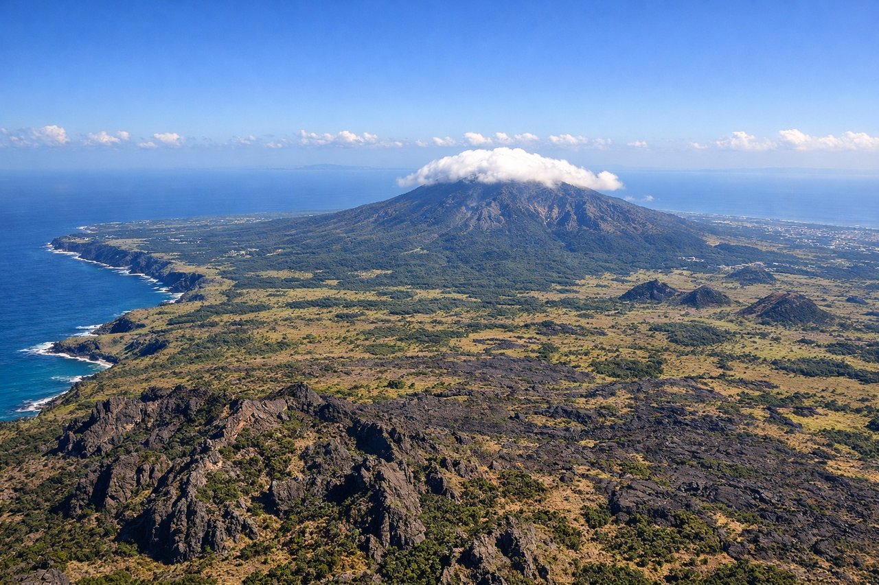
Takeoff from CJU
RIGHTRight side offers views of Jeju Island's volcanic terrain and the surrounding Korea Strait. You'll see the island's interior plateau and coastline as you climb northeastward toward Daegu.
Landing at TAE
LEFTLeft side provides views of the Nakdong River valley and the surrounding Gyeongsan-Daegu basin as you descend. You'll see the river's meandering path and the urban sprawl of Daegu's eastern districts before final approach.
Will your flight be in sunlight?
Pick a date and time in the Sun Map to watch the sun move across your whole flight.
About This Route
Which side of the plane should I sit on flying from Jeju International (CJU) to Daegu Ab (TAE)?
Sit on the Right side of the plane for the best views on flights from Cheju to Taegu. Right side captures the most distinctive visual sequence: Jeju's volcanic landscape and Hallasan during departure, then the Nakdong River valley and Daegu basin during descent. The flight path runs northeast across relatively open terrain, making the right side consistently more scenic.
What can I see during takeoff from Jeju International in Cheju?
During takeoff from Jeju International (CJU), sit on the Right side for the best views. Right side offers views of Jeju Island's volcanic terrain and the surrounding Korea Strait. You'll see the island's interior plateau and coastline as you climb northeastward toward Daegu. Notable sights include: Hallasan (1,950m volcanic peak, center-island), Jeju's black lava fields, Korea Strait coastline, Seogwipo city on the southern coast.
What can I see when landing at Daegu Ab in Taegu?
When landing at Daegu Ab (TAE), sit on the Left side for the best views. Left side provides views of the Nakdong River valley and the surrounding Gyeongsan-Daegu basin as you descend. You'll see the river's meandering path and the urban sprawl of Daegu's eastern districts before final approach. Notable sights include: Nakdong River (major river valley running north-south), Daegu city sprawl and urban grid, Palgongsan mountain range (east of Daegu), Gyeongsan city to the south.
How long is the flight from Cheju to Taegu?
The flight from Jeju International (CJU) to Daegu Ab (TAE) takes about 1 hour. The shortest flight path between them is 205 miles (331 km); winds and air traffic control usually add a few percent.
What does the Cheju to Taegu flight path pass over?
Korea Strait (open water between Jeju and mainland), Namhae Island and Geoje Island (southern coast islands), transition from coastal lowlands to the Nakdong River valley, Gyeongsan plain