While the left side offers Lake Erie views during departure, the right side provides the most dramatic and sustained scenery during the descent into Salt Lake City with the Wasatch Range. The landing approach scenery outweighs the takeoff advantage.
Flown CLE to SLC? Did we get it right?
Flight Path
Cleveland to Salt Lake City is 1,561 miles (2,513 km), a flight of about 3 hours 15 minutes.
The flight path crosses the Ohio River valley, transitions over Indiana and Illinois farmland, then enters the Mississippi River valley near St. Louis. Continuing westward, the aircraft passes over the Missouri River basin and the Great Plains, with the Rocky Mountain Front becoming visible approximately 200 miles east of Salt Lake City. The Wasatch Range and adjacent Uinta Mountains dominate the final approach corridor.
Great circle distance and headings ›


Phase by phase
Takeoff from CLE
LEFTLeft side offers views of Lake Erie immediately after departure, followed by the Appalachian foothills as the aircraft climbs westward. Right side faces inland terrain with fewer distinctive landmarks in the initial climb phase.
Landing at SLC
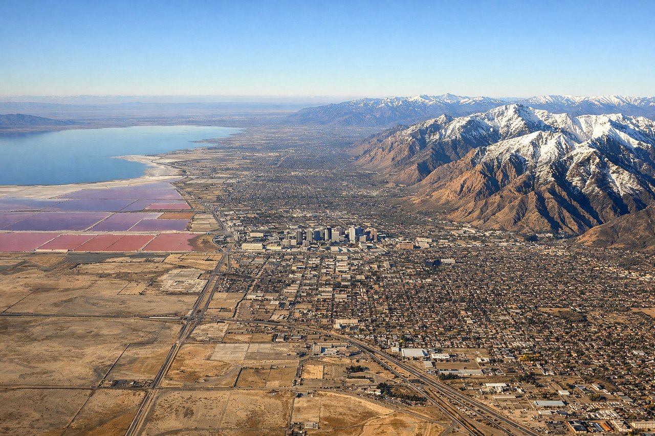
RIGHTRight side provides excellent views of the Wasatch Range as the aircraft descends into Salt Lake City from the east. The mountains dominate the approach, with the Great Salt Lake visible to the left but smaller in the frame. Left side faces the lake but misses the dramatic mountain backdrop.
Will your flight be in sunlight?
Pick a date and time in the Sun Map to watch the sun move across your whole flight.
About This Route
Which side of the plane should I sit on flying from Cleveland Hopkins International (CLE) to Salt Lake City International (SLC)?
Sit on the Right side of the plane for the best views on flights from Cleveland to Salt Lake City. While the left side offers Lake Erie views during departure, the right side provides the most dramatic and sustained scenery during the descent into Salt Lake City with the Wasatch Range. The landing approach scenery outweighs the takeoff advantage.
What can I see during takeoff from Cleveland Hopkins International in Cleveland?
During takeoff from Cleveland Hopkins International (CLE), sit on the Left side for the best views. Left side offers views of Lake Erie immediately after departure, followed by the Appalachian foothills as the aircraft climbs westward. Right side faces inland terrain with fewer distinctive landmarks in the initial climb phase. Notable sights include: Lake Erie (northern shoreline), Cuyahoga River valley, Appalachian plateau ridgelines, Cleveland urban sprawl.
What can I see when landing at Salt Lake City International in Salt Lake City?
When landing at Salt Lake City International (SLC), sit on the Right side for the best views. Right side provides excellent views of the Wasatch Range as the aircraft descends into Salt Lake City from the east. The mountains dominate the approach, with the Great Salt Lake visible to the left but smaller in the frame. Left side faces the lake but misses the dramatic mountain backdrop. Notable sights include: Wasatch Range peaks (including Mount Olympus and Lone Peak), Great Salt Lake western shoreline, Salt Lake Valley urban grid, Jordan River corridor.
How long is the flight from Cleveland to Salt Lake City?
The flight from Cleveland Hopkins International (CLE) to Salt Lake City International (SLC) takes about 3 hours 15 minutes. The shortest flight path between them is 1,561 miles (2,513 km); winds and air traffic control usually add a few percent.
What does the Cleveland to Salt Lake City flight path pass over?
The flight path crosses the Ohio River valley, transitions over Indiana and Illinois farmland, then enters the Mississippi River valley near St. Louis. Continuing westward, the aircraft passes over the Missouri River basin and the Great Plains, with the Rocky Mountain Front becoming visible approximately 200 miles east of Salt Lake City. The Wasatch Range and adjacent Uinta Mountains dominate the final approach corridor.