Left seats capture the superior takeoff view of the Wasatch Range's dramatic escarpment, which is the most visually distinctive feature of this route. While landing views favor the right, the Wasatch departure is more memorable and geographically striking than the Lake Erie approach.
Flown SLC to CLE? Did we get it right?
Flight Path
Salt Lake City to Cleveland is 1,561 miles (2,513 km), a flight of about 4 hours 15 minutes.
The flight path crosses the Rocky Mountain Front near the Wyoming-Colorado border (visible as a series of north-south trending ridges and basins), then transitions into the Great Plains. The Green River basin and Uinta Mountains are visible on the left (north) side during the first 90 minutes. The flight then crosses into Nebraska and Iowa, where the landscape flattens into agricultural plains with visible river valleys (Platte River, Missouri River) and scattered towns. As the aircraft approaches Ohio, the terrain remains flat with increasing evidence of urban and suburban development around major cities like Columbus and Pittsburgh (to the south). The Appalachian foothills become visible as subtle elevation changes in the terrain during the final 45 minutes of flight.
Great circle distance and headings ›


Phase by phase
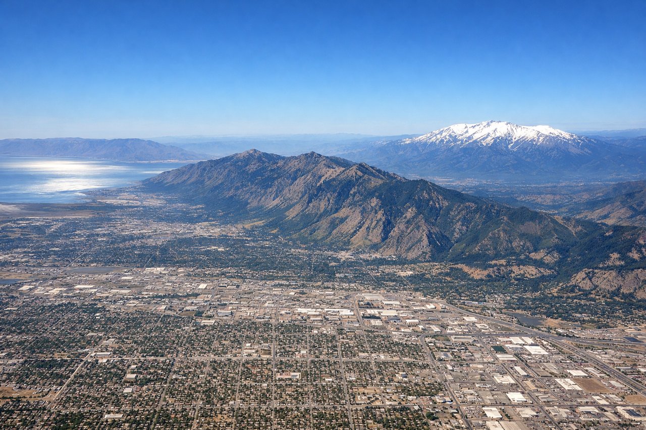
Takeoff from SLC
LEFTSLC typically departs westbound (Runway 16L/R) or eastbound (Runway 34L/R). Westbound departures favor left seats for views of the Wasatch Range's dramatic eastern escarpment rising directly from the Salt Lake Valley floor. Eastbound departures show the Great Salt Lake to the northwest, but the Wasatch view is more striking and closer during climb-out.
Landing at CLE
RIGHTCLE typically lands eastbound (Runway 24L/R) or westbound (Runway 06L/R). Eastbound approaches favor right seats for views of Lake Erie's southern shoreline and the Cleveland urban area spreading inland. Westbound approaches show similar geography but from the opposite angle. Right seats on eastbound final approach offer the clearest view of the lake meeting the city.
Will your flight be in sunlight?
Pick a date and time in the Sun Map to watch the sun move across your whole flight.
About This Route
Which side of the plane should I sit on flying from Salt Lake City International (SLC) to Cleveland Hopkins International (CLE)?
Sit on the Left side of the plane for the best views on flights from Salt Lake City to Cleveland. Left seats capture the superior takeoff view of the Wasatch Range's dramatic escarpment, which is the most visually distinctive feature of this route. While landing views favor the right, the Wasatch departure is more memorable and geographically striking than the Lake Erie approach.
What can I see during takeoff from Salt Lake City International in Salt Lake City?
During takeoff from Salt Lake City International (SLC), sit on the Left side for the best views. SLC typically departs westbound (Runway 16L/R) or eastbound (Runway 34L/R). Westbound departures favor left seats for views of the Wasatch Range's dramatic eastern escarpment rising directly from the Salt Lake Valley floor. Eastbound departures show the Great Salt Lake to the northwest, but the Wasatch view is more striking and closer during climb-out. Notable sights include: Wasatch Range (immediately adjacent, snow-capped peaks), Great Salt Lake (northwest, visible as large pale water body), Salt Lake Valley floor (urban grid below), Antelope Island (if visible in GSL).
What can I see when landing at Cleveland Hopkins International in Cleveland?
When landing at Cleveland Hopkins International (CLE), sit on the Right side for the best views. CLE typically lands eastbound (Runway 24L/R) or westbound (Runway 06L/R). Eastbound approaches favor right seats for views of Lake Erie's southern shoreline and the Cleveland urban area spreading inland. Westbound approaches show similar geography but from the opposite angle. Right seats on eastbound final approach offer the clearest view of the lake meeting the city. Notable sights include: Lake Erie (dominant water feature, southern shoreline), Cleveland downtown skyline (visible as cluster of tall buildings), Cuyahoga River (winding through industrial valley), Suburban sprawl extending south and east.
How long is the flight from Salt Lake City to Cleveland?
The flight from Salt Lake City International (SLC) to Cleveland Hopkins International (CLE) takes about 4 hours 15 minutes. The shortest flight path between them is 1,561 miles (2,513 km); winds and air traffic control usually add a few percent.
What does the Salt Lake City to Cleveland flight path pass over?
The flight path crosses the Rocky Mountain Front near the Wyoming-Colorado border (visible as a series of north-south trending ridges and basins), then transitions into the Great Plains. The Green River basin and Uinta Mountains are visible on the left (north) side during the first 90 minutes. The flight then crosses into Nebraska and Iowa, where the landscape flattens into agricultural plains with visible river valleys (Platte River, Missouri River) and scattered towns. As the aircraft approaches Ohio, the terrain remains flat with increasing evidence of urban and suburban development around major cities like Columbus and Pittsburgh (to the south). The Appalachian foothills become visible as subtle elevation changes in the terrain during the final 45 minutes of flight.