Left side wins both ends of the flight. At takeoff you get Charlotte's skyline and the Catawba River system; at landing you get the Mississippi River and the Gateway Arch head-on. The right side offers little of comparable interest at either airport.
Flown CLT to STL? Did we get it right?
Flight Path
Charlotte to St. Louis is 574 miles (924 km), a flight of about 1 hour 45 minutes.
The flight tracks northwest across the South Carolina and North Carolina Piedmont, then crosses the Tennessee River valley region near Knoxville before entering the rolling hills of Kentucky and southern Indiana. The Ohio River is visible as a wide boundary between Kentucky and Indiana roughly two-thirds through the flight. The terrain transitions from Appalachian foothills to flat Midwestern agricultural plains as you approach Missouri.
Great circle distance and headings ›

Phase by phase
Takeoff from CLT
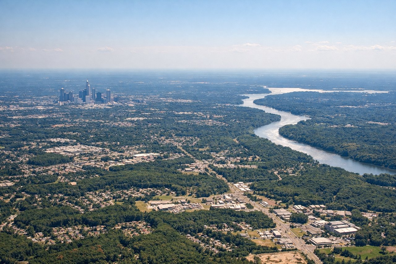
LEFTCLT's primary departure runways (18C/36C and 18L/36L) run north-south. Departing northbound toward STL, a left-side seat faces west, giving you a clear view of Charlotte's uptown skyline as you climb out. The city grid and the Catawba River are both visible before you clear the metro area.
Landing at STL
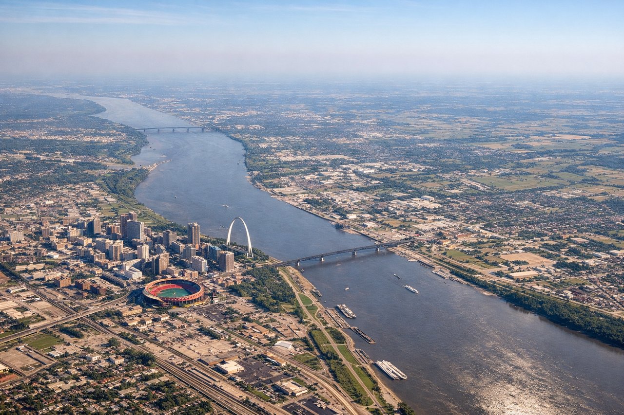
LEFTSTL's primary arrival runways (12L/30R orientation) mean aircraft often approach from the east or northeast. A left-side seat on approach gives you the best view of the Mississippi River and the Gateway Arch, which are east of the terminal and directly in the approach corridor. The Arch is unmistakable from several miles out.
Will your flight be in sunlight?
Pick a date and time in the Sun Map to watch the sun move across your whole flight.
About This Route
Which side of the plane should I sit on flying from Charlotte Douglas International (CLT) to Lambert St Louis International (STL)?
Sit on the Left side of the plane for the best views on flights from Charlotte to St. Louis. Left side wins both ends of the flight. At takeoff you get Charlotte's skyline and the Catawba River system; at landing you get the Mississippi River and the Gateway Arch head-on. The right side offers little of comparable interest at either airport.
What can I see during takeoff from Charlotte Douglas International in Charlotte?
During takeoff from Charlotte Douglas International (CLT), sit on the Left side for the best views. CLT's primary departure runways (18C/36C and 18L/36L) run north-south. Departing northbound toward STL, a left-side seat faces west, giving you a clear view of Charlotte's uptown skyline as you climb out. The city grid and the Catawba River are both visible before you clear the metro area. Notable sights include: Uptown Charlotte skyline, Catawba River, Lake Norman to the northwest, Charlotte Motor Speedway visible to the northeast.
What can I see when landing at Lambert St Louis International in St. Louis?
When landing at Lambert St Louis International (STL), sit on the Left side for the best views. STL's primary arrival runways (12L/30R orientation) mean aircraft often approach from the east or northeast. A left-side seat on approach gives you the best view of the Mississippi River and the Gateway Arch, which are east of the terminal and directly in the approach corridor. The Arch is unmistakable from several miles out. Notable sights include: Gateway Arch and St. Louis riverfront, Mississippi River, downtown St. Louis skyline, Cahokia Mounds site across the river in Illinois.
How long is the flight from Charlotte to St. Louis?
The flight from Charlotte Douglas International (CLT) to Lambert St Louis International (STL) takes about 1 hour 45 minutes. The shortest flight path between them is 574 miles (924 km); winds and air traffic control usually add a few percent.
What does the Charlotte to St. Louis flight path pass over?
The flight tracks northwest across the South Carolina and North Carolina Piedmont, then crosses the Tennessee River valley region near Knoxville before entering the rolling hills of Kentucky and southern Indiana. The Ohio River is visible as a wide boundary between Kentucky and Indiana roughly two-thirds through the flight. The terrain transitions from Appalachian foothills to flat Midwestern agricultural plains as you approach Missouri.