Takeoff views of the Coral Sea and reef system are more visually distinctive than landing views. However, if landing on runway 27 (eastbound approach), left seats would offer superior Mount Agung views. Right seats provide the more consistent and dramatic scenery across the full journey.
Flown CNS to DPS? Did we get it right?
Flight Path
Cairns to Denpasar is 2,133 miles (3,432 km), a flight of about 4 hours 40 minutes.
The flight path crosses the Coral Sea heading northwest, passing over the outer Great Barrier Reef system and open ocean. Around the midpoint (roughly 60 nm northeast of Cairns), the Coral Sea deepens to dark blue with no land visible. The route then transitions over the Timor Sea toward the Indonesian archipelago. Approximately 90 nm before Bali, the volcanic islands of the Lesser Sunda chain become visible on the horizon—first Lombok, then Bali's Mount Agung. The approach to Bali crosses over the Lombok Strait with clear views of both islands' volcanic topography.
Great circle distance and headings ›Phase by phase
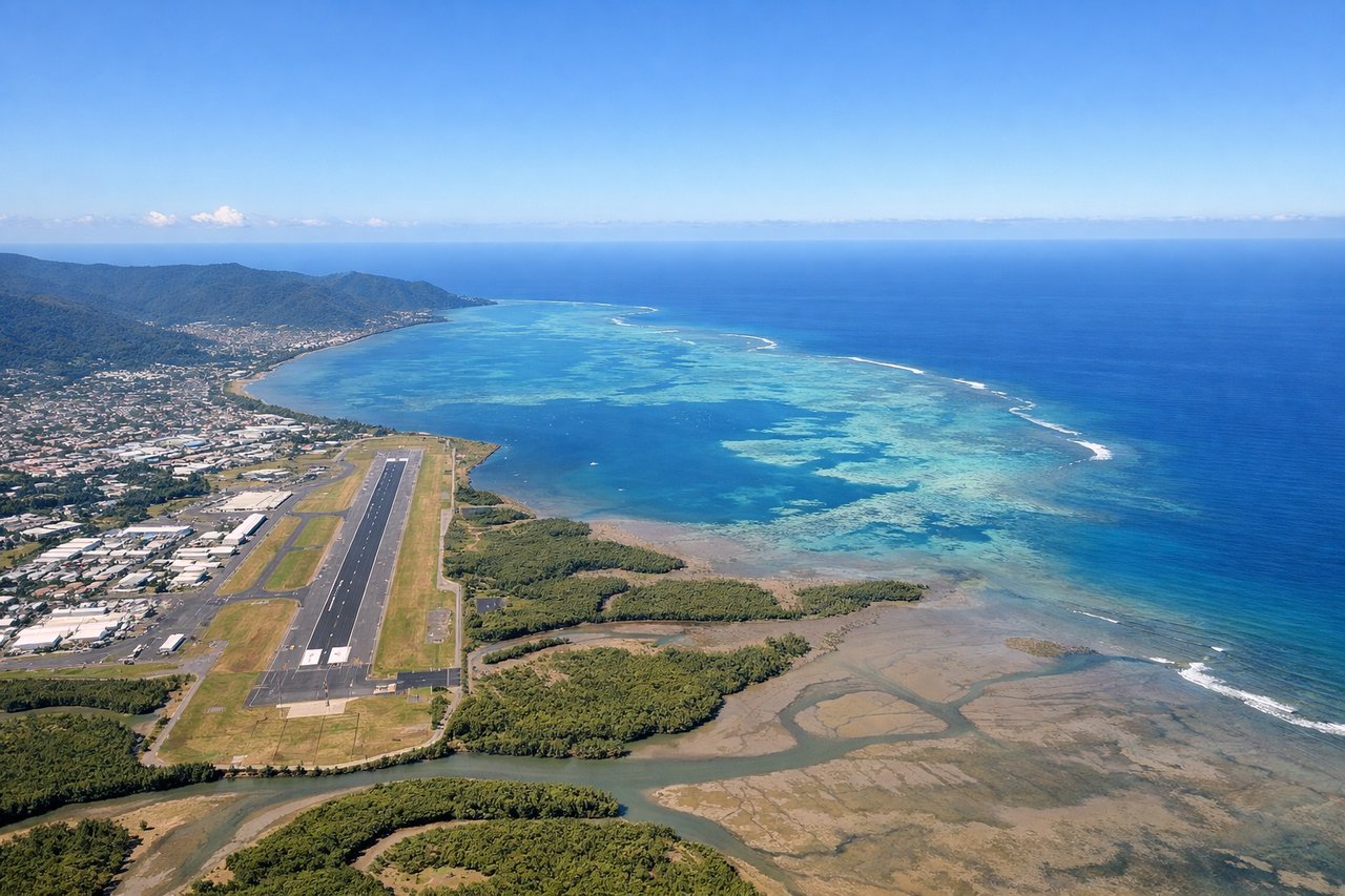
Takeoff from CNS
RIGHTCairns typically departs to the north or northeast. Right-side seats offer views of the Coral Sea coastline, the Great Barrier Reef lagoon system, and the rainforested Atherton Tableland rising inland. Left seats face inland terrain with less distinctive visual contrast.
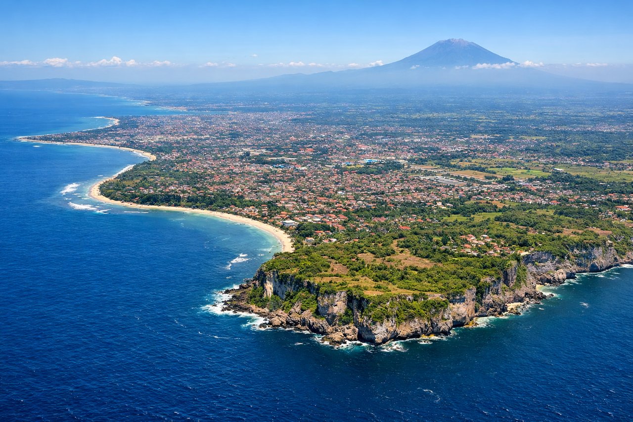
Landing at DPS
LEFTBali typically lands on runway 09 (westbound) or 27 (eastbound). Left-side seats on approach offer views of Mount Agung (3,142 m active volcano), the volcanic ridge system of eastern Bali, and the Lombok Strait. Right seats face the Bali Sea and western lowlands with less dramatic topography.
Will your flight be in sunlight?
Pick a date and time in the Sun Map to watch the sun move across your whole flight.
About This Route
Which side of the plane should I sit on flying from Cairns International (CNS) to Denpasar I Gusti Ngurah Rai International Airport (DPS)?
Sit on the Right side of the plane for the best views on flights from Cairns to Denpasar. Takeoff views of the Coral Sea and reef system are more visually distinctive than landing views. However, if landing on runway 27 (eastbound approach), left seats would offer superior Mount Agung views. Right seats provide the more consistent and dramatic scenery across the full journey.
What can I see during takeoff from Cairns International in Cairns?
During takeoff from Cairns International (CNS), sit on the Right side for the best views. Cairns typically departs to the north or northeast. Right-side seats offer views of the Coral Sea coastline, the Great Barrier Reef lagoon system, and the rainforested Atherton Tableland rising inland. Left seats face inland terrain with less distinctive visual contrast. Notable sights include: Coral Sea (immediate offshore waters), Great Barrier Reef outer edge (visible as pale turquoise band 10-20 nm offshore), Atherton Tableland escarpment (inland plateau edge rising 2,000-3,000 feet), Trinity Inlet (Cairns harbor inlet visible during initial climb).
What can I see when landing at Denpasar I Gusti Ngurah Rai International Airport in Denpasar?
When landing at Denpasar I Gusti Ngurah Rai International Airport (DPS), sit on the Left side for the best views. Bali typically lands on runway 09 (westbound) or 27 (eastbound). Left-side seats on approach offer views of Mount Agung (3,142 m active volcano), the volcanic ridge system of eastern Bali, and the Lombok Strait. Right seats face the Bali Sea and western lowlands with less dramatic topography. Notable sights include: Mount Agung (dominant volcanic peak on eastern horizon), Lombok Strait (body of water separating Bali from Lombok island), Bali's volcanic ridge system (north-south running highlands), Denpasar urban area (visible as developed lowland grid approaching from the north).
How long is the flight from Cairns to Denpasar?
The flight from Cairns International (CNS) to Denpasar I Gusti Ngurah Rai International Airport (DPS) takes about 4 hours 40 minutes. The shortest flight path between them is 2,133 miles (3,432 km); winds and air traffic control usually add a few percent.
What does the Cairns to Denpasar flight path pass over?
The flight path crosses the Coral Sea heading northwest, passing over the outer Great Barrier Reef system and open ocean. Around the midpoint (roughly 60 nm northeast of Cairns), the Coral Sea deepens to dark blue with no land visible. The route then transitions over the Timor Sea toward the Indonesian archipelago. Approximately 90 nm before Bali, the volcanic islands of the Lesser Sunda chain become visible on the horizon—first Lombok, then Bali's Mount Agung. The approach to Bali crosses over the Lombok Strait with clear views of both islands' volcanic topography.