Sapporo to Manila is 2,307 miles (3,712 km), a flight of about 4 hours 45 minutes.
The right side wins overall due to the dramatic Hidaka Mountain departure view from Hokkaido, and during the cruise the right side tracks closer to the Japanese archipelago's Pacific coastline — including views of Honshu's eastern coast and the Ryukyu Islands chain — before the Manila Bay approach favors the left. The takeoff scenery on the right is simply more memorable and sustained.
Flight Path
The route tracks southwest over the Pacific Ocean east of Honshu, passing within view of the Tohoku coastline and potentially Sendai Bay on the right side. The flight then crosses over or near the Ryukyu Islands chain (Okinawa visible on clear days), before crossing the Luzon Strait between Taiwan and the Philippines. The Babuyan Islands north of Luzon may be visible on descent, followed by the Cagayan Valley and Sierra Madre mountain range of northern Luzon before reaching Manila.
Great circle distance and headings ›Phase by phase
Takeoff from CTS
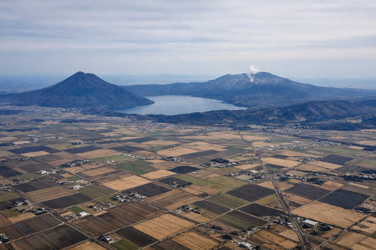
RIGHTNew Chitose typically departs southbound on runway 01R/19L or uses runway 36/18. On a southbound departure toward Manila, the right side gives you a clear view of the Hidaka Mountains running along the eastern spine of Hokkaido, with snow-capped peaks visible for several minutes after liftoff. The left side faces west toward flat agricultural plains around Tomakomai with less visual interest.
Landing at MNL
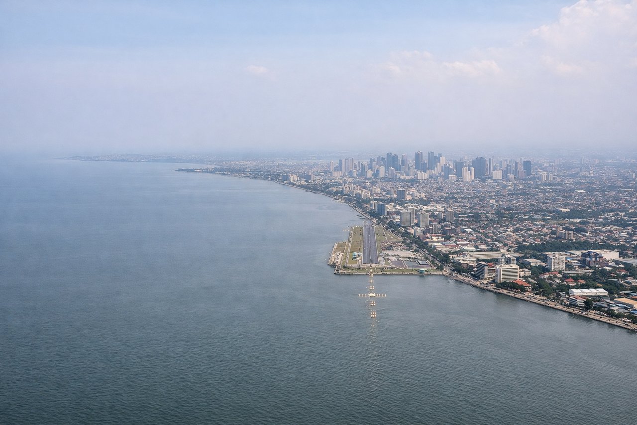
LEFTNinoy Aquino International typically lands on runway 06/24 or 13/31. On approach from the north, the left side gives you Manila Bay — one of the most visually dramatic urban-coastal approaches in Asia — with the Manila city skyline, the bay's broad expanse, and Corregidor Island visible. The right side faces toward Laguna de Bay and the inland suburbs, which are less distinctive.
Landmarks on this routeAll landmarks →
Will your flight be in sunlight?
Pick a date and time in the Sun Map to watch the sun move across your whole flight.
About This Route
Which side of the plane should I sit on flying from Chitose International Airport (CTS) to Ninoy Aquino International (MNL)?
Sit on the Right side of the plane for the best views on flights from Sapporo to Manila. The right side wins overall due to the dramatic Hidaka Mountain departure view from Hokkaido, and during the cruise the right side tracks closer to the Japanese archipelago's Pacific coastline — including views of Honshu's eastern coast and the Ryukyu Islands chain — before the Manila Bay approach favors the left. The takeoff scenery on the right is simply more memorable and sustained.
What can I see during takeoff from Chitose International Airport in Sapporo?
During takeoff from Chitose International Airport (CTS), sit on the Right side for the best views. New Chitose typically departs southbound on runway 01R/19L or uses runway 36/18. On a southbound departure toward Manila, the right side gives you a clear view of the Hidaka Mountains running along the eastern spine of Hokkaido, with snow-capped peaks visible for several minutes after liftoff. The left side faces west toward flat agricultural plains around Tomakomai with less visual interest. Notable sights include: Hidaka Mountain Range (including Poroshiri-dake at 2,052m), Lake Shikotsu (large caldera lake to the northwest), Uchiura Bay (wide bay opening to the south), Pacific Ocean coastline of southern Hokkaido.
What can I see when landing at Ninoy Aquino International in Manila?
When landing at Ninoy Aquino International (MNL), sit on the Left side for the best views. Ninoy Aquino International typically lands on runway 06/24 or 13/31. On approach from the north, the left side gives you Manila Bay — one of the most visually dramatic urban-coastal approaches in Asia — with the Manila city skyline, the bay's broad expanse, and Corregidor Island visible. The right side faces toward Laguna de Bay and the inland suburbs, which are less distinctive. Notable sights include: Manila Bay and its broad western opening, Manila city skyline and Roxas Boulevard waterfront, Laguna de Bay (large lake visible to the southeast), Corregidor Island sitting in the mouth of Manila Bay.
How long is the flight from Sapporo to Manila?
The flight from Chitose International Airport (CTS) to Ninoy Aquino International (MNL) takes about 4 hours 45 minutes. The shortest flight path between them is 2,307 miles (3,712 km); winds and air traffic control usually add a few percent.
What does the Sapporo to Manila flight path pass over?
The route tracks southwest over the Pacific Ocean east of Honshu, passing within view of the Tohoku coastline and potentially Sendai Bay on the right side. The flight then crosses over or near the Ryukyu Islands chain (Okinawa visible on clear days), before crossing the Luzon Strait between Taiwan and the Philippines. The Babuyan Islands north of Luzon may be visible on descent, followed by the Cagayan Valley and Sierra Madre mountain range of northern Luzon before reaching Manila.