Manila to Sapporo is 2,307 miles (3,712 km), a flight of about 4 hours 55 minutes.
The left side wins across all three phases: Manila Bay and its coastline at takeoff, Mount Fuji, the Japanese Alps, and Tokyo Bay during the Honshu overflight, and the volcanic Hokkaido interior with Mount Yotei on final approach. The right side is dominated by long stretches of open Philippine Sea and Pacific Ocean with few named landmarks.
Flight Path
The route crosses the open Philippine Sea east of Taiwan and the Ryukyu Islands before making landfall over Kyushu or Shikoku, then continues north along Honshu past the Kii Peninsula, Tokyo Bay area, and the Tohoku mountains before crossing into Hokkaido.
Great circle distance and headings ›Phase by phase
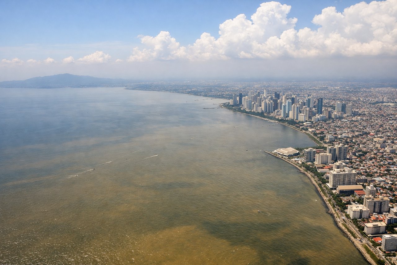
Takeoff from MNL
LEFTDeparting NAIA northbound, the left side overlooks Manila Bay, giving passengers a sweeping view of the bay's coastline, Corregidor Island, and the Bataan Peninsula's hills as the aircraft climbs out. The right side mainly shows Laguna de Bay and flat inland provinces with fewer distinctive features.
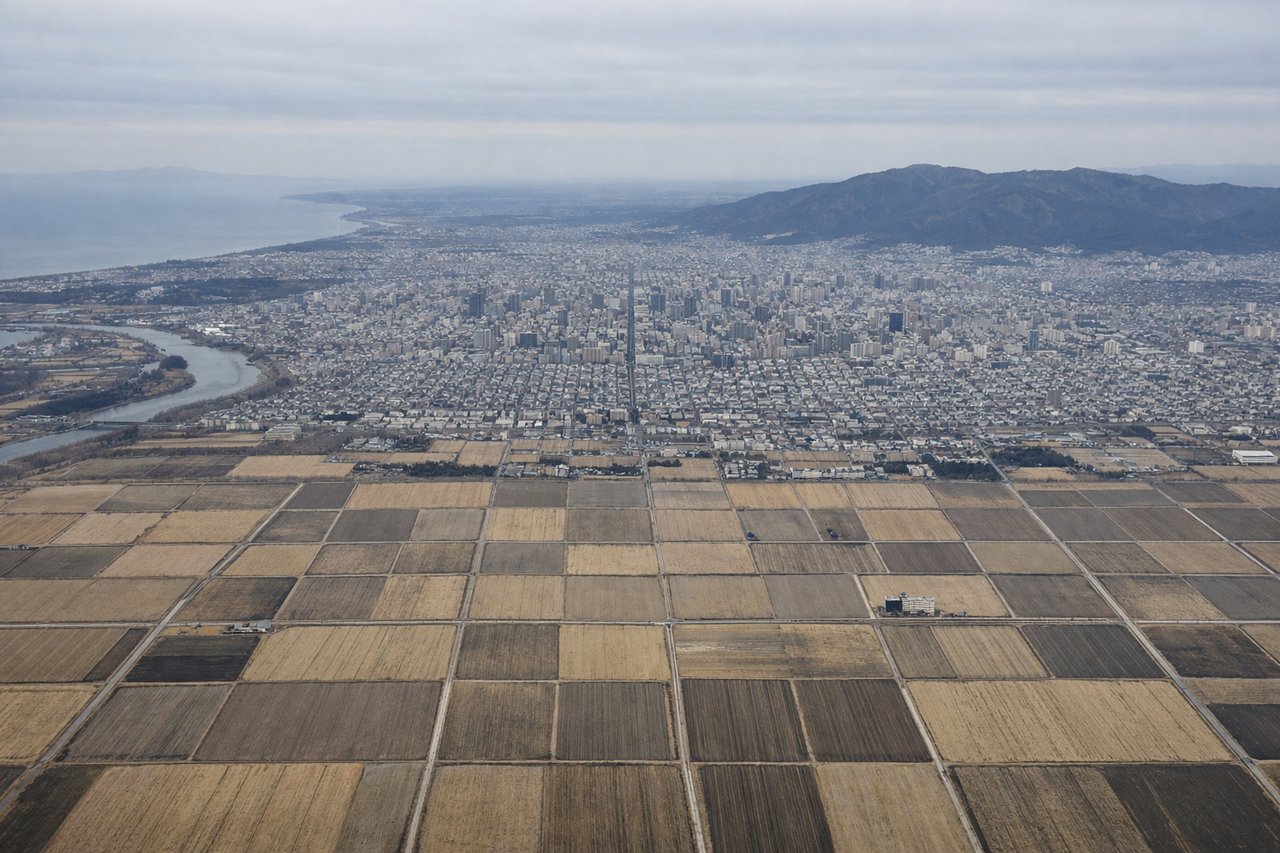
Landing at CTS
LEFTOn approach into Chitose from the south, the left side faces the volcanic interior of Hokkaido, offering views of Mount Yotei's symmetrical cone and the caldera lake district of Shikotsu-Toya National Park. The right side mostly shows the flatter Pacific coast near Tomakomai, which is far less dramatic.
Landmarks on this routeAll landmarks →
Will your flight be in sunlight?
Pick a date and time in the Sun Map to watch the sun move across your whole flight.
About This Route
Which side of the plane should I sit on flying from Ninoy Aquino International (MNL) to Chitose International Airport (CTS)?
Sit on the Left side of the plane for the best views on flights from Manila to Sapporo. The left side wins across all three phases: Manila Bay and its coastline at takeoff, Mount Fuji, the Japanese Alps, and Tokyo Bay during the Honshu overflight, and the volcanic Hokkaido interior with Mount Yotei on final approach. The right side is dominated by long stretches of open Philippine Sea and Pacific Ocean with few named landmarks.
What can I see during takeoff from Ninoy Aquino International in Manila?
During takeoff from Ninoy Aquino International (MNL), sit on the Left side for the best views. Departing NAIA northbound, the left side overlooks Manila Bay, giving passengers a sweeping view of the bay's coastline, Corregidor Island, and the Bataan Peninsula's hills as the aircraft climbs out. The right side mainly shows Laguna de Bay and flat inland provinces with fewer distinctive features. Notable sights include: Manila Bay, Corregidor Island, Bataan Peninsula, Metro Manila skyline (Makati/BGC).
What can I see when landing at Chitose International Airport in Sapporo?
When landing at Chitose International Airport (CTS), sit on the Left side for the best views. On approach into Chitose from the south, the left side faces the volcanic interior of Hokkaido, offering views of Mount Yotei's symmetrical cone and the caldera lake district of Shikotsu-Toya National Park. The right side mostly shows the flatter Pacific coast near Tomakomai, which is far less dramatic. Notable sights include: Mount Yotei, Lake Toya, Lake Shikotsu, Shikotsu-Toya National Park ridgelines.
How long is the flight from Manila to Sapporo?
The flight from Ninoy Aquino International (MNL) to Chitose International Airport (CTS) takes about 4 hours 55 minutes. The shortest flight path between them is 2,307 miles (3,712 km); winds and air traffic control usually add a few percent.
What does the Manila to Sapporo flight path pass over?
The route crosses the open Philippine Sea east of Taiwan and the Ryukyu Islands before making landfall over Kyushu or Shikoku, then continues north along Honshu past the Kii Peninsula, Tokyo Bay area, and the Tohoku mountains before crossing into Hokkaido.