Willemstad to Miami is 1,195 miles (1,923 km), a flight of about 3 hours 30 minutes.
The left side wins overall because the Willemstad harbor departure is one of the most visually distinctive moments of the entire flight — a compact, colorful colonial city on a Caribbean island is rare and memorable. The landing right-side view of Miami is excellent but more commonly seen. Left also picks up the northern coast of Curaçao and any views of the Venezuelan coastline faintly on the horizon shortly after departure.
Flight Path
After leaving Curaçao, the flight tracks northwest over the open Caribbean Sea. The island of Hispaniola (Haiti and Dominican Republic) may be visible to the right in the distance depending on routing. Cuba's eastern tip and the Windward Passage are typically crossed, with the Florida Straits and the shallow Bahama Banks visible as brilliantly turquoise water before the Florida coast appears. The Everglades appear as a flat dark-green expanse on the left side during descent into Miami.
Great circle distance and headings ›Phase by phase
Takeoff from CUR
LEFTHato Airport's primary departure runway (11/29) means northwestbound departures swing left over Willemstad's iconic harbor and the Schottegat inlet. The left side captures the Queen Emma Pontoon Bridge, the colorful Dutch colonial waterfront of Punda and Otrobanda, and the deep blue of the Caribbean stretching west.
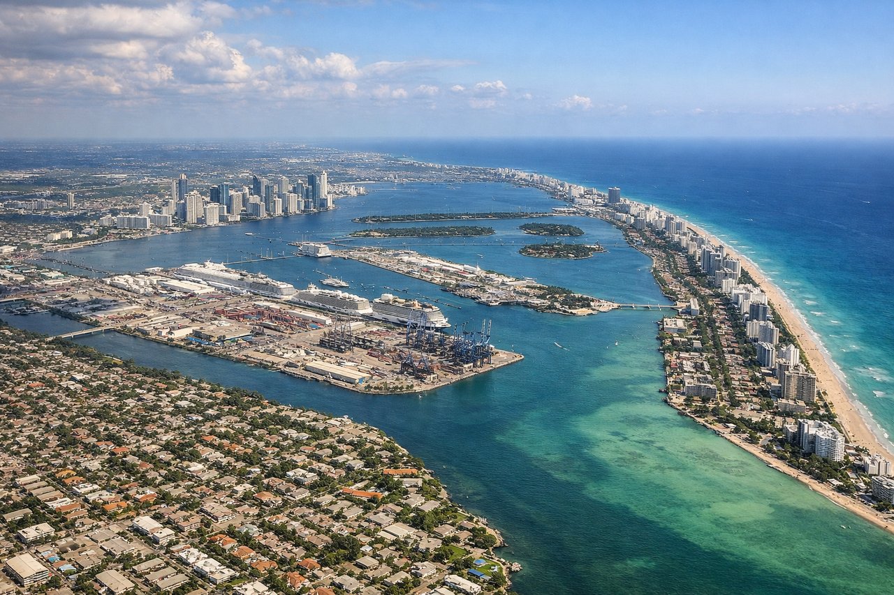
Landing at MIA
RIGHTApproaching Miami from the south-southeast on typical runway 08R/09 arrivals, the right side faces north and northeast over Biscayne Bay, the Miami Beach barrier island, and the downtown Miami skyline. The left side mostly sees the Everglades and agricultural flatlands to the south and west.
Landmarks on this routeAll landmarks →
Will your flight be in sunlight?
Pick a date and time in the Sun Map to watch the sun move across your whole flight.
About This Route
Which side of the plane should I sit on flying from Hato (CUR) to Miami International (MIA)?
Sit on the Left side of the plane for the best views on flights from Willemstad to Miami. The left side wins overall because the Willemstad harbor departure is one of the most visually distinctive moments of the entire flight — a compact, colorful colonial city on a Caribbean island is rare and memorable. The landing right-side view of Miami is excellent but more commonly seen. Left also picks up the northern coast of Curaçao and any views of the Venezuelan coastline faintly on the horizon shortly after departure.
What can I see during takeoff from Hato in Willemstad?
During takeoff from Hato (CUR), sit on the Left side for the best views. Hato Airport's primary departure runway (11/29) means northwestbound departures swing left over Willemstad's iconic harbor and the Schottegat inlet. The left side captures the Queen Emma Pontoon Bridge, the colorful Dutch colonial waterfront of Punda and Otrobanda, and the deep blue of the Caribbean stretching west. Notable sights include: Willemstad harbor and Sint Annabaai channel, Schottegat oil refinery lagoon, Punda and Otrobanda colonial waterfront districts, Caribbean Sea coastline of Curaçao.
What can I see when landing at Miami International in Miami?
When landing at Miami International (MIA), sit on the Right side for the best views. Approaching Miami from the south-southeast on typical runway 08R/09 arrivals, the right side faces north and northeast over Biscayne Bay, the Miami Beach barrier island, and the downtown Miami skyline. The left side mostly sees the Everglades and agricultural flatlands to the south and west. Notable sights include: Biscayne Bay and its shallow turquoise flats, Miami Beach barrier island and Atlantic Ocean, Downtown Miami skyline, Port of Miami on Dodge Island.
How long is the flight from Willemstad to Miami?
The flight from Hato (CUR) to Miami International (MIA) takes about 3 hours 30 minutes. The shortest flight path between them is 1,195 miles (1,923 km); winds and air traffic control usually add a few percent.
What does the Willemstad to Miami flight path pass over?
After leaving Curaçao, the flight tracks northwest over the open Caribbean Sea. The island of Hispaniola (Haiti and Dominican Republic) may be visible to the right in the distance depending on routing. Cuba's eastern tip and the Windward Passage are typically crossed, with the Florida Straits and the shallow Bahama Banks visible as brilliantly turquoise water before the Florida coast appears. The Everglades appear as a flat dark-green expanse on the left side during descent into Miami.