The left side delivers the spectacular Willemstad harbor departure view, which is genuinely one of the most photogenic airport departures in the Caribbean. The Atlanta landing view on the right is good but fairly standard for a US city approach. The Curacao departure is the highlight of this route.
Flown CUR to ATL? Did we get it right?
Flight Path
Willemstad to Atlanta is 1,774 miles (2,855 km), a flight of about 4 hours 15 minutes.
The flight tracks northwest over the open Caribbean Sea, crossing the western tip of Hispaniola or passing north of it depending on routing, then over Cuba or the Yucatan Channel, across the Gulf of Mexico, and into the southeastern United States over Florida or Georgia. The Appalachian foothills become visible in the final descent toward Atlanta. Much of the cruise is over open water with little to see below.
Great circle distance and headings ›Phase by phase
Takeoff from CUR
LEFTDeparting Hato Airport, aircraft typically take off heading west or northwest over the Caribbean. The left side gives you a clear view back over Willemstad's iconic harbor, the Schottegat lagoon, and the colorful Dutch colonial waterfront of Punda and Otrobanda. The right side faces open sea with little of interest.
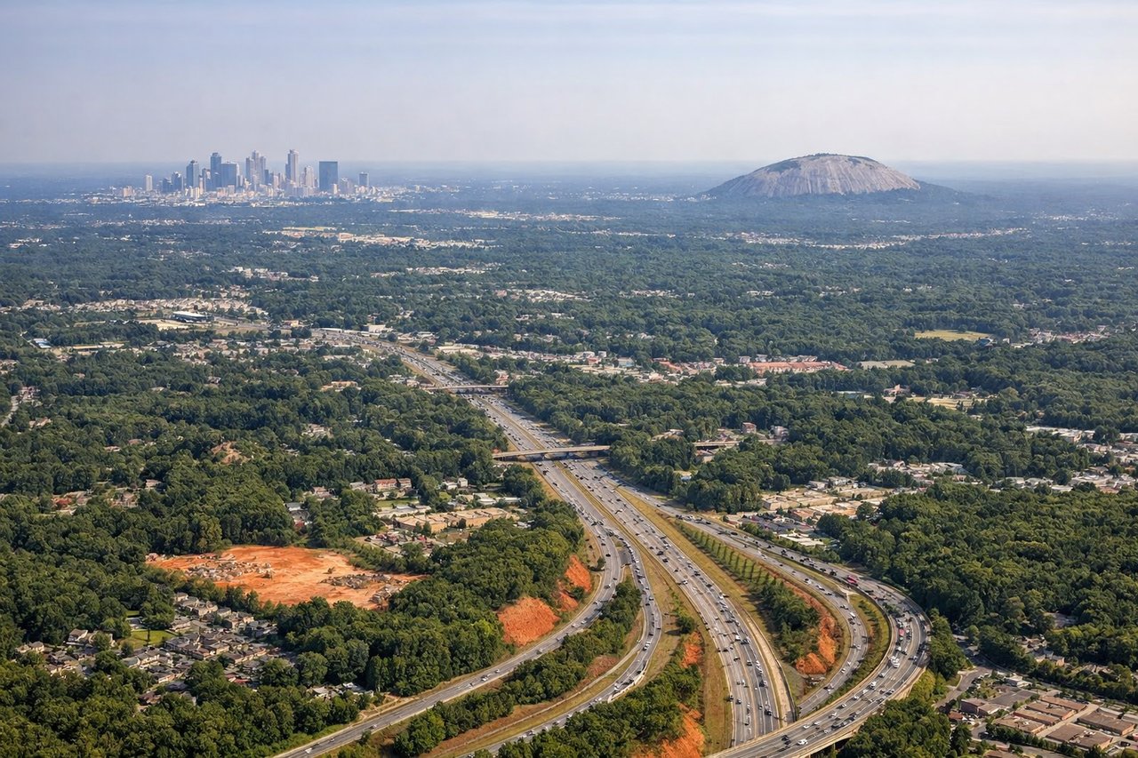
Landing at ATL
RIGHTHartsfield-Jackson typically handles arrivals from the south on runways 8L/8R or 9L/9R, with aircraft approaching from the southwest. The right side gives a clear view of downtown Atlanta's skyline, including Midtown and the Buckhead district to the north, as the aircraft descends over the southern suburbs. The left side faces away from the city center.
Will your flight be in sunlight?
Pick a date and time in the Sun Map to watch the sun move across your whole flight.
About This Route
Which side of the plane should I sit on flying from Hato (CUR) to The William B Hartsfield Atlanta International (ATL)?
Sit on the Left side of the plane for the best views on flights from Willemstad to Atlanta. The left side delivers the spectacular Willemstad harbor departure view, which is genuinely one of the most photogenic airport departures in the Caribbean. The Atlanta landing view on the right is good but fairly standard for a US city approach. The Curacao departure is the highlight of this route.
What can I see during takeoff from Hato in Willemstad?
During takeoff from Hato (CUR), sit on the Left side for the best views. Departing Hato Airport, aircraft typically take off heading west or northwest over the Caribbean. The left side gives you a clear view back over Willemstad's iconic harbor, the Schottegat lagoon, and the colorful Dutch colonial waterfront of Punda and Otrobanda. The right side faces open sea with little of interest. Notable sights include: Willemstad harbor and Queen Emma pontoon bridge, Schottegat lagoon, Sint Annabaai channel, Punda and Otrobanda colonial district waterfront.
What can I see when landing at The William B Hartsfield Atlanta International in Atlanta?
When landing at The William B Hartsfield Atlanta International (ATL), sit on the Right side for the best views. Hartsfield-Jackson typically handles arrivals from the south on runways 8L/8R or 9L/9R, with aircraft approaching from the southwest. The right side gives a clear view of downtown Atlanta's skyline, including Midtown and the Buckhead district to the north, as the aircraft descends over the southern suburbs. The left side faces away from the city center. Notable sights include: Downtown Atlanta skyline, Midtown Atlanta towers, Stone Mountain (distant, to the east), I-285 perimeter highway visible as a curved road arc.
How long is the flight from Willemstad to Atlanta?
The flight from Hato (CUR) to The William B Hartsfield Atlanta International (ATL) takes about 4 hours 15 minutes. The shortest flight path between them is 1,774 miles (2,855 km); winds and air traffic control usually add a few percent.
What does the Willemstad to Atlanta flight path pass over?
The flight tracks northwest over the open Caribbean Sea, crossing the western tip of Hispaniola or passing north of it depending on routing, then over Cuba or the Yucatan Channel, across the Gulf of Mexico, and into the southeastern United States over Florida or Georgia. The Appalachian foothills become visible in the final descent toward Atlanta. Much of the cruise is over open water with little to see below.