Willemstad to Toronto is 2,266 miles (3,648 km), a flight of about 5 hours 45 minutes.
Left side wins both ends of the flight. Takeoff delivers the spectacular Willemstad harbor and Dutch colonial waterfront, while landing provides the Toronto skyline and Lake Ontario waterfront approach. The left seat is the clear choice for this route.
Flight Path
After departing Curacao, the flight tracks northwest over the southern Caribbean Sea, passing north of Venezuela's Paraguana Peninsula and the Gulf of Venezuela. The route crosses the western Caribbean, passing over or near Jamaica and Cuba depending on routing, then over the Florida Straits or Gulf of Mexico. Crossing into the US, the flight passes over the southeastern US states before entering Great Lakes airspace over Lake Erie or Lake Ontario on descent into Toronto. The Appalachian Mountains may be visible as a broad ridged plateau in the mid-flight section over the eastern US.
Great circle distance and headings ›.jpeg?width=600)

Phase by phase
Takeoff from CUR
LEFTHato Airport's primary departure runway (11/29) typically sees westbound departures heading northwest toward the Caribbean. A left-side seat gives you the view back over Willemstad's iconic harbor, the Queen Emma pontoon bridge, and the colorful Dutch colonial waterfront of Punda and Otrobanda. The turquoise shallow waters of the Spanish Water lagoon are also visible to the southeast.
Landing at YYZ
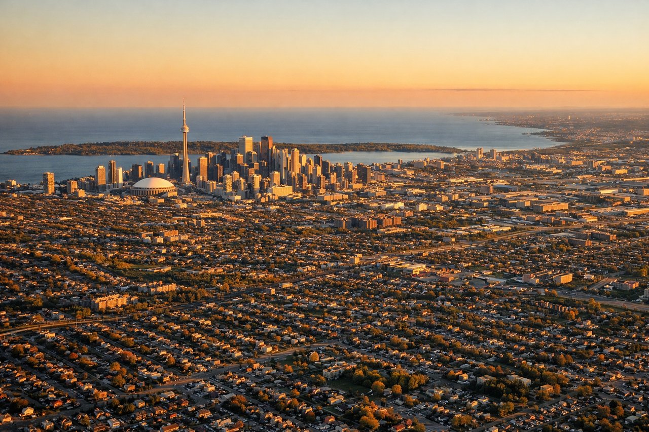
LEFTPearson's primary arrival runways (05/23 and 06L/24R) typically bring aircraft in from the southwest or southeast. A left-side seat on approach from the south gives views over downtown Toronto's skyline including the CN Tower, Lake Ontario's northern shoreline, and the Toronto Islands. The city grid and waterfront are clearly laid out on the left side during the final approach.
Landmarks on this routeAll landmarks →
Will your flight be in sunlight?
Pick a date and time in the Sun Map to watch the sun move across your whole flight.
About This Route
Which side of the plane should I sit on flying from Hato (CUR) to Lester B Pearson International (YYZ)?
Sit on the Left side of the plane for the best views on flights from Willemstad to Toronto. Left side wins both ends of the flight. Takeoff delivers the spectacular Willemstad harbor and Dutch colonial waterfront, while landing provides the Toronto skyline and Lake Ontario waterfront approach. The left seat is the clear choice for this route.
What can I see during takeoff from Hato in Willemstad?
During takeoff from Hato (CUR), sit on the Left side for the best views. Hato Airport's primary departure runway (11/29) typically sees westbound departures heading northwest toward the Caribbean. A left-side seat gives you the view back over Willemstad's iconic harbor, the Queen Emma pontoon bridge, and the colorful Dutch colonial waterfront of Punda and Otrobanda. The turquoise shallow waters of the Spanish Water lagoon are also visible to the southeast. Notable sights include: Willemstad harbor and Sint Annabaai channel, Queen Emma pontoon bridge, Punda/Otrobanda colonial waterfront district, Spanish Water lagoon to the southeast.
What can I see when landing at Lester B Pearson International in Toronto?
When landing at Lester B Pearson International (YYZ), sit on the Left side for the best views. Pearson's primary arrival runways (05/23 and 06L/24R) typically bring aircraft in from the southwest or southeast. A left-side seat on approach from the south gives views over downtown Toronto's skyline including the CN Tower, Lake Ontario's northern shoreline, and the Toronto Islands. The city grid and waterfront are clearly laid out on the left side during the final approach. Notable sights include: CN Tower and downtown Toronto skyline, Toronto Islands and inner harbor, Lake Ontario northern shoreline, Humber Bay and Etobicoke waterfront.
How long is the flight from Willemstad to Toronto?
The flight from Hato (CUR) to Lester B Pearson International (YYZ) takes about 5 hours 45 minutes. The shortest flight path between them is 2,266 miles (3,648 km); winds and air traffic control usually add a few percent.
What does the Willemstad to Toronto flight path pass over?
After departing Curacao, the flight tracks northwest over the southern Caribbean Sea, passing north of Venezuela's Paraguana Peninsula and the Gulf of Venezuela. The route crosses the western Caribbean, passing over or near Jamaica and Cuba depending on routing, then over the Florida Straits or Gulf of Mexico. Crossing into the US, the flight passes over the southeastern US states before entering Great Lakes airspace over Lake Erie or Lake Ontario on descent into Toronto. The Appalachian Mountains may be visible as a broad ridged plateau in the mid-flight section over the eastern US.