Toronto to Willemstad is 2,266 miles (3,648 km), a flight of about 4 hours 15 minutes.
Left side scores higher due to the dramatic Toronto departure over Lake Ontario and urban waterfront, which provides genuine scenic interest during the first 30 minutes of flight. The landing approach to Curaçao is equally modest on both sides—the island is small and the approach is brief—so the takeoff experience becomes the deciding factor. Both sides face 4+ hours of open Atlantic Ocean with minimal visual interest, capping the overall scores.
Flight Path
Open Atlantic Ocean dominates the entire cruise phase. No significant landmarks are visible from altitude between the North American coast and the Caribbean. Passengers may observe cloud formations, occasional weather systems, and the gradual color shift of ocean water from darker Atlantic blue to lighter Caribbean turquoise as the aircraft approaches the southern latitudes, but no named geographic features are visible.
Great circle distance and headings ›
.jpeg?width=600)
Phase by phase
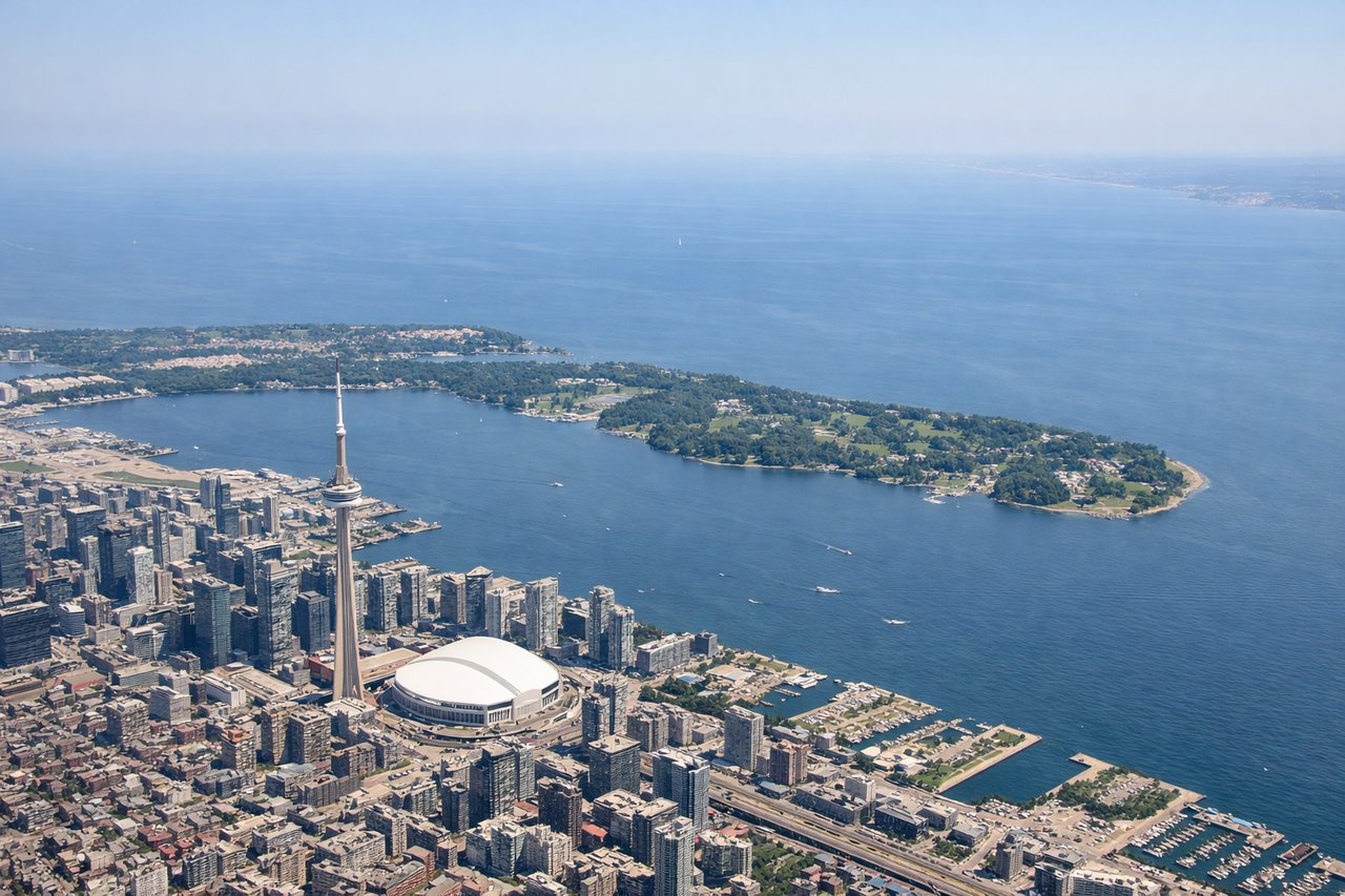
Takeoff from YYZ
LEFTLeft side captures Toronto's urban waterfront during departure, including Lake Ontario shoreline and the Greater Toronto Area sprawl. Right side faces inland toward flat agricultural terrain with minimal visual interest.
Landing at CUR
RIGHTRight side provides the only meaningful scenic approach to Curaçao. The island's distinctive geography—small, arid, with colorful Willemstad harbor and surrounding Caribbean waters—becomes visible during descent. Left side faces open ocean with no landmarks.
Landmarks on this routeAll landmarks →
Will your flight be in sunlight?
Pick a date and time in the Sun Map to watch the sun move across your whole flight.
About This Route
Which side of the plane should I sit on flying from Lester B Pearson International (YYZ) to Hato (CUR)?
Sit on the Left side of the plane for the best views on flights from Toronto to Willemstad. Left side scores higher due to the dramatic Toronto departure over Lake Ontario and urban waterfront, which provides genuine scenic interest during the first 30 minutes of flight. The landing approach to Curaçao is equally modest on both sides—the island is small and the approach is brief—so the takeoff experience becomes the deciding factor. Both sides face 4+ hours of open Atlantic Ocean with minimal visual interest, capping the overall scores.
What can I see during takeoff from Lester B Pearson International in Toronto?
During takeoff from Lester B Pearson International (YYZ), sit on the Left side for the best views. Left side captures Toronto's urban waterfront during departure, including Lake Ontario shoreline and the Greater Toronto Area sprawl. Right side faces inland toward flat agricultural terrain with minimal visual interest. Notable sights include: Lake Ontario, Toronto Islands, CN Tower and downtown Toronto skyline, Scarborough Bluffs.
What can I see when landing at Hato in Willemstad?
When landing at Hato (CUR), sit on the Right side for the best views. Right side provides the only meaningful scenic approach to Curaçao. The island's distinctive geography—small, arid, with colorful Willemstad harbor and surrounding Caribbean waters—becomes visible during descent. Left side faces open ocean with no landmarks. Notable sights include: Curaçao island, Willemstad harbor with its characteristic pontoon bridge, Caribbean Sea, Sint Michiel Bay.
How long is the flight from Toronto to Willemstad?
The flight from Lester B Pearson International (YYZ) to Hato (CUR) takes about 4 hours 15 minutes. The shortest flight path between them is 2,266 miles (3,648 km); winds and air traffic control usually add a few percent.
What does the Toronto to Willemstad flight path pass over?
Open Atlantic Ocean dominates the entire cruise phase. No significant landmarks are visible from altitude between the North American coast and the Caribbean. Passengers may observe cloud formations, occasional weather systems, and the gradual color shift of ocean water from darker Atlantic blue to lighter Caribbean turquoise as the aircraft approaches the southern latitudes, but no named geographic features are visible.