The right side tracks the more dramatic terrain for most of the flight — the Sandia Mountains near Albuquerque, the Painted Desert and San Francisco Peaks region, and the approach into Las Vegas past Sunrise Mountain with a clear view of the Strip. The left side offers only the Dallas skyline at departure and flatter terrain thereafter.
Flight Path
Sandia Mountains near Albuquerque, Painted Desert and Petrified Forest badlands, San Francisco Peaks near Flagstaff, high Colorado Plateau terrain east of the Grand Canyon, Mojave Desert basins approaching Nevada
Great circle distance and headings ›.jpg?width=600)

.jpeg?width=600)


Phase by phase
Takeoff from DAL
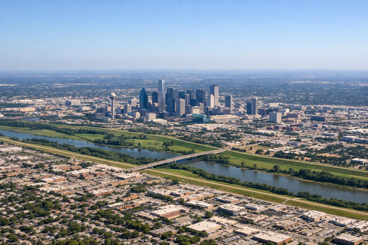
LEFTLove Field departures typically climb out and bank to align westbound, putting downtown Dallas's skyline — including Reunion Tower and the Bank of America Plaza — in view on the left as the aircraft turns away from the field. The right side mostly shows flat North Texas suburbs during this same turn.
Landing at LAS
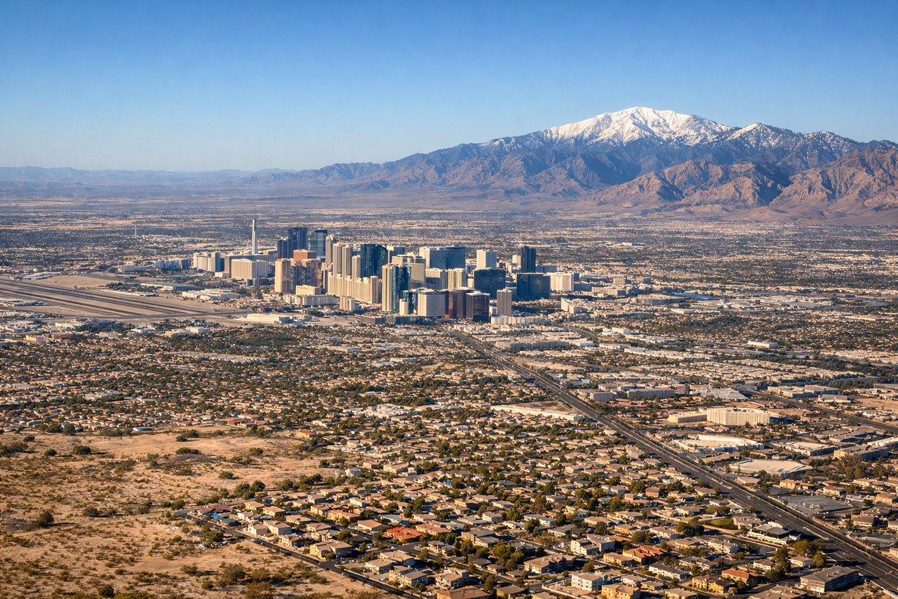
RIGHTOn the common westbound approach into runway 26 at McCarran, the flight path crosses the eastern Las Vegas Valley with the Strip's towers and Sunrise Mountain visible off the right side as the plane descends. This side also captured the Sandia Mountains and Grand Canyon region earlier in cruise, making it the stronger overall side.
Landmarks on this routeAll landmarks →
Will your flight be in sunlight?
See exactly which side of the plane gets sun and shade at your departure time.
About This Route
Which side of the plane should I sit on flying from Dallas Love Fld (DAL) to Mc Carran International (LAS)?
Sit on the Right side of the plane for the best views on flights from Dallas to Las Vegas. The right side tracks the more dramatic terrain for most of the flight — the Sandia Mountains near Albuquerque, the Painted Desert and San Francisco Peaks region, and the approach into Las Vegas past Sunrise Mountain with a clear view of the Strip. The left side offers only the Dallas skyline at departure and flatter terrain thereafter.
What can I see during takeoff from Dallas Love Fld in Dallas?
During takeoff from Dallas Love Fld (DAL), sit on the Left side for the best views. Love Field departures typically climb out and bank to align westbound, putting downtown Dallas's skyline — including Reunion Tower and the Bank of America Plaza — in view on the left as the aircraft turns away from the field. The right side mostly shows flat North Texas suburbs during this same turn. Notable sights include: Downtown Dallas skyline, Reunion Tower, Trinity River, North Texas suburban sprawl.
What can I see when landing at Mc Carran International in Las Vegas?
When landing at Mc Carran International (LAS), sit on the Right side for the best views. On the common westbound approach into runway 26 at McCarran, the flight path crosses the eastern Las Vegas Valley with the Strip's towers and Sunrise Mountain visible off the right side as the plane descends. This side also captured the Sandia Mountains and Grand Canyon region earlier in cruise, making it the stronger overall side. Notable sights include: Las Vegas Strip skyline, Sunrise Mountain, Spring Mountains, Lake Mead vicinity.
How long is the flight from Dallas to Las Vegas?
The flight from Dallas Love Fld (DAL) to Mc Carran International (LAS) takes 2h 20m.
What does the Dallas to Las Vegas flight path pass over?
Sandia Mountains near Albuquerque, Painted Desert and Petrified Forest badlands, San Francisco Peaks near Flagstaff, high Colorado Plateau terrain east of the Grand Canyon, Mojave Desert basins approaching Nevada