While takeoff offers urban scenery, the right side dominates the longer northbound flight path. You'll see the Appalachian ridges, the Ohio River valley, the Great Lakes region, and eventually the dramatic transition to boreal forest and the Tanana River valley on approach. Right-side seats capture more of the journey's geographic diversity.
Flown DCA to FAI? Did we get it right?
Flight Path
Washington to Fairbanks is 3,277 miles (5,273 km), a flight of about 5 hours 15 minutes.
Appalachian Mountains (ridges visible for first 90 minutes), Ohio River valley, Great Lakes shoreline (Lake Michigan or Lake Superior depending on exact routing), transition from deciduous to boreal forest around northern Minnesota/Wisconsin, Yukon River drainage systems in interior Alaska, and the gradual shift from temperate to subarctic landscape
Great circle distance and headings ›

Phase by phase
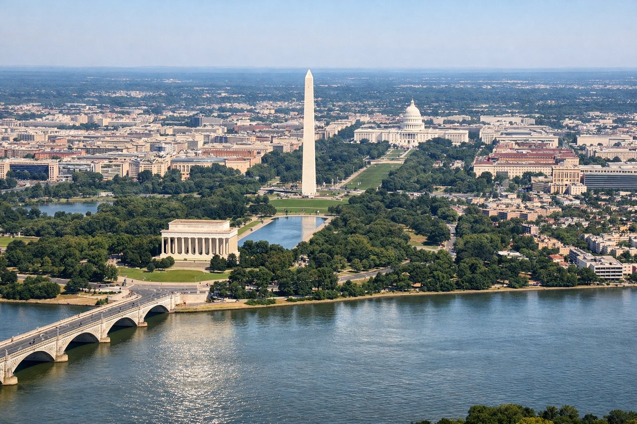
Takeoff from DCA
LEFTLeft side offers views of the Potomac River and Washington, D.C.'s urban grid as you climb out northwestward. The Capitol, monuments, and the river's distinctive curves are visible during initial climb before heading northwest toward the Appalachian corridor.
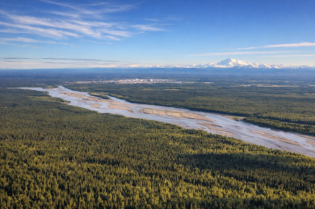
Landing at FAI
RIGHTRight side provides views of the Tanana River valley and the approach into Fairbanks from the south. You'll see the river's braided channels and the surrounding boreal forest landscape as you descend toward the airport on the north bank.
Will your flight be in sunlight?
Pick a date and time in the Sun Map to watch the sun move across your whole flight.
About This Route
Which side of the plane should I sit on flying from Ronald Reagan Washington National (DCA) to Fairbanks International (FAI)?
Sit on the Right side of the plane for the best views on flights from Washington to Fairbanks. While takeoff offers urban scenery, the right side dominates the longer northbound flight path. You'll see the Appalachian ridges, the Ohio River valley, the Great Lakes region, and eventually the dramatic transition to boreal forest and the Tanana River valley on approach. Right-side seats capture more of the journey's geographic diversity.
What can I see during takeoff from Ronald Reagan Washington National in Washington?
During takeoff from Ronald Reagan Washington National (DCA), sit on the Left side for the best views. Left side offers views of the Potomac River and Washington, D.C.'s urban grid as you climb out northwestward. The Capitol, monuments, and the river's distinctive curves are visible during initial climb before heading northwest toward the Appalachian corridor. Notable sights include: Potomac River, Washington Monument and Capitol Building area, Arlington area across the river, Appalachian foothills to the northwest.
What can I see when landing at Fairbanks International in Fairbanks?
When landing at Fairbanks International (FAI), sit on the Right side for the best views. Right side provides views of the Tanana River valley and the approach into Fairbanks from the south. You'll see the river's braided channels and the surrounding boreal forest landscape as you descend toward the airport on the north bank. Notable sights include: Tanana River and its braided channels, boreal forest (black spruce), Fairbanks city lights and runway approach, low hills to the south.
How long is the flight from Washington to Fairbanks?
The flight from Ronald Reagan Washington National (DCA) to Fairbanks International (FAI) takes about 5 hours 15 minutes. The shortest flight path between them is 3,277 miles (5,273 km); winds and air traffic control usually add a few percent.
What does the Washington to Fairbanks flight path pass over?
Appalachian Mountains (ridges visible for first 90 minutes), Ohio River valley, Great Lakes shoreline (Lake Michigan or Lake Superior depending on exact routing), transition from deciduous to boreal forest around northern Minnesota/Wisconsin, Yukon River drainage systems in interior Alaska, and the gradual shift from temperate to subarctic landscape