Takeoff views from the right side are significantly more distinctive (Potomac, Pentagon, Monument). While landing favors the left, the departure experience is more visually rewarding and the flight path westbound offers limited dramatic features for either side during cruise.
Flown DCA to ONT? Did we get it right?
Flight Path
Washington to Ontario is 2,260 miles (3,637 km), a flight of about 5 hours 15 minutes.
The flight path crosses the Appalachian Mountains (West Virginia/Kentucky border region), then transitions to the Mississippi River valley near St. Louis, continues over the Great Plains of Kansas and Oklahoma, and approaches the Rocky Mountain front near Colorado. The Continental Divide is crossed in Colorado/New Mexico. Most of cruise altitude (35,000-37,000 ft) offers limited distinctive ground features except major river valleys and mountain ranges on the horizon.
Great circle distance and headings ›


Phase by phase

Takeoff from DCA
RIGHTDCA typically departs runway 01 or 19 depending on wind. Right-side seats offer views of the Potomac River, Arlington, and the Washington Monument area during initial climb. Left side faces industrial areas and less distinctive terrain.
Landing at ONT
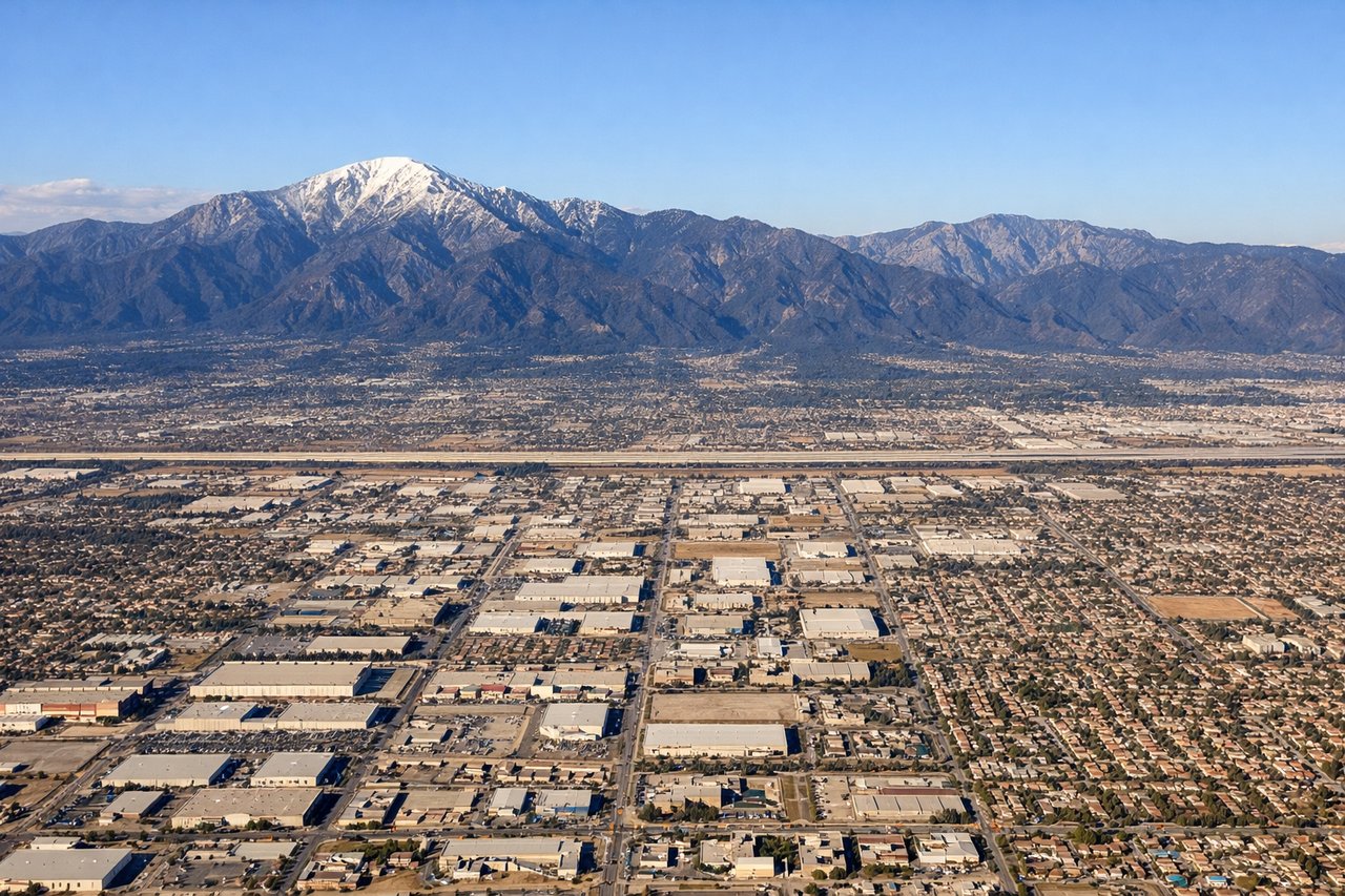
LEFTONT typically uses runways 08L/08R or 26L/26R. Left-side seats during descent provide excellent views of the San Gabriel Mountains to the north and the Inland Empire sprawl. The approach path over San Bernardino County offers better geographic definition than the right side.
Will your flight be in sunlight?
Pick a date and time in the Sun Map to watch the sun move across your whole flight.
About This Route
Which side of the plane should I sit on flying from Ronald Reagan Washington National (DCA) to Ontario International (ONT)?
Sit on the Right side of the plane for the best views on flights from Washington to Ontario. Takeoff views from the right side are significantly more distinctive (Potomac, Pentagon, Monument). While landing favors the left, the departure experience is more visually rewarding and the flight path westbound offers limited dramatic features for either side during cruise.
What can I see during takeoff from Ronald Reagan Washington National in Washington?
During takeoff from Ronald Reagan Washington National (DCA), sit on the Right side for the best views. DCA typically departs runway 01 or 19 depending on wind. Right-side seats offer views of the Potomac River, Arlington, and the Washington Monument area during initial climb. Left side faces industrial areas and less distinctive terrain. Notable sights include: Potomac River (immediate left bank), Arlington National Cemetery and Pentagon (right side, 2-3 miles), Washington Monument and Capitol dome (distant, south-southeast), Theodore Roosevelt Island (in river below).
What can I see when landing at Ontario International in Ontario?
When landing at Ontario International (ONT), sit on the Left side for the best views. ONT typically uses runways 08L/08R or 26L/26R. Left-side seats during descent provide excellent views of the San Gabriel Mountains to the north and the Inland Empire sprawl. The approach path over San Bernardino County offers better geographic definition than the right side. Notable sights include: San Gabriel Mountains (north, snow-capped peaks visible in winter), San Bernardino Valley floor (immediate surroundings), Cajon Pass (northeast, mountain gap), Chino Hills (southeast, lower ridgeline).
How long is the flight from Washington to Ontario?
The flight from Ronald Reagan Washington National (DCA) to Ontario International (ONT) takes about 5 hours 15 minutes. The shortest flight path between them is 2,260 miles (3,637 km); winds and air traffic control usually add a few percent.
What does the Washington to Ontario flight path pass over?
The flight path crosses the Appalachian Mountains (West Virginia/Kentucky border region), then transitions to the Mississippi River valley near St. Louis, continues over the Great Plains of Kansas and Oklahoma, and approaches the Rocky Mountain front near Colorado. The Continental Divide is crossed in Colorado/New Mexico. Most of cruise altitude (35,000-37,000 ft) offers limited distinctive ground features except major river valleys and mountain ranges on the horizon.