Right side scores higher due to the exceptional Caribbean approach with turquoise waters, cenote formations, and dramatic coastal geology visible during landing. While left side offers superior Washington D.C. departure scenery, the landing experience on the right dominates the overall flight value. The Yucatan Peninsula's distinctive limestone and water features provide more sustained visual interest during the cruise phase than the inland route over the southeastern United States.
Flown DCA to TQO? Did we get it right?
Flight Path
Washington to Tulum is 1,437 miles (2,313 km), a flight of about 4 hours 15 minutes.
Appalachian foothills of Tennessee and Kentucky, Mississippi River valley near Memphis, Gulf of Mexico coastline near Louisiana-Texas border, Yucatan Peninsula limestone plateau with cenote lakes
Great circle distance and headings ›Phase by phase
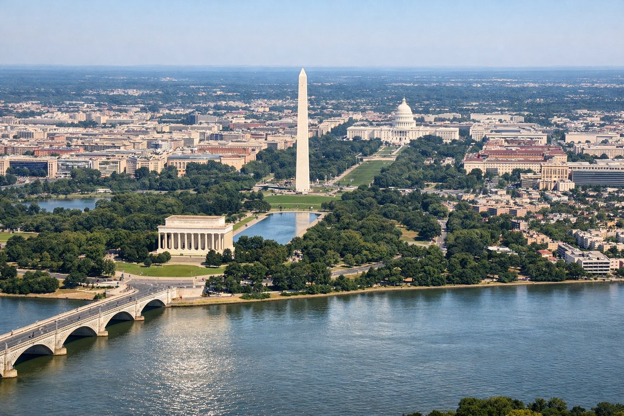
Takeoff from DCA
LEFTLeft side captures the Potomac River, Washington Monument, and Capitol Building during departure from DCA. The airport sits directly on the river, making westbound climbs over central Washington highly scenic. Right side faces the Virginia suburbs and Chesapeake Bay approaches—less dramatic urban density.
Landing at TQO
RIGHTRight side offers the Caribbean approach to Tulum with turquoise shallow waters, white sand beaches, and the Yucatan Peninsula's distinctive limestone geology. The final descent reveals the cenote-dotted landscape and coastal mangrove forests. Left side faces inland jungle and lacks the dramatic water-and-reef scenery.
Will your flight be in sunlight?
Pick a date and time in the Sun Map to watch the sun move across your whole flight.
About This Route
Which side of the plane should I sit on flying from Ronald Reagan Washington National (DCA) to Felipe Carrillo Puerto International Airport Tulum (TQO)?
Sit on the Right side of the plane for the best views on flights from Washington to Tulum. Right side scores higher due to the exceptional Caribbean approach with turquoise waters, cenote formations, and dramatic coastal geology visible during landing. While left side offers superior Washington D.C. departure scenery, the landing experience on the right dominates the overall flight value. The Yucatan Peninsula's distinctive limestone and water features provide more sustained visual interest during the cruise phase than the inland route over the southeastern United States.
What can I see during takeoff from Ronald Reagan Washington National in Washington?
During takeoff from Ronald Reagan Washington National (DCA), sit on the Left side for the best views. Left side captures the Potomac River, Washington Monument, and Capitol Building during departure from DCA. The airport sits directly on the river, making westbound climbs over central Washington highly scenic. Right side faces the Virginia suburbs and Chesapeake Bay approaches—less dramatic urban density. Notable sights include: Potomac River, Washington Monument, U.S. Capitol, Arlington National Cemetery.
What can I see when landing at Felipe Carrillo Puerto International Airport Tulum in Tulum?
When landing at Felipe Carrillo Puerto International Airport Tulum (TQO), sit on the Right side for the best views. Right side offers the Caribbean approach to Tulum with turquoise shallow waters, white sand beaches, and the Yucatan Peninsula's distinctive limestone geology. The final descent reveals the cenote-dotted landscape and coastal mangrove forests. Left side faces inland jungle and lacks the dramatic water-and-reef scenery. Notable sights include: Caribbean Sea turquoise waters, Tulum beachfront ruins area, Yucatan Peninsula white sand beaches, cenote formations.
How long is the flight from Washington to Tulum?
The flight from Ronald Reagan Washington National (DCA) to Felipe Carrillo Puerto International Airport Tulum (TQO) takes about 4 hours 15 minutes. The shortest flight path between them is 1,437 miles (2,313 km); winds and air traffic control usually add a few percent.
What does the Washington to Tulum flight path pass over?
Appalachian foothills of Tennessee and Kentucky, Mississippi River valley near Memphis, Gulf of Mexico coastline near Louisiana-Texas border, Yucatan Peninsula limestone plateau with cenote lakes