Denver to Cleveland is 1,198 miles (1,928 km), a flight of about 2 hours 55 minutes.
Left side wins both ends of the flight. At departure you get the full Rocky Mountain Front Range panorama, and at arrival you get the Cleveland skyline and Lake Erie shoreline. The midpoint over the Great Plains offers little dramatic scenery on either side, so the bookend views at takeoff and landing are what matter most on this route.
Flight Path
The flight tracks northeast across the high plains of Nebraska and Iowa, crossing the Missouri River near Omaha, then over the flat agricultural patchwork of Iowa and northern Illinois. The Mississippi River is visible near the Iowa-Illinois border. Over northern Indiana and Ohio the terrain remains flat with scattered lakes and the urban sprawl of Toledo visible before descending toward Lake Erie and Cleveland.
Great circle distance and headings ›

Phase by phase
Takeoff from DEN
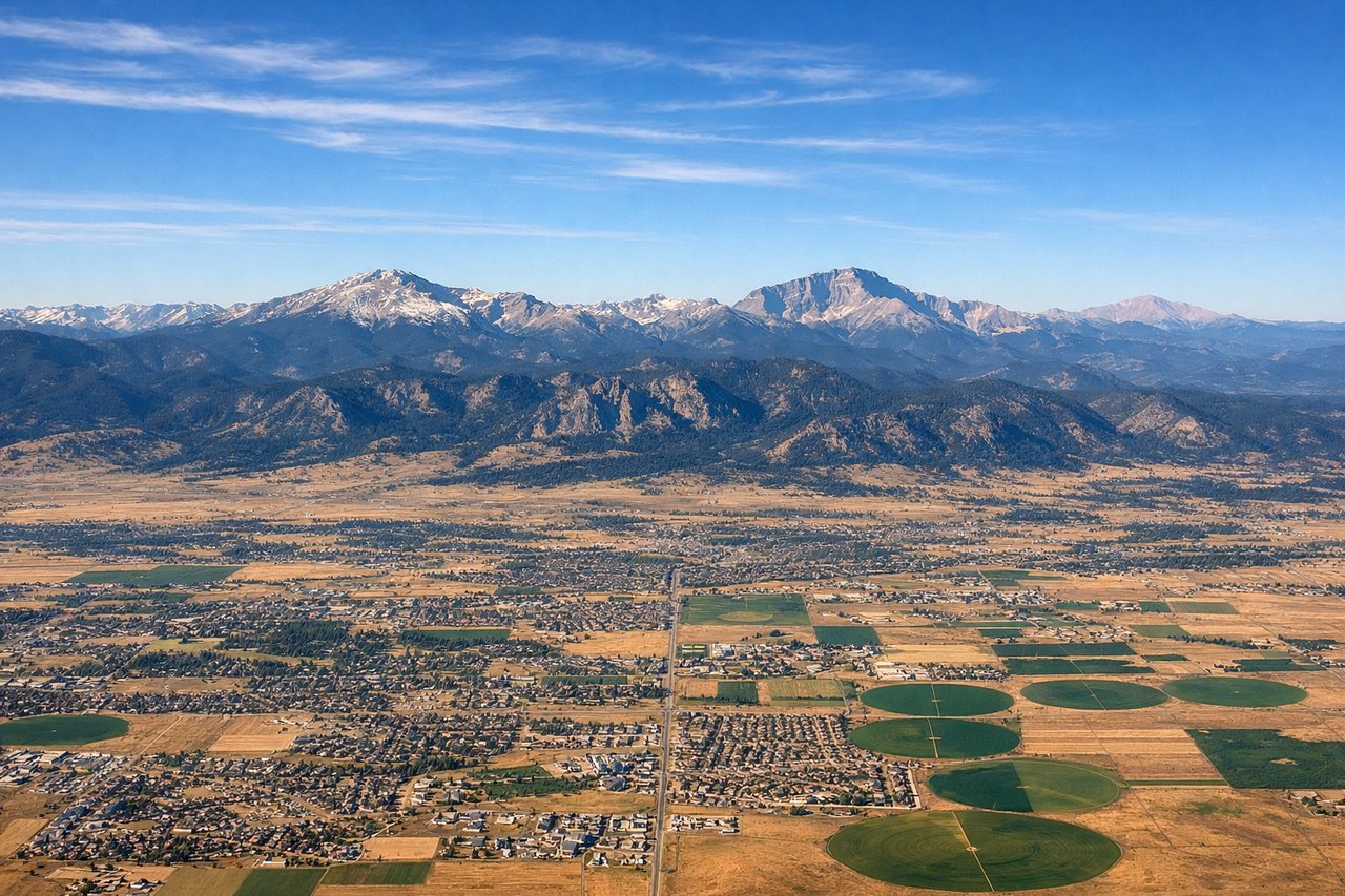
LEFTDEN typically departs eastward on runways 16/34 or 8/26. On an eastbound departure climbing out heading east, the left (north) side gives you a clear view back toward the Front Range and the Rocky Mountains as you bank northeast. The entire Front Range from Pikes Peak in the south to Longs Peak in the north is visible on the left side during the climbing turn.
Landing at CLE
LEFTCLE typically lands westbound on runway 24L/24R or eastbound on 6L/6R. On a westbound approach over Lake Erie, the left (south) side gives you the Cleveland skyline, the Cuyahoga River valley, and the lakefront clearly visible. The right side would face open lake water with little of interest.
Landmarks on this routeAll landmarks →
Will your flight be in sunlight?
Pick a date and time in the Sun Map to watch the sun move across your whole flight.
About This Route
Which side of the plane should I sit on flying from Denver International (DEN) to Cleveland Hopkins International (CLE)?
Sit on the Left side of the plane for the best views on flights from Denver to Cleveland. Left side wins both ends of the flight. At departure you get the full Rocky Mountain Front Range panorama, and at arrival you get the Cleveland skyline and Lake Erie shoreline. The midpoint over the Great Plains offers little dramatic scenery on either side, so the bookend views at takeoff and landing are what matter most on this route.
What can I see during takeoff from Denver International in Denver?
During takeoff from Denver International (DEN), sit on the Left side for the best views. DEN typically departs eastward on runways 16/34 or 8/26. On an eastbound departure climbing out heading east, the left (north) side gives you a clear view back toward the Front Range and the Rocky Mountains as you bank northeast. The entire Front Range from Pikes Peak in the south to Longs Peak in the north is visible on the left side during the climbing turn. Notable sights include: Front Range of the Rocky Mountains, Longs Peak, Denver city grid below, Rocky Mountain National Park peaks on the horizon.
What can I see when landing at Cleveland Hopkins International in Cleveland?
When landing at Cleveland Hopkins International (CLE), sit on the Left side for the best views. CLE typically lands westbound on runway 24L/24R or eastbound on 6L/6R. On a westbound approach over Lake Erie, the left (south) side gives you the Cleveland skyline, the Cuyahoga River valley, and the lakefront clearly visible. The right side would face open lake water with little of interest. Notable sights include: Lake Erie shoreline, Cleveland downtown skyline, Cuyahoga River, Burke Lakefront Airport.
How long is the flight from Denver to Cleveland?
The flight from Denver International (DEN) to Cleveland Hopkins International (CLE) takes about 2 hours 55 minutes. The shortest flight path between them is 1,198 miles (1,928 km); winds and air traffic control usually add a few percent.
What does the Denver to Cleveland flight path pass over?
The flight tracks northeast across the high plains of Nebraska and Iowa, crossing the Missouri River near Omaha, then over the flat agricultural patchwork of Iowa and northern Illinois. The Mississippi River is visible near the Iowa-Illinois border. Over northern Indiana and Ohio the terrain remains flat with scattered lakes and the urban sprawl of Toledo visible before descending toward Lake Erie and Cleveland.